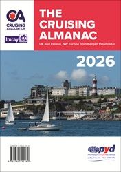
If North West Europe is in your sights for cruising next year, then you can’t go wrong with the Cruising Almanac, first published in 1909 and updated annually. Covering NW Europe from the Shetlands in the north to Gibraltar in the south and from the Baltic in the east to the west coast of Ireland, it remains the perfect onboard companion for cruising sailors.
Based on first-hand experience and official data, all the content, including text, plans and tidal data, is checked and updated for each new edition. Over 750 port entries sit alongside readily identifiable blue boxed passage notes, enabling easy access to the information you need, both for passage planning and whilst at sea.
New for 2026:
- Updated guidance on EES and ETIAS regulations for the EU Schengen zone
- Thousands of updates to ports and marinas
- Newly added and extensively revised harbour plans, drawn from the latest Hydrographic Office data and the insights of local experts
- Clear layouts for easy reference alongside relevant text
- Ports of entry clearly listed at the start of each chapter
- Fully updated regulatory information in the Introduction.
Published in a convenient A4 size, the Cruising Almanac is designed for easy reference even in tough sea conditions. Passage notes are prominently highlighted within the main text. Tidal stream plans and full tidal details for secondary ports are included alongside the relevant port information, while a supplementary booklet provides tide tables for 47 standard ports.
Updating of the Almanac continues throughout the year, with corrections published monthly on the Cruising Association website Almanac corrections page.
Noonsite users get a 10% discount on all Imray products.
By: Cruising Association
Publisher: Imray, 2026 Edition


