Things to consider if you plan to cruise Off the Beaten Path include:
- Weather reporting, including long distance communications equipment.
- Spare parts, maintenance equipment and manuals. Bear in mind that you will often be a long ways from help and parts and manuals (and high speed internet!).
- Emergency equipment.
- Navigation equipment. And backup. This should include cruising guides.
Navigation Equipment
This report will focus on the last item, navigation equipment. I won’t really discuss the sometimes controversial items, including carrying paper charts, or celestial navigation.
My first two years of full time live-aboard cruising was right on the beaten path: up and down the ICW of the US and the eastern Caribbean. My chartplotter with Navionics, was great and reliable. I also had chart books with more details for cruising in the US.
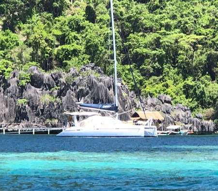
- Anchored in Coron, the Philippines
Let Down by Charts
Up the Manamo River in Venezuela, the charts let me down: they were dead wrong and then stopped showing anything. It was like sailing off the edge of the world! They were off in parts of Panama too, but there was an excellent guide book, which included detailed chartlets for the San Blas islands. The charts were also off in parts of French Polynesia, but not bad. The Cook Islands was where the chart errors became dangerous. The entrance and channel to one of the atolls was off by about 100 meters! Perfectly parallel, but way off. And the entrance was difficult to see.
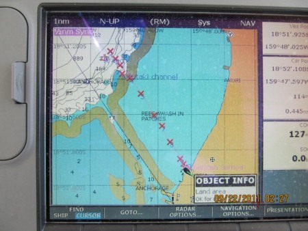
- The Red Xs on this system mark the actual route. Photo (c) Robert Watson.
Fellow cruisers were happy to share their downloaded satellite images and openCPN for use on my laptop. There are websites that offer free cruising information, which is far more up to date than paper cruising guides. You can donate your updated info too. For crossing the pacific, check out the Soggy Paws Compendiums. You can also find detailed info about satellite imagery for your laptop.
Unreliable Data
An example of unreliability. I anchored off a small island in Tonga (hoping the whales would get close enough for a good visit!), I had three electronic charts – ISailor, CM93, and Navionics – and I had a detailed paper chart of the area. There all showed me in the same place: on the wrong side of the island!! Google Earth showed where I was, accurately.
- Somewhere in Tonga. Photo (c) Robert Watson.
There was an iPad app, that allowed an overlay of CM93 charts and Google satellite imagery. It was dropped and an app was developed to download and store satellite imagery. It too was dropped. The most recent satellite imagery app, Guru(pro) is a bit more cumbersome to learn than it’s predecessor, but is easier to download different satellite images. It is simple to leave a track. You can set up the screen to show cruising data, and location.
 Using Satellite Imagery
There are three satellite imagery sources that I use. Often, one is not clear, from sun glare or cloud cover. For these areas (that might be visited), I download more than one satellite image version. Choose the level of detail you want to download. Download to your hearts content when you have high speed internet. It doesn’t seem to take much space on the tablet or phone, so if you just might possibly visit, download lots of high resolution, zoomed in, detail.
The Sat2Chart program automates the process and has more sources of map data available. Download the program from the link. There are numerous tutorials in the program: http://www.gdayii.ca/Downloads.php. Instead of using GoogleEarth, most people in the know are using SAS.Planet as their source of satellite images. SAS has 4-6 different sets of satellite images. And Sat2Chart can be used to automate making charts of larger
areas. Best to use the version of SAS.Planet on the GDay site as it has been configured to work well with Sat2Chart. Just download and unzip. No installer necessary.
Google imagery is just one of the satellite images available, and often, not the best one. Others to check include ArcGIS and Bing. In some places, I switch between the three images to get the best image for critical spots. Critically important if you travel off the beaten path.
Not difficult to download (and store) using Guru (for IOS).
More than one source
No one image source is always superior. I use Google Earth as my base, since it includes place names. Bing and ArcGIS are the others that are often better images. It is easy to switch between the different images, but not to overlay with charts.
Paper charts?
Not many people use them any more. There are typically less accurate than electronic charts (and more difficult to update.). I grew up on coastal navigation and enjoy paper, but they became a waste of space and money. At a marina in the Philippines, somebody donated a huge stack of paper charts for people to take. I don’t know how many years they sat there, but they eventually got used: I cringed when they got used to start the BBQ.
And if you have a sextant and know how to use it, by all means bring it. If you want to delay starting your cruise, mastering celestial navigation is a good excuse.
I prefer having at least two spare GPS devices, with charts: one of which is stored in a different location. If the world changes so much that all GPS is lost, you may not be in a hurry to get to civilization.
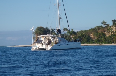
- Anchored in the Marshall Islands with a mega-yacht for company. Photo (c) Robert Watson
On entering a new channel or anchorage, I have a setup at the helm station. I want it right next to me for immediate access – three screens:
- One is my iPad with the best satellite image showing. This gives a rough idea of depth, and obstacles. My chart plotter (MFD) is split screen.
- One side shows my chart, with depths, but not a trustworthy GPS location. Too many times my chartplotter has shown me anchored on an island, or traversing a reef.
- The other side is my depth sounder. I gave up on an analog model, just showing depth. I use one that shows bottom contour (Raymarine downvision, but there are newer, better versions). Now I can’t imagine anchoring without it.
Yes there is a whole world out there: much of it, such as some of the islands of Micronesia, is still largely unspoiled (for now!). Go explore!
Robert Watson
SV Changing Spots
………………………………………………………………………………………………………………………………………
About the Author

- Robert Watson (at front – right) with fellow cruisers somewhere in the Philippines.
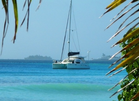
Robert Watson retired in 2007 and in February 2008 moved aboard Changing Spots, a 40 foot, Leopard catamaran. She was much more complex than his previous boats, so Robert spent the first year cruising the East Coast of the US, in an out of the Intra-Coastal Waterway.
He learnt all the boat’s systems, either breaking it in or breaking it and started adding things like a watermaker, solar panels, SSB radio and sewing projects. Changing Spots has been his full time home as he explores ‘off the beaten path’.
Robert is currently in Malaysia, undertaking repairs and maintenance to his boat.
………………………………………………………………………………………………………………………………………..
See more “Off the Beaten Path” articles and resources here.
………………………………………………………………………………………………………………………………………..
The opinions expressed in this article are the author’s own and do not reflect the view of Noonsite.com or World Cruising Club.
Leave a comment
You must Login or Register to submit comments.