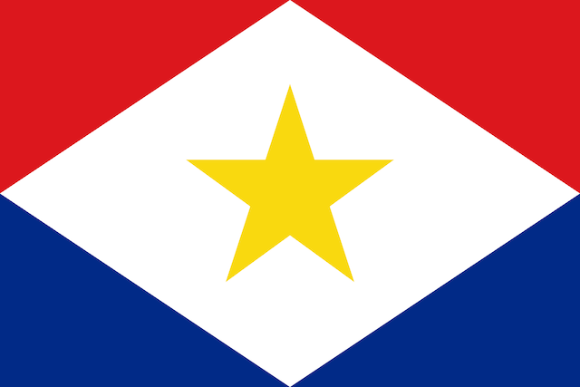
Saba - Facts

Select your download option below


  • Saba is now part of the Kingdom of The Netherlands and was originally settled by small groups of Dutch, Scottish and English people, together with a few from Africa.
  • This small Caribbean island lies about 25nm NW of Statia.
  • An extinct volcano, only 2 miles (3 km) in diameter, Saba rises sheer out of the sea up to 3084 ft (940 m).
  • Saba is unique in that its entire coast is a protected marine park. There are no beaches, but the underwater scenery is remarkable.
  • A permanent mooring buoy system has been placed within the Saba National Marine Park for specific users and there are strict anchoring rules.
  • There are two designated anchorage zones within the Saba National Marine Park: one between Ladder Bay and Wells Bay (west side) and one in front of the Fort Bay Harbour (east side).
  • Entry formalities have to be completed first at Fort Bay, which offers better protection in strong NE winds, while the other anchorage is more sheltered in SE winds.
  • It is strongly recommended to only come ashore at Fort Bay harbor, as attempting to land at Well’s Bay, Ladder Bay or Cove Bay can be treacherous in certain seas.
  • The construction of the airport, the road to the harbour in Fort Bay, and later a pier, has brought in tourism on a small scale.
  • It is advisable to self-sufficient when visiting Saba as getting ashore is not always easy. See Yachting Essentials for more information.

Read and Post Related Comments

If you have information for this section, or feedback on businesses used, please let us know at [email protected]. We also welcome new information about businesses you have used (see Related Businesses).


Select your download option below


Next Section: Profile: Security

Saba was last updated 5 months ago.

Related to following destinations:


YachtFlags.com provides high quality courtesy flags that are manufactured in durable Knitted Polyester fabric. Knitted so that the fabric itself does not deteriorate in the constant movement that marine flags are usually exposed to, and polyester so that the flag does not weaken in the strong UV-light usually found in the main sailing areas of the world.

YachtFlags.com offers a discount to Noonsite members.

Use the coupon code NOONSITE_5A2B when checking out to get 10% off today.

Buy Now On YachtFlags.com

YachtFlags.com provides high quality courtesy flags that are manufactured in durable Knitted Polyester fabric. Knitted so that the fabric itself does not deteriorate in the constant movement that marine flags are usually exposed to, and polyester so that the flag does not weaken in the strong UV-light usually found in the main sailing areas of the world.

YachtFlags.com offers a discount to Noonsite members.

Use the coupon code NOONSITE_5A2B when checking out to get 10% off today.

Buy Now On YachtFlags.com

YachtFlags.com provides high quality courtesy flags that are manufactured in durable Knitted Polyester fabric. Knitted so that the fabric itself does not deteriorate in the constant movement that marine flags are usually exposed to, and polyester so that the flag does not weaken in the strong UV-light usually found in the main sailing areas of the world.

YachtFlags.com offers a discount to Noonsite members.

Use the coupon code NOONSITE_5A2B when checking out to get 10% off today.

Buy Now On YachtFlags.com

You must Login or Register to submit comments.

  1. January 16, 2019 at 8:01 AM
    Data Entry2 says:

    See this link for mooring maps: https://www.sabaport.com/yacht-moorings

    About half of the moorings in Ladder’s and Wells Bays were missing as of early Jan 2018. I think we were on mooring P, which is farther out than it seems from shore. Mooring G is definitely the best sheltered. Definitely take a look around the mooring field to understand the mooring locations. (Also the balls are pretty small so you’ll need to get up close to locate them.) Make sure that you run your own rode through the mooring pendant; the marine park is trying to prevent chafing of their mooring lines.

    We used the Anchor Pro app and kept one phone with the boat at all times.

    The marine park people said that mooring overnight at Fort Bay was not recommended at all (but you can take your “big boat” there during the day if your tender cannot traverse the sometimes treacherous 2 nm from Wells Bay to Fort Bay).

    Mooring at Wells Bay was most comfortable but rolly at night. Wind speeds were roughly 12 knots or less. Would not recommend going to Saba if the forecast calls for any higher than that.

    We found it impossible to land our dinghy at Wells Bay or Ladder Bay, so we took it to Fort Bay every day. We have an inflatable that did just fine. We were lucky to catch a weather window with little swell. Make sure you have enough dinghy fuel when you arrive. If you need to fill up a tank, there is a gas station at Fort Bay — take the road heading east and walk up the slope. The fuel station is at the top of the slope.

    Taxis: you can get a list of taxi operators at the marine park office. Hitchhiking also works.

    Must-dos: hiking the Ladder, hiking Mount Scenery, scuba diving, snorkelling. You can moor your tender to the diving mooring balls as long as you vacate the mooring if an actual dive boat shows up. Wells Bay and Torrens Point have great snorkelling.

    Laundromat: is on The Road, about a third of the way up to the Bottom.

    We really enjoyed Saba and thought the visit was worth the extra preparation and hassle.

  2. August 16, 2017 at 8:00 AM
    Data Entry2 says:

    Sargassum hits Saba:
    Reported by Joan Conover 10 August 2017.
    Saba has its beaches full of Sargassum weed. There is currently no solution to this problem. An online site to track Sargassum weed via satellite images is in development – lots of discussions right now about what to do about this problem.
    Search “Sargassum” on noonsite for latest news items.

Click to access the login or register cheese