Western Indonesia: Cruising the Riau Islands

Long-term cruisers in SE Asia, as well as long-term contributors to Noonsite, Sue and John Woods spent 2 months cruising the Southern Riau Islands in Western Indonesia in early 2019. Their route took them down the west coast of most islands and then back up the east coasts on their return trip, giving them a good overview of what each island has to offer. This extremely useful cruising report includes details of all the anchorages they used, passage and weather details plus a wealth of local information.
Published 6 years ago, updated 4 years ago
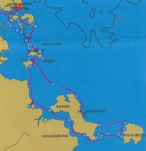 The southern Riau Islands, Indonesia, are a collection of large island groups bordered by Singapore and Johor Bahru, Malaysia to the north-west, Sumatra to the west, Kalimantan to the east and the Java Sea to the south. It is just 360 miles from north Batam to southern Belitung as the crow flies, but this area includes hundreds of small and some large islands.
Not many years ago this area had a negative reputation that suggested piracy, unfriendly local inhabitants and difficulty in gaining official cruising access from the Indonesian government. While a significant amount of commercial shipping passed through, there were very few cruising yachts.
In the past 10 years or so, with the increase in cruising boats visiting South East Asia and the Indonesian sailing rallies – supported by the Indonesian government – visiting some parts of the Riau Islands, more interest has been generated about this region. The change in cruising permit conditions by Indonesia in 2016 has also made access much easier.
Our 2019 cruising plans included 2 months in the Southern Riau Islands. With such a contained area to explore, we hoped for a slow, relaxed meander through these island chains.
We entered Indonesia at Nongsa Point marina, on the north coast of Batam Island in early March.
Batam Island to Lingga Island:
After completing formalities to clear into Indonesia, we left the marina and headed west, travelling parallel to Singapore’s coastline and viewing its famous landmarks across the shipping lanes. There are many large ships anchored off the coast and much heavy industry – ship building, container wharves, etc – lining the shore of Palau Batam and some of the larger islands. There is a large town, Sekupang, in the deep bay just SW of Nongsa Point. Many fast-speed ferries roar in all directions and the water is choppy with boat wash and intersecting currents. Further west, then south, there are many small islands, most with some sort of industry or water village attached, and channels between. There is a lot of water traffic in the area.
We initially intended to travel down the main channel between Palau Batam and Palua Bulan/Palau Lumba, but our GPS/AIS showed intensive shipping throughout the channel. We wound our way further west and eventually dropped south-west into one of the small channels between the islands off the Palau Bulan coast and found a spot in one of the many quiet backwaters for the night.
The scenery here is not wonderful – there are many small, low-lying, mud-ringed islands, much heavy industry on the bigger islands and fish stakes everywhere, but it was interesting to see poor water villages and fishermen in small canoes with the high-rise buildings of downtown Singapore and huge oil tank farms behind them.
We motored down a major channel beside Palau Kepalajerih, through Sister’s Islands Marine Park to Palau Combol. Here it was much less busy, the water was much clearer and the islands were attractive, with some sandy beaches and palms. Further south, below the larger islands of Bulan, Rempang and Galang – where there were still quite a lot of large ships anchored and some heavy industry ashore, the scenery “opened up” and it was much more appealing.
We continued further south-east, on a track for Lingga Island, but kept stopping at wonderfully calm, lovely anchorages along the way. There was a low and short south-west swell in the open sea but this was easily avoided by travelling in the lee of the many islands, most of which lay in a NW to SE orientation.
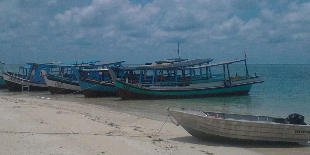
We spent a couple of days in the passage between Palau Abang Besar and Palau Abang Kecil. There is a large bay on the north side of the channel with good depths for anchoring. At the northern end of this bay the depth increases to 20 metres in places but we anchored in the centre of the bay, in 6 metres over sand. The water is clear and the whole bay is quite protected. On Abang Kecil there is a village with some tiny shops selling basic supplies, including eggs and vegetables. The Ranoh Resort, also on Abang Kecil, mainly caters to day guests but staff are happy for yachtees to come in for a meal and drinks. Prices were reasonable.
The next group of islands to the south-east forms a natural “harbour”, providing several excellent anchorages which have great weather protection from most directions. We anchored on the southern coast of Palau Ansunda, away from the main town on Palau Benan, as it was quite busy there with a lot of fast ferries and local boats coming and going. We moved across the bay to P. Senimpan when a SE swell rolled in. The town of Benan is good for provisioning – there was vegetables, eggs, canned and dried good, some drinks, etc at the main store, even beer! There are two radio communication towers here, so phone and internet reception is good.
By this time we were cruising in typical tropical waters and the scenery was seriously gorgeous – clear blue water, many luxuriant islands with sandy beaches, and lots of reef. The local folk have marked many of the reefs with stakes at the edge, or have built fish traps or huts on the reef flats – this and the clear water helps navigation. Our three navigation systems continued to be fairly accurate but we did note that Navionics would at times indicate large areas of reef where actually there were deep channels with reef only at the edges. This was especially notable where several islands were clustered together.
We spent a few days in the myriad of waterways in the island group just north of Lingga Island. This area is fantastic for exploring by dinghy if you have a decent outboard – the currents can be fierce. There is a lot of reef, mainly fringing but there are certainly some isolated and unmarked patches. The electronic charts will indicate most of the reefs and rocks but sometimes their position and size can vary substantially from the charts. We found marked islands to be completely missing, reefs much less extensive than shown and in one anchorage, 2 of our 3 navigation programs had us inland on a nearby island and the other program had us on a reef, when we were in fact in 15 metres over sand, well off the reef.
You need to keep a close visual lookout at all times when maneuvering through these islands.
We used the passage from this internal waterway just north of Palau Lingga (between Palau Gajah and Palau Talas) through to the open sea to the west. The passage is easily navigable but full of rocks and reef, whirlpools and overfalls. The confused water and fast current flow is especially demanding at the “chokepoints” of the passage – at both ends and where it narrows in the middle. There was always plenty of water beneath us, but the seabed is very convoluted, and this probably adds to the whirlpool effect. Full attention is needed here.
Once through this tricky passage we noticed that our latitude was reading “south”. We had crossed over into the southern hemisphere while we were travelling through the passage!
Lingga Island to Bangka Island:
Palau Lingga is mountainous on its western side, and travelling down its western coast is very scenic. The peaks provide a wonderful backdrop to the fishing huts and passing fishing boats. Once we gained Lingga’s south coast we could see that its east coast is much flatter.
At this point we needed a bank, a Telkomsel phone reload, beer and a big restock of vegetables – in other words, a town with facilities.
Through Google Earth we found a large town nearby – Dabo, on Palau Singkep, and it proved easy enough to get to from where we were anchored against P. Selayer. We dinghied to the town jetty at Tg Jagoh, on the north coast of P. Singkep, where we were met by some local lads who immediately offered transport “to town”. The options were 300,000rp for 2 people to Dabo and return by car, with a 2 hour wait there, or 100,000rp for a return trip by motorbike. We took the car option, found all that we needed and enjoyed a great tour of the east side of the island en route.
Traveling further south along the east coast of Singkep we encountered a brewing thunderstorm and strong westerly winds. We found a lovely anchorage against the coast, close to the SE corner of the island where we anchored amongst some fishing huts in 5 metres. Here we were out of the wind, though there was a low SE swell. The beach here is lovely, all sand and no reef/rocks – great for swimming.
next morning we set off at dawn, in the wake of a storm cell, to cross the Berhala Strait. This passage was unremarkable, except for the muddy-looking water, the widespread haze, the wreck just north of Palau Berhala and the low, shallow east coast of Sumatra. With storm activity still around we spent time going up the middle river of Teluk Sekhana in Sumatra to ensure a comfortable night. Unfortunately the locals were not too friendly and the fishing boats with nets in the bay were quite a trial to avoid.
Bangka Island:
The passage to the SW corner of Bangka was more of the same. The anchorage at Tg Kelian is very attractive but is open roadstead – OK in settled NW season weather, but we were experiencing storms most nights this past week, so we were watching the weather carefully. Tg Kelian is very close to the larger town of Montuk.
We continued our travels south through the Selat Bangka, which we found to be fairly unattractive and not so enjoyable. The scenery was mainly a flat low shoreline with a few lighthouses and no decent protected anchorages. An exception to this was the Rangka Islands – an attractive group with some lovely beaches and with a good anchorage at the southern end of Rangka Besar. The weather we experienced in the Selat Bangka was gloomy with numerous threatening rain cells and frequent thunderstorms.
The southern coast of P. Bangka is more interesting, with huge boulders on the shore – and some offshore. The water is clearer here, too. At the southern end of the Lepar Strait there are about a hundred fishing huts just offshore, and at night they were all lit up like a fairy village. It was quite a sight.
We wanted to travel north along the Lepar Channel but it proved quite a challenge. There is a huge sandbank across the southern entrance which small local fishing boats may cross at high tide. We eventually found the main channel used by larger fishing boats – the entrance is hard against Lepar Island, by the bay we anchored in. We followed a local boat through at what seemed like quite a high tide, but watching the depth sounder was heart-stopping. Twice we had depths of 1.4 metres (our draft is 1.3M) but we did make it through, and stayed in the very protected bay beyond the channel for 3 days.
The town at the top of the channel, Sadai (or Sadar on one chart), had some useful facilities – a bank with an ATM, a shop that could sell us more credit for our internet connection, small shops with vegetables and eggs, a fellow who sold beer from the back of his shop, and a small supermarket. We found the “canteen” at the ferry terminal at Sadai on Palau Bangka has quite good food (albeit cold) and several times we bought food to take back to the boat. The choices included chicken curry, sambal prawns, fried chicken, stuffed sotong (squid), fried fish, various fritters and sweet bread items.
We were greeted warmly by the locals we met at the water taxi dock. Jeffry (Ph. No. 0878 69908505) seems to be the main “meet and greet” guy, who will offer advice and transport via motorbike or car. As we felt very comfortable here and the anchorage was very protected, we decided to go to Toboali, a large town about 40 minutes drive away. There we visited a dentist, the wet market, a bank and a small “supermarket”. Jeffry asked for 300,000rp for the trip, which included some running around and waiting.
Bangka Island to Belitung:
The crossing from Bangka to Belitung was made in blissful weather – sunny, calm, no wind or swell. There was reef to dodge when leaving Palau Lepar and when approaching the barrier islands on the west coast of Belitung but the Navionics and GPS charts were remarkably accurate here. We were astounded at the colour and clarity of the water – it was an amazing deep blue and crystal clear.
- Belitung
Belitung Island:
We anchored in Teluk Brang on the west coast of Belitung for a few days. This was a very protected bay with depths generally greater than indicated on our electronic charts, though there were patches of reef and huge sandbanks further up the bay. This was a very comfortable spot and the locals were very friendly, though none seemed to speak English. We found nice beaches for a swim, had a good walk to a local village and found a great little resort on Leebong (or Klebong on one chart) Island.
Our next stop was Tanjung Pandan, the capital city on the NW coast of Belitung. The approach to the river looked quite daunting with very shallow depths, but as we approached the town, we noticed on our GPS the AIS image of a sizeable ship entering the river. This convinced us we could as well, and we followed a fishing boat in. At mid tide we found the shallowest depth on our track was 2 metres. The only marker past the small island was a single stick poking out of the water, with a rough arrow shape attached.
Once in the river we were amazed how many vessels were there and how little room there was to manoever. We found a tiny patch of water toward the end of the town area, adjacent to the local boat graveyard. We were close to sitting on the bottom at low tide, but all was good. The town is quite large and the markets are close by the local water taxi/public jetty, where we left the dinghy safely for a couple of hours.
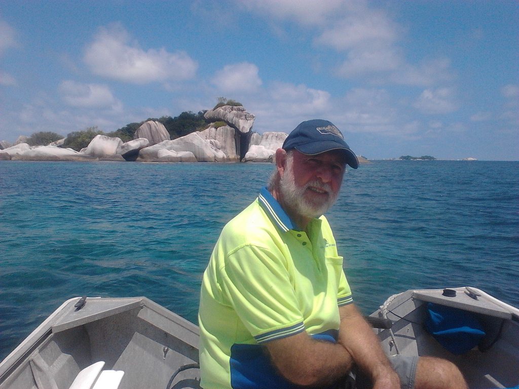
After an overnight stay we headed north for Tanjung Kelayang on the NW corner of Belitung. This anchorage has been used by yachties for quite a while but it was quite a navigational exercise to miss all the reef, rocks and shoals to tuck into the sheltered corner of the bay. The bottom is sand and seagrass and there are several resident turtles living here. The bay and surrounding area is beautiful with the clearest water we have seen in years.
Ervan is the “go-to” guy here (Ph. 0819 77781455) – he owns the café at the end of the jetty, and can arrange most things – fuel, bike/car hire, trips to Tanjung Pandan, laundry, etc.
We had a lovely few days here dinghy-touring around the various islands, islets and rock formations, swimming in the clear water and eating in the local restaurants that line the beach. We also asked Ervan to provide us with some diesel and to take us to Tanjung Pandan by car to reprovision. We were quite sad to have to move on.
Returning North:
We had now reached our turn-around point so it was back to Palau Bangka across the Selat Gelasa, and we stopped for the night at Tanjung Berikat. We spent two days travelling up the east coast of Bangka and passed some interesting sights. Just north of Palau Panjang we saw a huge fleet of small sand dredges anchored together – there must have been over a hundred of them. A little further on we saw what looked like a Thai temple or palace on a hillside. At the entrance to the Sungai BatuRusa there were two huge modern sand dredges anchored amongst other ancillary dredging vessels and a couple of coastal freighters waiting to get into the river, which seemed to have an opening bridge over it close to the entrance.
We stopped at a small group of islands en route from Palau Bangka to Palau Singkep, as the total distance was too great to do in a single day. The anchorage was attractive, with several turtles swimming by and some friendly locals waving to us, but it gave only scant protection. If the weather was calm, this small island group would be a great place to explore by dinghy. Unfortunately for us, that night the wind swung 180 degrees and we had a few worrying hours until daybreak when we could head off again.
We returned to the channel between P. Singkep and P. Selayer for a few days to rest, refuel, do some boat chores, visit Dabo to reprovision and use an ATM. Every day we were there big storm clouds rolled down from the mountains on west Lingga, over Selayer and onto Singkep so we caught lots of water here. On a dinghy tour of Palau Selayer we found several lovely sandy beaches with no reef – great for swimming and picnics – on its northern coastline.
Our next stop was the large bay at the eastern tip of Palau Lingga. This bay is big but open and quite shallow. We had a rolly time there with a southern swell and easterly wind, though as it often does, the wind dropped off in the evening. As we moved further north along the east coast of Palau Lingga we noted that this side of the island is quite flat, with a sparse population.
There are several very attractive island groups off the east coast of Lingga and many passages within the waterways of north Lingga that offer interesting anchoring options for any weather conditions. We crossed the Equator again in this area. One notable anchorage was on the southern side of Palau Tapeuh where we watched thousands of fruit bats take off from their trees at sunset. Amongst the myriad of passages are many villages, small and large, and the locals seem very friendly – always offering a wave in greeting as they pass.
Travelling further north we stopped off at the Palau Benan island group, where we knew we could stock up on some fresh food and buy some diesel fuel. We tried anchoring off the main town but the high speed ferries made it very clear we were in their way – their wash was terrible. We moved over to our previous anchorage against P. Senimpan where all was calm and quiet.
The weather improved as we moved further north. It seemed that the further away we were from the mountainous islands of Bangka, Belitung and west Lingga the less stormy weather we experienced. We did get a couple of days of drizzling rain around southern Bintan Island, which topped up our water tank nicely.
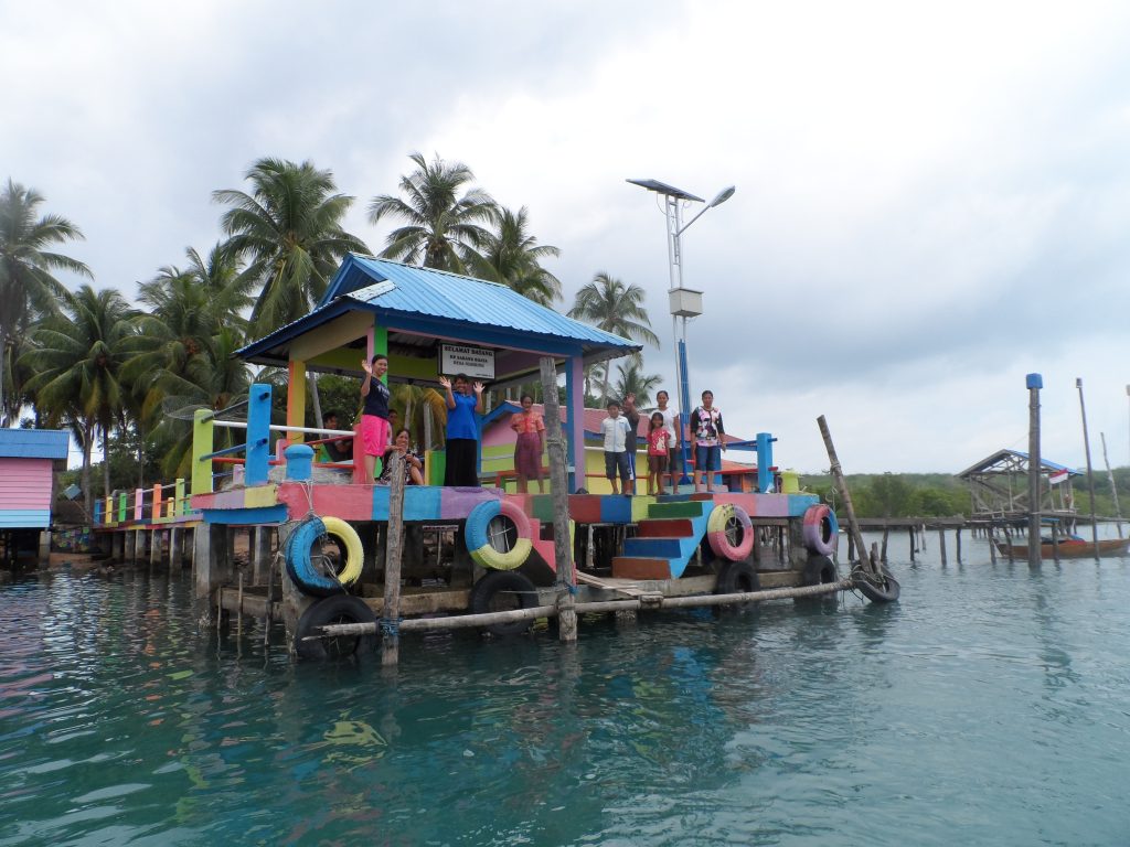
- Kampong Dulux
We found a delightful anchorage in the channel between Palau Gin and Palau Numbing. There were several small kampongs and villages along the channel, and we anchored off one we named Kampong Dulux. The inhabitants had painted their houses, their roofs and the jetty in many bright colours. The village really stood out amongst the green of the trees and mangroves. Everyone we met here was so friendly; we had waves from every passing boat and the occasional “toot” from the school ferry! We also popped over to nearby Palau Rinti in the dinghy for a swim – the water is so clear there! The main village in the channel had several shops with basic supplies, some fresh vegetables and eggs, and we even bought a frozen chicken!
We spent another few days amongst the waterways of southern Bintan and eastern Batam Islands. There is considerable evidence of bauxite mining around Bintan, though we didn’t see much mining activity happening. The small passages between islands are intriguing but careful navigation is required – there are many shoals, rocks and reefs, with strong currents through most passages. Some of the bays in east Batam still accommodate traditional fishing villages and others contain a mix of industries and activities – fishing ports, heavy manufacturing, shipbuilding, but also tourist resorts, passenger ferry terminals and seafood restaurants.
We returned to Nongsa Point marina just shy of our 60 days and stayed overnight while the marina staff organised our clearance out of Indonesia. By 10am the next morning we were heading back across the Singapore Strait, bound for Malaysia.
It had been a wonderful 8 weeks – we would highly recommend the southern Riau Islands as a fantastic cruising ground.
See our list of Anchorages HERE.
Formalities:
We applied for 60 day tourist visas at the Indonesian Consulate in Penang. This was done with minimal fuss and at a cost of 205RM per person. We submitted our application one morning (with a sponsor’s letter) and collected our passports after 2pm the next day. The visas allowed us 3 months to activate them.
We chose Nongsa Pt marina as our “Port of Entry” because of the promise of an easy check-in facility there. We had visited Indonesia previously and were aware that entry formalities can be protracted and stressful. We knew the cost would be considerable (1,000,000rp for check-in, plus 940,000rp for one night at the marina). We were assured that check-in was possible 7 days a week, even on holidays and weekends.
We were told to clear into and out of Belitung with the Tanjung Pandan Harbour Master, but when we visited them they said there was no need for this and that we could just clear out of our final port in Indonesia. We did this with no problems back at our entry port of Nongsa Point marina.
Navigation:
Good navigation here is crucial. There are numerous rocks (some marked on the charts, some not, some with markers, most without), mud and sand banks, fish traps, islets, channel markers and fast currents. We used three navigation systems – Navionics, Open CPN and Insight (on our Simrad GPS) – and generally all three were very close to each other, and with what we saw, most of the time but you do need to keep a close visual look out. We found many patches of unmarked shallow reef. Depths vary greatly and are often not what is indicated on the charts. The depths noted seem at times to be an average depth of the nearby seabed. For insurance we also travelled with a rising tide and with good overhead light when possible. Travelling through this area at night would be quite foolhardy.
Strong currents can exist in passages between islands, and they can affect the local sea conditions to a significant degree. At the entrances to passages or at the corner of an island there can be confused seas with undertows, small whirlpools and overfalls. Areas of greatly varying depths can also cause upwelling currents which can also contribute to short, sharp choppy waves, but these disturbances are very local, and obviously worse with spring tides.
Jerry & Caz, on SY Mandarina had reported to Noonsite in 2010 – “The area is tidal, with reported tide streams of up to 3 knots (we saw one of 4 knots). The flows are tortuous around the islands but generally set West & South for the flood, East and North for the ebb. The strong streams scour the sand and mud from many of the channels and areas around islands. Tides are diurnal in the North, a single tide predominating in the South.” We experienced the same on our trip, and also found that tides sometimes varied greatly from what was predicted in the navigation programs. We had trouble finding accurate tide information on all our navigation programs once we were in the Bangka/Belitung area.
Weather:
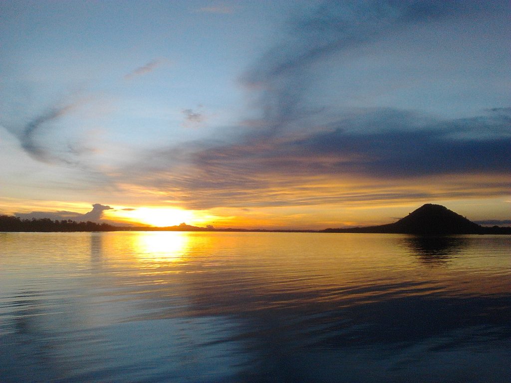
Weather is always a chancy thing. The Indonesian Pilot, describing the area of the southern Riau Islands, states “The NW monsoon prevails from November to March and the SE monsoon is established over the whole region from April to September”. On rainfall and thunderstorms, it says “..the rainy season is associated with the NW monsoon and the wettest months are December and January.” It also states “Thunderstorms are reported on most days in some parts of the area, and tend to be more persistent over the sea before dawn.” We chose to travel this area in a transition period, hoping for light and variable conditions and with more NW wind in the first month, turning to SE in the second month.
When we set out from Batam in early March, we found that the weather in the more northern areas of the Riau Islands to be delightful – not too hot, just an occasional shower which quickly cleared, and clear skies for most of the time. There was very little wind and it was variable.
Further south around southern P. Singkep, the Sumatran coast and Palau Bangka, it became more unsettled and stormy. There were calm mornings, often a westerly breeze with a storm developing by midday to mid-afternoon, and the wind swinging to the north by mid/late afternoon. Occasionally there were storms at night. By late March we were experiencing thunderstorms most afternoons or nights. We had hoped the Bangka Strait would provide some shelter but it is too wide for this – strong winds hit us across the channel from the west several times. This period of stormy activity continued for several weeks while we were in the Bangka/Belitung area. Typical for this area, or just the time of year we were here?
By mid April we were still experiencing almost daily afternoon thunder and cloud buildup, which usually resulted in a storm or rain that night. In mid-April we also experienced the first southerly wind, variable and light initially but eventually establishing itself as the main wind direction for the rest of our travels here.
As we returned to the more northern Riau Islands area in late April, most of the stormy weather had eased, though we often had light rain most days. Some mornings we had a couple of hours of S/SE winds at 12-15 kts, then calm in the afternoons. At times it was windless and hazy. Overall, the conditions were light with frequent cloud build-up and occasional thunderstorms, and by early May the SW monsoon was becoming established.
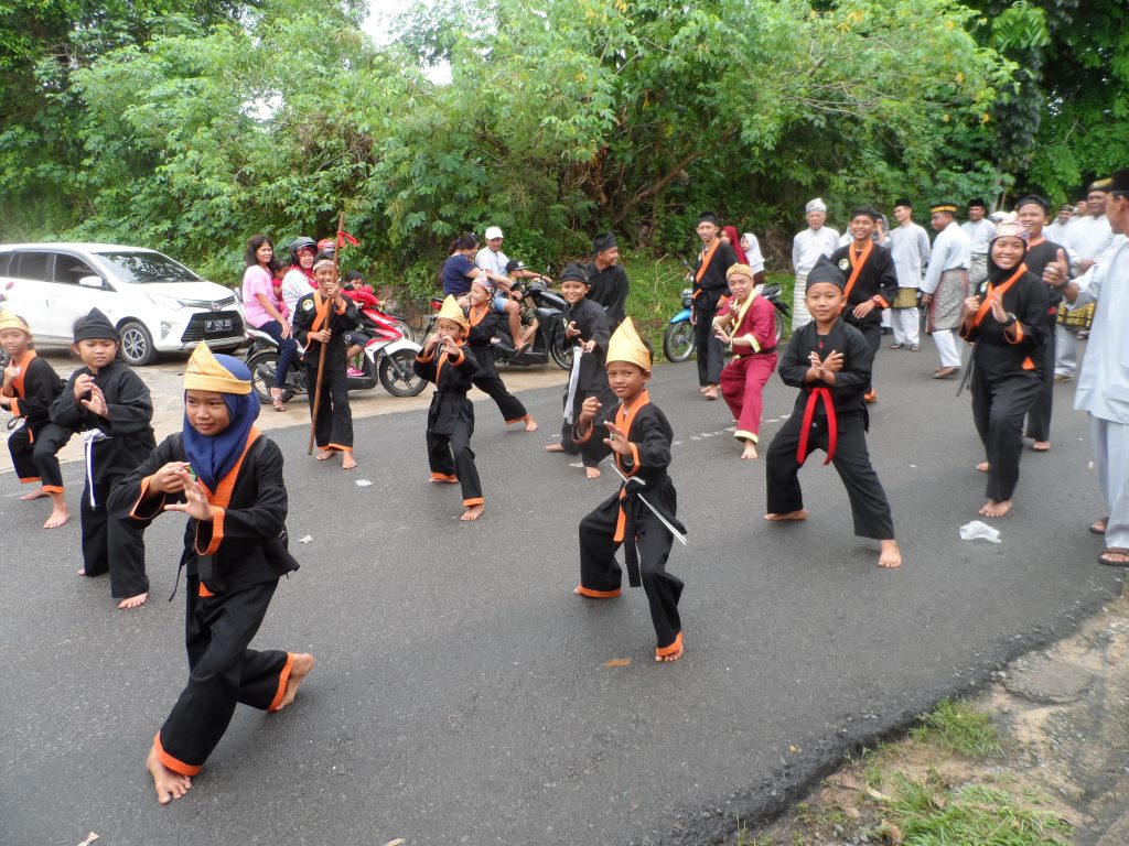
- Part of a parade in Kijang, Palau Bintan
The Locals:
The local people were generally very friendly, usually waving and giving a “thumbs up” as they passed. Several in the north Lingga area came to visit the boat – some to offer fish or fruit for sale, others just to say hello and have a look. We didn’t feel intimidated at all by these visitors. In one anchorage the school ferry passed us every day heading home and we were enthusiastically greeted by about 25 yelling school children. We found that it was only in the more remote and isolated spots that the locals didn’t wave or smile as much.
Boat Traffic:
Boat traffic through this area varies greatly. We often saw small canoes with a triangular sail drifting along with the wind. Other small boats are rowed, but in a forward motion and with the rower in a standing position. Other small open fishing boats have small engines, usually a single cylinder diesel engine mounted midships. Very few have mufflers. The larger fishing boats have a larger foredeck and a wheelhouse of sorts, with a larger multi cylinder diesel engine. Between Batam/Bintan and Singkep we also saw many fast ferries zooming between the islands, usually powered by multiple large outboards. There are also smaller local ferries and the occasional modern open speedboat. There are small car ferries and the occasional pelni (large passenger ferry) travelling between the larger islands. We enjoyed noting the slight variations in fishing boats and fishing huts in the different regions, and were amazed at the common rowing style of standing and pushing the oars forward. While many local boat drivers swung by for a look at us, most were very courteous about slowing down when passing and leaving us some room. Many would signal with a torch at night especially if their boat was poorly lit.
Provisioning:
Provisioning can be difficult in the smaller island groups. Most villages will have a couple of “shops” with quite an array of packaged goods – small containers or packets of cleaners/detergents/shampoo/noodles/spice mix etc. but very little in the way of fresh vegetables or fruit. You can occasionally buy small tomatoes, cucumbers, potatoes, carrots, bananas, limes and maybe a cabbage or pumpkin. There is usually no meat, fish or chicken available and certainly no cheese, bread or other western type of food.
The larger towns we visited had fresh chickens and fish for sale at their local wet market, but with no refrigeration, you need to shop early in the day. The markets generally had a great range of vegetables and fruit, and eggs were always available. In the stores there are quite a variety of biscuits and crackers, sweet cake things in packages and noodles, but no cereals or pulses. We saw no cheese, butter or yoghurt but did on occasion find sliced white bread. Beer was obtainable if you had a local with you to show you where to go – it was usually stored in a back room, with no advertising. We saw no other alcohol but did hear of some “local whiskey” for sale (though our guide said “no good!”). Pet food and other supplies are non-existent – luckily our moggie liked the tinned sardines once the sauce was washed off.
Eating Out:
Eating out is a real treat because opportunities are so limited. The smaller villages have a few “warungs” which sell nasi or mei goreng (fried rice and noodles), maybe a soto (soup) or some sort of fried chicken or sates. The larger towns will have “restaurants” that will offer a limited selection, usually already cooked and on display. The only protein we saw was chicken, fish or prawns. There were very few vegetable dishes. Usually the food on display was cold – we sometimes bought a meal and took it back to the boat to heat and eat later.
We found very few “resorts” or restaurants. We came across the following places as we tiki-toured about.
• Ranoh Resort, off Palau Abang Kecil, at 0*33.55’S, 104*13.83’E. The staff was very welcoming and the resort beach area is impressively clean and attractive. To use their resort’s facilities and groomed beach is 550,000rp per person per day, but they were happy for us to use the bar and restaurant at no extra cost.
• Leebong Island Resort in Teluk Brang on the west coast of Belitung, at 2*57.65’S, 107*32.03’E. The resort occupies the whole of Leebong Island, and there is a lovely trail to follow around or through the island to their sand spit café/bar (mainly used at low tide!). Again, they usually charge 450,000rp per person per day to use the resort, but were accommodating to us in providing just lunch for 2 persons for 350,000rp. The lunch was very impressive – several courses served together, including chicken, fish, vegetables, calamari and rice with 2 sauces.
• There are several restaurants along the beach at Kelayang, Belitung. We ate at Lili’s, which also sells Bintang beer, and the food was very good. There is also a pizza restaurant on the main road about 500 metres east of Ervan’s café.
• The Happy Restaurant and Bakery in Tanjung Pandan, Belitung has a wide menu and very good food! It is close to the main roundabout in the town – just ask a local to show you.
Communications:
Technology has made its way to the southern Riau Islands. We saw many radio communication towers, satellite dishes and TV aerials. Many of the locals have smart phones and they often asked us to pose with them for a photo, which they wanted to put up on their facebook page. Cell phones are common, some used with ear pieces. This seemed to us quite a contrast to the unpainted timber and thatch-roofed houses without glass in the window spaces, rickety timber walkways connecting houses in water villages and the lack of more varied and healthier food. We noticed that many of the fishing boats around Bintan and Batam Islands had VHF antennas and some even had GPS aerials.
There are telecommunication towers even in the more remote areas and people seemed to use their phones for talking, texting, as a camera and for facebook. While we managed internet connections with our tablet in most anchorages, the strength of the internet connections is generally so poor that we were only able to connect our laptop to the internet, via Telkomsel dongle, in the larger towns. International phone calls chewed up the load on our phone very quickly. Likewise the internet load – it seemed to go much sooner than expected.
Suggestions:
1. Bring enough cash with you. Only the larger towns have banks with ATMs, and the banks do not like to do a withdrawal transaction over the counter with a foreign card. The ATMs will often only allow you a small withdrawal amount, often only one transaction a day, and sometimes they are empty!
2. If you need diesel, start looking early. Some distributors won’t sell to foreigners; others may charge you a non-local rate.
3. Get your internet and phone needs sorted out in the first large town you come to, and put a lot of load on your device. It is difficult to find somewhere to reload, and the rate of usage seems to go very quickly.
4. Try to be as self-sufficient as possible – there are few towns with marine supplies or trained mechanics. Maybe have a contact back in Malaysia/Singapore who is able to send parts if needed.
5. Palau Batam has duty-free wine, beer and spirits! You have to hunt for the shops (use Google maps) and the prices seemed to be similar to or slightly higher than Malaysian supermarket prices, but it is there for purchase. No passports needed.
Sue Woods
MV Solita
For other cruising reports submitted to Noonsite by MV Solita search here.
……………………………………………………………………………………………………………………………..
The opinions expressed in this article are the author’s own and do not reflect the view of Noonsite.com or World Cruising Club.
Related to the following Cruising Resources: Off the Beaten Path

I want to give a thumbs up on the welcome and service s/v Flying Fish received by Yacht Facilitator Joni and proprietors Penny and Evan at the Dermaga Resto in Belitung.
Joni completed a visa extension for me in a super quick 2.5 days (it took 3 weeks in Lombok). He is a high school administrator who takes pride in speaking English. He is courteous and his fee is fair.
Evan and Penny can handle anything else a cruising sailor needs including clean fuel, motorbike rentals, laundry, and great food. Penny’s amazing smile is worth the stop alone.
Both are on WhatsApp.
Joni: +62 812-7143-4108
Evan and Penny: +62 819-7778-1455
PS – potentially, one could check out of Malaysia in Tioman and into Indo at Riau Island (the big one by that name). Then check out of Riau when leaving and into Malaysia at Kuching. No?
Hi Sue,
Read with interest your journey through the South Riau Islands and your many posts here and on CF regarding your travels through PHL. Found them very helpful in making my own passages through PHL, where I am a permanent resident.
Wondering if you have ever done an island hopping trip through the northern Riau Islands off peninsular Malaysia, and over to Kuching in Sabah?
Looks like it might be doable during the SW monsoon. I’m thinking of starting in Mersing on the mainland and hitting Tioman, Jemaga, Siantan, Riau, then SE to Subi Besar and Kuching.
Except for Tioman, these islands are Indonesian. Wondering if there is any way to check in to them, or if anyone might care or even know I was there. Could simply anchor off the beach.
If you have not made the trip, do you know of anyone who has done this and might have first hand info on this stuff and possibly on tides, currents, dangers along the way? China sea is pretty shallow and narrow there, so that may be a concern. Any good, free sailing directions available which might help?
Thanks for all your great posts,
G2L2
The northern Riau Islands, ie Anambas and Natuna island groups have been well visited and documented by individual sailors and rallies since the Indonesian Govt. improved access to these and other areas in late 2016. Now you are able to arrive at Tarempa and apply for a “30 day visa on arrival” – which would probably be more than enough time to explore the area and move on towards the Sarawak coast.
We traveled from Kuching to Palau Tinggi in late 2016, stopping in at Terampa and the surrounding islands of Anambas for 3 weeks. We try to avoid traveling at night because of the numerous fishing boats, FADS, nets etc so essentially day-hopped all the way. We have written an account of our visit there, including all anchorages – it is available on noonsite under “Anambas Islands”. Prior to our visit, the Howarths on their yacht “Alba” wrote an excellent account of their time in this area – this is also logged on the noonsite web site. We found their notes excellent when planning our time in the Anambas.
The Passage to the East rally now also travels via the Anambas and Natuna islands. They leave the Malaysian peninsula around May, heading east from Tioman. The rally guide, which is updated annually by Elizabeth and Patrick on “Le Barque”, gives excellent information about this area, as well as anchorages.
With all these resources I’m sure you will be able to plan your journey eastward from Tioman.