
The Red Sea: Don’t Rush Through an Incredibly Beautiful Area
Despite their concern about the unstable political situation and possible threat of pirate attack, Hans and Imma Geilinger say their decision to sail through the Gulf of Aden, up the Red Sea and into the Mediterranean, was one of the best they have made on their cruising adventure around the world. In this very detailed report they outline the safety aspect, clearance procedures and every anchorage they visited on their way north.
Published 10 months ago
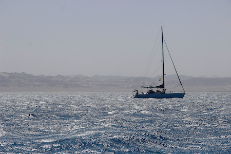
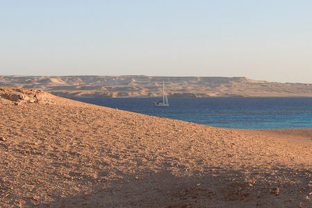
Many sailors look at the Red Sea as a mere transit area to get to the Suez Canal as quickly as possible. Accordingly, they sail as fast as the prevailing north winds allow to Suez, but miss an incredibly beautiful sailing area with a variety of excellent anchorages in coral reefs, with great diving and friendly people in Sudan and Egypt. So, absolutely no need to rush!
Clearance
We made clearance in Djibouti, Suakin – Sudan, Hurghada (Egypt in), Suez (Egypt out). So we passed a long time between Sudan and Egypt without having clearance papers, but this is more or less accepted by the Egyptian authorities. It would have been possible to make clearance in Port Ghalib, but we avoided it as we didn’t need any fuel or food and in the end you sail and stop as well going north.
Once we made official clearance in Hurghada / Egypt, obtained our visa stamps in passports and a cruising permit, officially we couldn’t go on land in the anchorages between Hurghada and Suez. However, we went for walks on shore every time when we didn’t see any police station or village in front of the anchorage.
So, clearing into Egypt only makes sense when you want to go for land trips, see the small towns, go shopping or have crew changes on the way. We cleared in officially and felt very happy we had, even it is really expensive to do so!
Agents
We never used agents in sailing around the world, but in the Red Sea you will need an agent. Basically, because most of the authorities only speak Arab (and you won’t, I guess) and bureaucracy is a nightmare. The only exception could be Djibouti, at least if you are French speaking.
Contact all the agents some days before you leave the last country and lose the internet connection. The only smooth way is using WhatsApp. Often, they ask for many ship documents and pictures of your equipment, sending it as photos through WhatsApp is the easiest. In general, if you send them emails by Iridium or if you are calling them, they do not reply. So, WhatsApp is the only way (Note: I think the latest IridiumGo Exe (Spring 2023) is able to send WhatsApp).
Nautical charts
Navionics is very often completely wrong and very poor on details. CM93 on OpenCPN too. It’s mandatory to use Google Earth offline if you want to enter the reefs of Sudan and Egypt. We used an Android tablet with geolocation, which allowed us to switch on OpenCPN between Navionics, CM93 and Google Earth, all offline. This very useful tablet was configured by Philippe from SV Ulani – http://www.ulani.net.
There is also circulating in the cruising community a shared Dropbox archive with all the Google Earth images, which you can use.
Books
The Red Sea Pilot book is old, but still very useful. Everyone should have it on board. You can’t buy it anymore, but it’s also circulating in the cruising community as a PDF.
Henry de Moinfreid published 100 years ago a very nice book, called in French “Les secrets de la mer Rouge”. Available also in German and English as an e-book. It gives you an idea about the history of the Red Sea. Maybe there have not been so many changes since then.
GULF OF ADEN – PIRACY
Piracy was still an issue when we crossed the Gulf of Aden coming from Maldives early 2023. So, we sailed under the vigilance of the international military force.
Organizations
There are two principal military organizations who are protecting ships in the high risks area (HRA) covering the last 600 miles to Djibouti:
- The UK Maritime Trade Operations (UKMTO)
- The European Maritime Security Centre – Horn of Africa (MSCHOA). The MSCHOA is the planning and co-ordination centre for the EU Naval Forces (EU NAVFOR).
As of Spring 2023, it seems that both are operating as usual – even if it has been reported about the end of the HRA. On the website of UKMO and MSCHOA I couldn’t find anything about it. In Djibouti we talked with some Spanish military officials and they confirmed that they are still working as usual in the area.
Safety Areas
There are two different areas and a corridor:
- Voluntary Reporting Area (VRA) > 2000 miles to Djibouti / 300 miles before arriving in the Maldives;
- High Risk Area (HRA) > 1000 miles to Djibouti;
- The Maritime Security Transit Corridor (MSTC) > 600 miles to Djibouti.
We contacted UKMTO ([email protected]) and MSCHOA ([email protected]) when we were in Phuket, Thailand and obtained all the necessary information about the trip through the Gulf of Aden and the first leg from Djibouti up to the Red Sea.
In my opinion it’s mandatory to have an Iridium on board, not only for the weather but also for safety. You need to be able to make phone calls anytime in case of a piracy emergency and send emails. With IridiumGo this works perfectly. From Maldives onwards, every morning at 0800, we sent both organizations our daily position. Once in the HRA – High Risk Area – we entered the safety channel.
Reports
1. Daily report every morning at 08:00 local time approx. with IridiumGo SMS to:
2. Text:
- a) Boat name
- b) Position GPS
- c) Course
- d) Speed
3. Type of reports:
- Initial report (Upon entering the VRA)
- Daily reports (Update on ship’s position, course and speed)
- Final reports (Upon departure from VRA or arrival in port)
- Reports of suspicious/irregular activity (When necessary)
Emergency
In the event of a suspicious approach, or if in any doubt, call UKMTO without delay on +971 50 552 3215.
Experience
We entered the MSTC Channel and sailed from then on in a two mile (3.2km) wide lane between the separate traffic zones. It was easy and safe, even though we always saw a lot of tankers going up and down on both sides. You are not alone! From time to time a military aircraft overflew us, asking about boat name and speed. We never saw any pirates!
From Djibouti on we followed the same strategy, till the end of the MSTC. Eritrea and Yemen in our time were still no go zones, as both are in civil wars. Yemen seems at the moment (Spring ’23) on the way to find peace, so hopefully soon it will be possible to anchor there.
Just days after we left Suakin, Sudan entered in a new violent war, so it’s probably not possible to stop there anymore. The entire region is politically not very stable, so be well-informed but don’t let it stop you sailing the Red Sea. It’s a great sailing area and stop as well as you can. Don’t rush!
DJIBOUTI
- Djibouti – Anchor Position 11°35.954’N 43°7.954’E
Coming from the Maldives we made clearance here with agent Assan Phoenix Mohammed, WhatsApp +253 77627015. He very professional, but all the extra charges were very expensive (e.g. laundry). At the end we spent US$800. However, Mohammed did me a very good service, taking me to a very good dentist, spending the whole day for free with us.
We tried to get a cruising permit to go to Illes Moucha, but unfortunately Mohammed was not able to resolve it. It’s also possible to make clearance without an agent here, it just takes a little bit more time but it works. Another vessel – SV Eucalypt – which was close to us was able to do so.
The anchorage is easy, 4 meters on sand with plenty of room. The Dinghy Dock is at the small harbor just in front, for which you pay a small fee (US$50/ week), but it’s safe and easy.
You can buy everything in Djibouti. There are big French supermarkets for the expats with everything including alcohol, but it is very expensive. More fun is going to the local market in the streets around the bus station. It is not possible to fill up American system gas bottles, but you can buy new French system ones.
ERITREA / YEMEN
Due to the civil wars in both countries we didn’t stop in any of the small islands on both sides of the coast, which was a pity. Close to the Yemen Jabal Zubayr Island at 14°58.955’N 42°7.816’E we received a visit from three skiffs with automatic rifles AK 47 on the bow, heading towards us. At the end it was only the Yemen Police, but for a while we were quite terrified. In our blog you will find the whole story.
SUDAN
Note: Just after our wonderful time in Suakin and Sudan waters, the country entered into a violent war.
- Suakin – Anchor Position 19°6.481’N 37°20.348’E
The entrance is easy, but be careful in the narrow channel, just close to the big old house in ruins at the island of the old town. Keep your course there at the NW part, as there are two dangerous shallows in the SE of 19°6.772’N 37°20.363’E and 19°6.663’N 37°20.358’E (marked with plastic). We draw 2.10 meters and you will find the way in with no problem.
As with everybody, we made clearance into Sudan here, with agent Ahmed Mohamed. WhatsApp +249 91 214 2678. He’s the only one and I think its mandatory to use him. He is doing a very good job resolving any problems, so, we felt very comfortable with him.
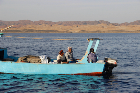
Suakin is extremely poor, but the people are nice and friendly. The city seems to be very safe, no robbery or crimes. You can walk around without being worried about your goods. In the “new” town you can go shopping, basically fresh fruits and vegetables. The agent will provide you with a SIM card, internet works, but very very slowly. A visit to the old town is very interesting, even if everything is crumbling down just like after a big earthquake. But its scenic!
- Sanganeb Reef – Anchor Position 19°43.941’N 37°26.882’E
Our track for entering was:
19°44.316’N 37°26.303’E
19°44.187’N 37°26.816’E
19°44.099’N 37°26.798’E
19°43.983’N 37°26.800’E
We anchored in 8m of sand and corals. Lifting up the anchor it took us a bit of time to free the chain from some small corals, but it was not really a big issue. Very good protection, we had winds from the north up to 28kts and it was still calm in the anchorage. You will find an island here with a big lighthouse. You can visit it and climb up to the top. Amazing views!
Here you will get a Sudan mobile connection. The six (!) workers here were very friendly to us and we bought some T-Shirts (US$10) with images from Sanganeb. There is incredibly good snorkeling, just in the north of the anchorage. Don’t miss it!
- Shab Rumi – Mooring Position 19°56.826’N 37°24.226’E
This is Jaques Cousteau’s Reef, the Mecca of diving! Entering through the SW pass, 19°56.402’N 37°24.198’E, which was made with TNT by Cousteau, is easy with a calm sea. It’s 20 meters wide. On the north side you will find a small beacon marking the channel. Once inside it’s mostly very deep. No land here, only coral reefs. No mobile connection. But the best diving ever seen. Snorkeling in Sanganeb was absolutely great, but Rumi is still better, if possible!
- Taila Island – Anchor Position 20°38.062’N 37°13.490’E
We anchored just on the south side, behind the tiny sand spit. Good holding in 4 meters of sand. Perfect protection with northerly winds, with southerlies you can move to the other side (but we didn’t have to). Behind the dunes of the coast of Sudan there are several lines of mountains giving an amazing panorama. We went with the dinghy to the sandy island, walking around and enjoying the sunset. Really a great spot! In the morning we tried to go to the coast by dinghy, but around 100m from the shore its too shallow and you can’t land and go for a walk.
EGYPT
We didn’t clear in till Hurghada, stopping and diving along the way, but without going ashore.
- Sha’ab Abu Fendera – Anchor Position 22°53.488’N 36°18.449’E
A part of an isolated one meter high rock, similar to a huge mushroom, you will find only a large semi-submerged reef. No sandy islands like shown in Navionics. You will anchor just like in the middle of nowhere. But the reef provides good protection against all winds from the north (NE till NW), which makes Sha’ab Abu Fendera a very useful stop on your track up or down the Red Sea. We had up to 28kts of wind from 300 degrees and stayed well and safe.
Obviously it’s not an “official stop over anchorage” before making clearance into Egypt (e.g. in Port Ghalib). No mobile coverage.
As stated in the Red Sea Pilot it’s mandatory to enter with good daylight. But as we arrived late we entered super carefully and with absolutely no wind on a dark night, using only our Google Earth geolocated images (which works on Open CPN) and a track from another sailor. The GPS points on the Red Sea Pilot are perfectly located and we entered from the east side.
Enter from 22°53.450’N 36°18.950’E in a straight line to 22°53.300’N 36°18.550’E and you will be safe. North of this line there is still an isolated bommie. We anchored deep in 22 meters on sand, no coral, good holding, so we put all the chain we had (85m) and stayed perfectly. There are some small isolated corals spread on the sand bottom, but you will see them in the crystal clear water. Snorkeling should be amazing, but we didn’t.
During the night two fishing boats arrived and anchored more or less close to us. We bought a very nice fish from them. There is nothing to do here but fix your boat, wait for better weather and enjoy the Red Sea in a safe place. It’s simply amazing!
- Gezzirat Wadi Gimal – 24°39.468’N 35°9.479’E
Easy anchorage in a wide open to South Bay behind the reef. You could also enter at night, it’s free of danger. Good protection against northerly winds, we had 34 knots of wind. We anchored in 6 meters of sand. If your draft is less then 1.5 m you could go closer to the beach, once you have crossed the corals heads, it’s again 3 meters. But anchoring further out it’s also perfectly safe. Nice and safe place for waiting for winds from the south.
There is absolutely no problem heading from here directly to the north, just go carefully to 24°40.060’N 35°7.071’E and then to 24°41.600’N 35°6.821’E. Always 3 meters deep or more.
- Shaab Samadai – Entrance from the south on 24°58.757’N 35°0.106’E
This is a complete atoll with a wonderful lagoon inside with turquoise water. Very good protection against northerly winds.
Several US Aid moorings at 24°59.040’N 35°0.190’E. This is a National Park and you can’t stay overnight, you need to leave at 3 PM. So, arrive at 4PM and stay overnight, I would suggest… if someone comes, tell him that you have an engine problem to fix.
We arrived at 2:30 PM and found some big local dive boats attached directly to some coral blocks inside of the lagoon, destroying the corals. Absurd and surreal. One of them came over telling us that it is forbidden to stay overnight and that we would run into a big problem if we stayed here overnight. So, I don’t know why, we believed him and left again.
Our agent from the nearby Port Ghalib recommended this reef as an official anchorage on the way up north, before clearing in to Egypt.
Later on in Hurghada we talked to him about this issue. But I didn’t got a clear response, maybe it’s just like often in Egypt: there are many rules and many ways to apply them, all is continually changing and it depends of the moment and the people you encounter ….
- Marsa Alam Reef – Anchorage 25 04.3903 N 34 56,1578E
We stayed here for an overnight stopover with moderate NW winds of 15 knots. Anchor in 20 meters of sand and some corals. Good protection against northerly winds. We had some trouble raising up the anchor, but it really was not a problem.
- Ernesto Reef – Anchorage 25°18.806’N 34°46.046’E
We anchored in 20 meters of sand, some small coral heads. We stayed here several days with strong winds up to 33 knots from the north. The protection was acceptable, with winds over 30 knots sometimes not very comfortable, but safe. Local dive boats pick up the moorings attached to the corals, but I understood it is too dangerous for a sailing vessel, as then you can’t swing around. It would be more calm behind the big coral head in the middle of the small “bay”, but it’s a very narrow space there. Navionics is wrong and without details, use satellite pictures. We had some trouble again to lift up the anchor, but at the end it wasn’t a big issue. The snorkeling around the reef is excellent, don’t miss it. A local man delivered us here SIM cards and some food.
- Abu Daba – Position Mooring 25°20.689’N 34°46.376’E
We picked up a local dive mooring which was attached to an isolated coral head, just in between the three reefs. The depth of the coral head is over three meters in low tide. Check the holding of the mooring! There are three different reefs: Abu Daba 1, 2 and 3.
Absolutely excellent snorkeling around Abu Daba 2, but probably all are good. Navionics is wrong with no details, so use satellite pictures. No protection against winds, stay here only with calm seas. Usually on Fridays this location is full of big dive boats heading to or coming from Port Ghalib on their weekly trips. Avoid Fridays, but the rest of the week usually you are alone.
- Soma Bay – Anchorage 26°50.828’N 33°58.747’E
We entered from the east at night, following the waypoints 26°49.800’N 33°59.499’E and 26°50.160’N 33°59.290’E. Easy and no problem. Good anchorage with perfect holding in 10m over sand. We didn’t go on shore as we still hadn’t made clearance in Egypt. The snorkeling close to the sandy island was ok, but in comparison to the reefs more in the south it was a bit poor.
Ibrahim, a local man, will deliver you food, beer, SIM card and fuel – even if you haven’t made clearance yet in Egypt. WhatsApp him on +20 102 0456528.
Hurghada
- Commercial dock 27°13.796’N 33°50.693’E
After sailing in Egypt waters from the south, we finally (and officially) entered Egypt, making clearance in Hurghada with Mohamed from Felix Maritime Agency.
After calling port control on VHF CH16 and a short waiting time of 15 minutes, we moored in the SE corner of the commercial dock, which is deep and free of danger.
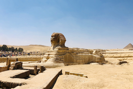
The process went smoothly and without problems. We paid with credit card using the mobile of our agent – US$1,052 directly to the Egypt administration. After a couple of hours we could move down to the marina. We stayed nine days with the boat in the marina, flying to Cairo for sightseeing and having a crew change.
- Marina Hurghada Entrance at 27°13.443’N 33°50.582’E
We called them on VHF CH74 and after a short time we could enter. Plenty of free berths here, very helpful marina staff. There are many restaurants (the best is the Egyptian one) and a lot of day tourism due to the dive boats. But the feeling is nice, friendly and peaceful and after many weeks offshore crossing the Red Sea this was a perfect place.
Behind the marina you will find the real town, which is a completely different world. The Fish Market is amazing, the Mosque wonderful, the rest is poor like Djibouti. You can easily buy food in large supermarkets like Carrefour close to the marina. Alcohol is sold only in Restaurants, but for a good price. We went to Samos Restaurant, which is close to the marina.
Once in the marina, Mohamed from Felix Maritime Agency provided us with fuel and benzine in jerrycans, refilled our American system gas bottles, helped us with our laundry and was very helpful with anything that we needed. A great choice!
We left Hurghada marina with a kind of internal cruising permit, clearing out in Suez and transiting the canal. However, this permit does not give you permission to go on land outside of official ports – at least if there is a police station nearby.
- Shi’b al Irj – Anchor position 27°24.822’N 33°51.769’E
Only 10 miles to the north of Hurghada Marina. Anchored in 10m, sand. Wide and easy, but you need to enter carefully between the coral heads using Google Earth. The semi-submerged reef protects very well against the waves of the northerly winds. Great snorkeling. Dolphins!
- Endeavor Harbor / Tawila Island – Anchor position 27°34.240’N 33°47.881’E
We anchored in 10m over sand, good holding, easy entering. Would be possible to enter by night, but we didn’t. Before sunset a boat from the resort with a kind of official in uniform came over claiming we needed to pay a harbor fee of US$75. As we had an engine problem (dirty diesel) we didn’t have to pay. Next morning with the problem resolved we left the anchorage. Even with the resort, it’s a nice spot and would have been worth staying another night and going for a walk on land.
- Bluff Point – Anchor position 27°40.573’N 33°48.220’E
A big wide, beautiful bay with plenty of room behind the coral reef for anchoring. We found many dive boats attached to the corals, but there is enough space here. We anchored in 10 meters over sand with some coral, good holding. Very nice walk to the beach and up to the lighthouse.
- Qaysum – Anchor position 27°40.294’N 33°44.284’E
Easy anchorage in 6m, sand. Would be possible to enter by night, but we didn’t. We stayed here with 33 knots from the north, calm and good holding. The island in front is all sand, but quite scenic. Good for a long walk with the feeling of being in the desert. We found here some tourism boats with kite surfers, many of them enjoyed the good winds and flat seas.
- Kanisha (Sinai Peninsula) – Anchor position 27°55.910’N 33°53.793’E
Good holding in sand and 15 m depths, perfect protection against northerly winds. Nice surroundings under the 2200m high mountains of Sinai. Sadly the nearby police station didn’t allow us to go for a walk on land.
- Shaykh Riyah (Sinai Peninsula) – Anchor position 28°9.755’N 33°39.195’E
Very good holding in 8m over sand, calm anchorage with W/N/E winds. Shelter from waves, but not from the winds. There is a police station nearby, so we didn’t go on shore. Very nice spot, even if kind of in the middle of nowhere. High mountains in the distance, in the foreground a sand bank with small fishing boats.
- Abu Meish (Sinai Peninsula) – Anchor position 29°25.977’N 32°46.566’E
As we had southerly wind we went behind this semi-submerged reef. Deep on low tide only 2.7 meters. The reef doesn’t give a lot of protection, but we also don’t know how it would have been “outside”. We couldn’t go on shore, as the fishermen here had informed the police. But I think if you anchor with northerly winds at the westerly corner you will be far away from anywhere and it won’t be a problem.
- Suez Yacht Club – Port position 29°56.867’N 32°34.367’E
We called to Mustafa, our Agent from Felix Marítime. First we moored between two mooring balls, then we could move to the small dock. We got different visits from the authorities, but all was well and smooth, organized by Mustafa. Next day we went shopping to the fish market, a big round building in down town. Amazing fresh fish and seafood, also fruits and vegetables. All very cheap and good quality. We made the trip to downtown mainly by taxi, just stop the taxi in the street everywhere. Uber was not working.
On the dock we found a kind of mariner, trying to help us and asking for baksheesh. He was not an employee of the marina, so we didn’t let him work for us.
- Ismailia Yacht Club – Port position 30º 35.108N 32º 16.397E
We moored directly on the dock alongside, as we were the only yacht. Water for free. They can deliver food, diesel if you need. We couldn’t go out of the small area, as we had already cleared out of Egypt. The officials there are very nice, as always in Egypt.
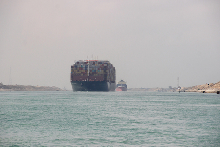
Suez Canal Passage
All quite easy, you need to run at a minimum of 5 knots boat speed.
Suez – Ismailia 45nm, Ismailia – Port Said 40nm. The first leg is more interesting. Big tankers are sailing together with you, double your speed. So keep always to the left side. There are currents, sometimes 1.5 kts in favour, sometimes against. In each leg you will have a pilot on board. The first one was very nice, we had a lot of fun with him as he was speaking some English, the second one was a boring guy.
Fees in Egypt
For the administration work we used Felix Maritime Agency. They have agents in every port. All went smooth and fast with them.
Hurghada:
Hurghada Agent fee: US$100
Official Clearance fee in Hurghada: US$1052 [paid online directly to the Egypt administration by credit card, through the smartphone of our agent Mohamed]
Hurghada Marina fee: US$855 [paid by credit card, including water, no electricity, no shower, no laundry, 40 feet, 9 nights, 95USD/night]
The agent who helped us from Felix Marítime Agency in Hurghada was Mohamed – WhatsApp +20 101 5509749. He did a very good job, resolving every problem which we had. We would highly recommend him and would certainly use him again anytime. Some days Amany was also there – he is usually in Port Ghalib. But you don’t need him, Mohamed does a perfect job.
Egypt internal Cruising Permit fees:
- US$140 – Maritime inspection
- US$150 – Immigration
- US$50 – Coast Guard
- US$60 – International Security
- US$50 – Visa (2 Pax)
- US$60 – Crew Change (1 in, 1 out)
Paid by cash to the agent in Hurghada.
Suez:
Suez Yacht Club / Suez Canal fees:
- US$583 – Canal fee (paid by credit card)
- US$78 – Clearance fee (paid by credit card)
- US$50 – Agent fee
The man in Suez from the Felix Marítime agency is Moustafa (WhatsApp +20 106 9912287). He did a very good job, highly recommended, resolving every problem which we had. We would book him again anytime.
There were no fees at the Ismalia Yacht Club.
Into the Mediterranean!!
CYPRUS
- Ayia Napa Marina – Marina position 34 58.71N 33 56.86E
As we needed to make clearance, we needed to choose one of the Ports of Entry. The marinas in Cyprus seemed to be very full and the only one available was Ayia Napa Marina. The marina is brand new, very safe, very nice architecture, great management and smooth clearance procedures. The only negative is the price: 90€ / night + VAT. After staying a long time in the Red Sea it was coming back to all the reality and luxury of Europe!
FOOTNOTE
A Personal Experience
We have written this very personal information about what we have experienced ourselves, without any claim of this being a full cruising guide, completely covering the sailing region. Of course, we are looking forward to additions and corrections and we will occasionally update this document on our website. We are not native English speakers, so sorry about all the grammatical mistakes!
Track
Our track, including a miniblog in Spanish, can be find online at this PredictWind Page.
If anyone is interested, I am happy to send our tracks as a GPX (exported by OpenCPN) file by email.
Our website and blog are in Spanish and German with pictures from our travels, as well as some more Cruising Guides.
- Website: www.tuvalubarcelona.es/index.php/crew/
- Blog: www.tuvalubarcelona.es.
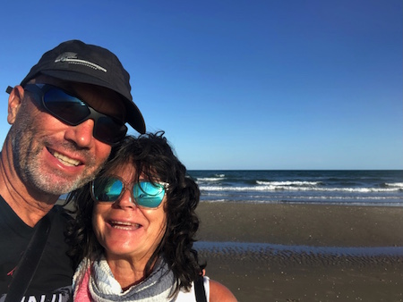
Hans and Imma Geilinger
SV Tuvalu
………………………………
About the Authors
Hans from Switzerland and Imma from Barcelona have been sailing around the world slowly since 2011 on their Dufour 40 Performance “Tuvalu”. So far they are sailed 50,000 nautical miles (as of 2023), with hopefully many more ahead. They are currently in Greece. Hans is writing a book about their travels, which he hopes to publish next year.
Other Reports from SY Tuvalu:
Maldives: More than just a stopover (March 2023)
Related Reports:
Cyprus: A Warm Place to Spend the Winter (March 2023)
………………………………
The opinions expressed in this article are the author’s own and do not reflect the view of Noonsite.com or World Cruising Club.
………………………………
Find out all news, reports, links and comments posted on Noonsite, plus cruising information from around the world, by subscribing to our FREE monthly newsletter. Go to https://www.noonsite.com/newsletter/.
Related to following destinations: Ayia Napa, Canal, Cyprus, Djibouti, Djibouti, Egypt, Hurghada, Port Ghalib, Port Said, Port Suakin, Red Sea (Egypt), Southern Cyprus, Sudan, Suez Canal
Related to the following Cruising Resources: Anchorages, Circumnavigation, Circumnavigation, Cruising Information, Gulf of Aden / Indian Ocean / Red Sea, Piracy & Security, Red Sea, Routing, Travel Information


A very thorough report. I loved to read it. Thanks,
Petra Mommersteeg
SY Pippin