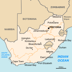
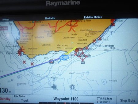
South Africa: Cruising the Coast from Richards Bay to Cape Town

The South African coast from Richards Bay to Cape Town is considered one of the most dangerous in the world says well known South African weather router and Noonsite contributor Des Cason. In this report, Des provides some comprehensive cruising notes for those contemplating cruising through these waters.
Published 2 years ago
The coast from Richards Bay to Cape Town is considered one of the most dangerous in the world, second only to the Grand Banks off Nova Scotia, for a very good reason.
In sustained SWS 25-30kts over 24-36 hrs period, the effects of wind against current results in survival conditions and the number of vessels and yachts lost on the coast due to rogue waves etc. is legend. There is no excuse for getting caught in these conditions as all the weather information you could ever need is freely available.
Don’t bargain on the current from Richards Bay to Durban for an extra boost, as it has been playing hide and seek for ages. From Durban south it behaves itself being close inshore.
The section from Durban to East London is known as the “big black hole” due to the lack of lights on shore along the Transkei coast and the number of vessels it has swallowed. There is no place to hide!!
Anchorages
Despite what you have read or heard, there are no secure anchorages along the coast with the exception of Knysna. If you need to seek shelter, it is an indication that you did not do your homework and took a chance. That would be a very stupid thing to do as this coastline is unforgiving and takes no prisoners!
Weather Patterns
Winter
From the end of April to the end of September and before the rain season starts.
The wind is determined by the high and low pressure systems moving west to east with centers below 35-40S.
High pressure systems east of Durban bring ENE wind along the coast and normally last between 3-4 days making the trip from Richards Bay and Durban down to East London pretty easy and predictable. Low pressure systems with clockwise rotation bring SW winds up the coast. As these systems are large and powerful, they very seldom if ever deviate from the forecasts.
Summer
From the end of September/October when the rain starts.
Again the wind is determined by the high and low pressures, but due to the tilt axis, the centers are further south and consequently the affect on the coastal weather is less. The main issue in the summer is the occurrence of “cut off coastal low pressures” which appear off the coast at East London every time a High tries to establish east of Durban.
This results in the gaps south becoming shorter and also a high level of volatility as these lows feed off the warm water and are inclined to form Revolving Tropical Storms (RTSs). This is the cause of a lot of frustration as the gaps are just not long enough to make it to East London from Durban, never mind Richards Bay.
Extreme caution is advisable in summer as these RTSs can generate wind speed >45kts and can intensify within six hours or less. You do not want to be on the Transkei Wild Coast between Durban and East London with an RTS coming up the coast towards you.
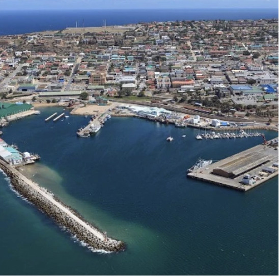
EAST LONDON
This is a river port and is pretty relaxed. The anchorage up the river is below a road and rail bridge over the river and the metal filings off the track wind up on your deck and rust spots are the consequence.
The Buffalo Cruising Club is very welcoming and friendly. Shopping is a problem as walking or cycling into town through a high crime area is not on, so taxi or arrange a lift with one of the club members.
Unless you are into surfing or fishing it does not have much going for it, but is a safe stop over. I believe a nice “yachty friendly” restaurant operates on the north bank of the river, just past the bridge.
PORT ELIZABETH
This is a great place – it is just a pity that the marina – which was wrecked 10 years ago in a major NE/E blow – has not been totally repaired. The consequence is you end up often ramped onto a concrete wall in the harbor with swell that regularly breaks mooring lines and rips winches out of decks.
You are close to a manganese terminal in the harbor which in a blow parks the dust on your deck, but bear in mind this is a working harbor. In recent times the club has been in disputes with the harbor authorities over financial issues and it has been confirmed that a settlement has been reached with a new organization which is now running the show.
You can contact John Tudehope, the OCC Port Officer on 082 854 3961, or email john@gatewaypm.co.za for further information. I seriously recommend you investigate closely before committing yourself to this location. See the website sailingpe.co.za for more information.
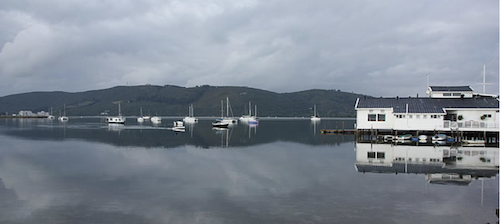
KNYSNA
Getting in through the Heads here is pretty tricky – in fact the Royal Navy in years gone by used this entrance to train their young captains – so that says it all. It’s a pity, because it is a tremendous place and the local NSRI (National Sea Rescue) guys love coming out to guide yachties in.
However, if the weather is not playing the game and you have a heavy SW swell running, it is suicide. In addition, at times, the cold Benguella current from Cape Town side ridges in and with warm air, causes fog so thick you can’t see the front of your yacht while at the same time the guys at the yacht club are sitting in clear skies and sunshine having a cold one.
MOSSEL BAY
This your next option down the coast and when you look at the charts you will see it gives good protection in SW/W on anchor outside the harbor, but is totally untenable the moment the wind swings E/NE as it brings the SW swell kicked up by the SW wind into the anchorage.
The marina in the harbor is very small and can’t accommodate many boats and nothing more than 15m LOA. This is a pity as the yacht club is extremely welcoming and usually allows visiting yachts, anchored outside the harbor, free access to the club house and facilities. Contact them in advance to ensure they can accommodate you and if so go for it.
The other problem with Mossel Bay is that as soon as the SW dies down you cannot stay in the anchorage due to swell (dragging and anchor chains broken) and have to head for Cape Agulhas – which just having had a strong SW will have swell 5-6m to go into.
This usually flattens out quite quickly with an E wind blowing, but you can’t sit on anchor outside the harbor in the swell. A rock and a hard place! As for Port Elizabeth, there are constant rumors of conflict between the authorities and the club relating to financial issues etc. so I recommend you check with them before committing yourself.
It would appear that the financial disagreement between the yacht club and marina management has broken down and the club and management of the club facilities has been taken over by the port authorities. I strongly advise contacting them in advance well before committing yourself to stopping there.
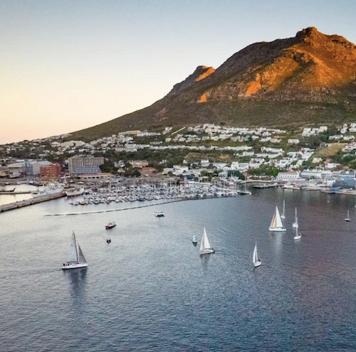
SIMONS TOWN
This is the next destination en route to Cape Town. It is the logical choice if you can’t make it to Cape Town in one go. Being in the NW corner of False Bay, it is very easy to get into with the dominant SE behind you.
However, it is a different story getting out as you have to leave on a SE so you can have it from behind up the coast to Cape Town. This entails a tough beat in a pretty tight area for 20nm to round Cape Point. In addition, if the marina can’t accommodate you, you have to anchor out and some yachts in the past have had to endure 3-4m swells and broken anchor chains etc.
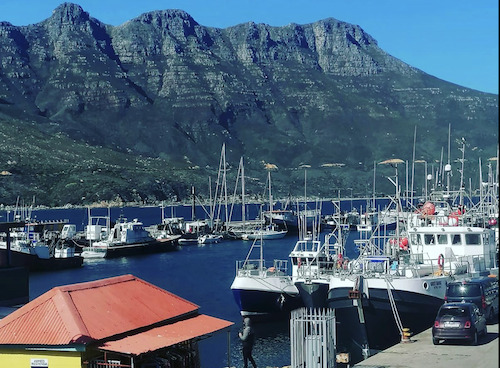
HOUT BAY
Just around the corner from Simons Town, Hout Bay is the most underrated and unknown stop over and is my personal favorite.
It is a short distance from Cape Town and easy to get in and out, with a very friendly yacht club. It is also more convenient to get to Cape Town from here. However, space is limited and I strongly suggest contacting them in advance for a berth.
Contact OCC Port Officer Roy McBride roy@ckdboats.co.za and Hout Bay Yacht Club marina@hbyc.co.za. Visit their website for detailed information on facilities and approaches.
CAPE AGULHAS TO CAPE TOWN
Due to the close proximity of a mountain range on the coast from Mossel Bay to Cape Agulhas and Cape Town, the forecasted wind speeds are invariably exceeded. This is especially the case with False Bay on approach to Simons Town, when you can expect at least an additional 10-15kts over and above the forecast speeds due to the compression zone between the mountains. Winds up to SE60kts on a sunny day is not exceptional.
Similarly, you can expect wind sheer off the mountains between Cape Point and Cape Town and due to their sudden and unexpected nature be prepared. These gusts, which are very localized, can appear from nowhere and add 15-20kts to normal wind speed.
IT IS NOT KNOWN AS THE “CAPE OF STORMS” FOR NOTHING!!
Des Cason
Ex SV Gambit
………………………………
About the Author
Des Cason and his late wife Nell, used to run the Madagascar relay station for the Peri-Peri net. Sadly Nell passed away in 2021 and these days Des says the prospect of communicating daily with what he consider to be the only sane people left in this “clown world” – the cruising yachties – makes it a pleasure to wake up in the morning.
Des can be contacted at; sygambit@gmail.com
Due to the rapid and sudden weather changes that occur on this coastline, Des recommends daily position updates. This ensures you are always in possession of the latest and most accurate weather information. Contact Des to get on his mailing list.
Also for Noonsite by Des:
- Tanzania Cruising Notes
- Madagascar Cruising Notes
- Madagascar and Mozambique Channel
- Mozambique Security Update
- Mozambique Channel Hideways
- A Guide to Crossing the Indian Ocean
- Cyclone Patterns in SW Indian Ocean
………………………………
Sailing in the Agulhas Current – South Africa
From the OSASA Newsletter [https://www.osasa.org.za/]:
Anybody with an interest in cruising around the eastern and southern coasts of South Africa, and certainly every South African yachtie worth their salt, knows about the mighty Agulhas current. When approaching South Africa from the Indian Ocean side (as the majority of circumnavigators do), any yacht making landfall at Durban or Richards Bay must exercise extreme caution in selecting the right weather window to continue southwards and on to Cape Agulhas and the Cape of Good Hope.
The combination of lows proceeding in a north westerly direction and the south flowing current (which can run as strong as 6 knots) can lead to very rough conditions, as well as the infamous rogue waves. A northwesterly breeze can swing and develop into a south westerly gale acting against the current in only a few minutes.
Thorough route-planning and weather watching is a must, and research and local knowledge is invaluable. A starter from Oyster Yachts can be found here, while a popular local resource (if you can find a copy) is Tony Herrick’s Southern African Cruising Guide (East to West). Of course, you can also pop an email to OSASA, who can point you in the direction of some local knowledge!
………………………………
The opinions expressed in this article are the author’s own and do not reflect the view of Noonsite.com or World Cruising Club.
………………………………
Find out all news, reports, links and comments posted on Noonsite, plus cruising information from around the world, by subscribing to our FREE monthly newsletter. Go to https://www.noonsite.com/newsletter/.
Related to following destinations: Cape Town (Table Bay), Durban, East London, Hout Bay, Knysna, Mossel Bay, Port Alfred, Port Elizabeth, Richards Bay, Simon's Town, South Africa
Related to the following Cruising Resources: Circumnavigation, Circumnavigation, Indian Ocean, Routing
Comments