Madagascar and Mozambique Channel
The general consensus amongst Indian Ocean cruisers is that the Mozambique Channel is the most technically challenging of their circumnavigation. Having done 40,000NM up and down the channel to Madagascar, Tanzania and Kenya from his base in Richards Bay South Africa over the last 13 years, Des Cason has learnt it is a stretch of water not like any other. This welcome revision of his cruising notes from 2014 not only covers basic tactics and weather patterns, but also the restrictions that Covid has put on cruising in the region and how best to ensure a safe transit. An extremely comprehensive guide to this notorious stretch of water.
Published 3 years ago
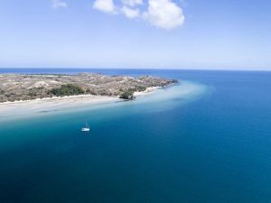
- Bazaruto Archipelago
INTRODUCTION
Since the publication of my Madagascar and Mozambique Channel Cruising Notes in 2014 so much has changed (not to mention Covid) that a revision is overdue.
The terra firma is still where it has always been so the basic tactics and weather patterns are the same.
I have published updates on the Mozambique issue with the emergence of Islamic Jihadist activity on the northern coast – but requires some elaboration.
In addition Covid has resulted in some old tried and tested destinations now being in jeopardy and this requires the investigation of alternatives to ensure a safe transit around Madagascar and down the Mozambique Channel.
Due to the Covid issue, many yachts had no alternative but to abandon the Maldives and seek refuge in the Seychelles. The traffic from Victoria to Cap D ‘Ambre at the top of Madagascar resulted in some tense sailing and requires a bit more elaboration.
COVID
It is reasonable to assume that the current “panic” will moderate once vaccines become available, but cannot see the overnight opening of all frontiers to anything close to the pre-Covid days. One can expect that once vaccines are available the different countries will relax some of the regulations as time goes by, but it must be appreciated that the average man in the street who is not that clued up on what is happening will still retain a certain level of reticence to inter react with yachties. It will take time for the inherent superstition and fears in these communities to return to normal and this could alter the entire experience on a personal level.
Obviously I am not prepared to divulge the feed back from the yachtie’s experiences in 2020 during lockdowns, but am quite happy to fill in the gaps in private exchanges.
WEATHER
I have recently published a general weather and routing guide for the crossing from Malaysia to Africa on Noonsite and suggest you access the information via that report.
ROUTES
For detailed information on the southern route from Reunion/Mauritius to South Africa see the article on Noonsite by Anne Lloyd of SV Sofia.
The Northern Route around the top of Madagascar has one choke point and is the crux of any decision you make.
The Equatorial Current flows eastwest along +-6S -14 S and hits Mada at +-12S and splits into two – a north bound section going around Cap D’Ambre and the south bound section running down the east coast and passing around the bottom. A portion from the north and south bound sections curve around the landmass and converge at Cap St Andre 16S on the Mada west coast.
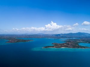
- Madagascar Smiles
TO MADAGASCAR
Chagos to Cap D’Ambre: 1400nm bearing 253T
During the SE monsoon from end April to end OctNov each year the wind is consistent SSSESE 25-35 kts with occasional short spells of 20kts. In addition the Equatorial Current coming from Australia hits the coast line at +-12-13S and splits with the northern section flowing at 1.5 – 2kts. To complicate matters even more, the dominant swell is from between 160T to 180T 4-6m @8-10seconds setting up rough and turbulent seas in the compression zone.
Compression zone between 9S 46E – 7S 50E – 12S 55E – 14S 50E.
Yachts who have attempted the direct route from Chagos on 253T have run out of wind on the approach to the Mascarene Bank and then had a hard drive from 55E across the compression zone. Very few made the direct crossing of this area and those who did had to detour further NW and wound up close to Aldabra Island, some with damage.
This option is only for the foolhardy and bold.
Cap D’Ambre needs to be approached with wind, swell and current behind you, so the tried and tested tactic is to head for 12S 61E (12S Gap) and from there stay below 12 30S min until you encounter the compression zone from +- 50-52E. From there you turn on a more N heading sailing for comfort and safety and aim for a waypoint +-30nm off shore and +- 50nm from the top.
This puts you into the compression zone, but the current flattens out the swell as you get closer to the coast and reduces the sea state as you round the top.
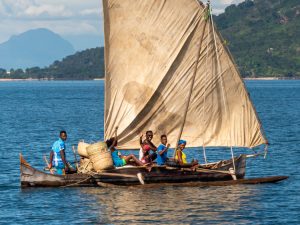
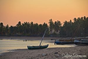
- A local fishing boat off the coast of Madagascar
SEYCHELLES TO MADAGASCAR
Victoria to Cap D’Ambre: 570nm bearing 219T.
This section of your cruise will be the most challenging before you reach the Mozambique Channel proper below 16S.
The SE trades from the end of March/April blows onto the east coast of Madagascar.
Due to the mountainous ridge running up Madagascar closer to the east coast the west coast is pretty arid and dry with very little influence from the SE trade wind.
However the east coast bears the brunt of this wind and it is common to hear that the east coast has two seasons – the rain season and the wet season with constant onshore moist wind. The mountains cause uplift and pretty constant rain throughout the year.
The area above Diego Suarez +- 12S is no exception except the wind has an escape around the top and as a result from April to end Oct you will have consistent SSESE25-30+ with the odd period of calm in between with SE20+!
This compression zone extends to the NE and NW of Cap D’Ambre in the area bounded by 9S 46E – 7S 50E – 12S 55E – 14S 50E.
This consistent wind is compounded by the swell angle which is dominant from 160T and invariable runs at 6-8 seconds. In addition you have the Equatorial Current coming from Australia hitting the coast south of Diego Suarez and splitting into two. The north flowing section can run anything from 2-4 kts depending on the wind.
This time of year (April to Oct) the SE trade extends up to the Seychelles, but obviously reduces in strength as it gets further north. On average you can expect SE10-15 in Seychelles on departure and progressively increasing as you get closer to the compression zone.
Picking the right gap south is in the realms of “black art”, but over the past 5 years have had some success but the majority of yachts have had to detour quite a bit to the west due to the harsh conditions. It is not uncommon to have a forecast from 3 different models of 25+ and the yachts’ experience 35-40 in gusts. This is due to systems to the SE of the compression zone driving ridges of increased pressure in a NW direction and are totally unpredictable.
The one advantage is that the further west you deviate from the rhumb line, the more the wind and effect of swell and current diminishes but adds extra time and mileage to the trip.
It can be argued that with the Covid ”crisis” there is no burning need to get to Mada and makes the determination to round Cap D’Ambre a dubious proposition.
Ensure you are adequately provisioned.
Do not underestimate the challenges of this short trip south and consider whether the potential pleasures of the Seychelles are worth it. My personal experience is that Mayotte (1st world – French) 200nm west of Cap D Ambre is a better proposition.
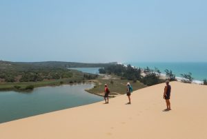
- Nosy Lava
MADAGASCAR ANCHORAGES
These are anchorages which we have personally visited over 12 years of cruising and co-ordinates are off Google Earth and are APPROXIMATES – beware of chart errors. They are our recollection of the most sheltered and peaceful, but is by no means definitive as many bays and coves we never visited due to time constraints.
Weather:
North of the Mitsios from mid June the SE trade wraps around the top and blows pretty consistently NEE15+ during the day and at night calms down a bit, but from the SW. From there south daily onshoreoff shore conditions prevail and seldom gets above W15 kts by sundown. The only exception being from Nosy Saba south to past Mahajunga, where during the day you will experience katabatic SE 25-30 kts winds coming off the land which persist up to sundown when it becomes dead calm. So stick close in to the coast, max 5 nm offshore in the lee of the land.
- Russian Bay
the North:
The entire NW coast from Cap D ‘Ambre down to Cap St Sebastian is a declared nature conservation area and officials will collect fees from you whilst anchored. However if you stay overnight and keep moving south you could get away with no payment as they will have to catch up with you. Cost +-$20 per personday. Yachts have been boarded with firearms and threats if you refuse to pay up, so rather go further south below Cap St Sebastian.
- NW ENTRANCE after rounding Cap D’Ambre: 12 06.629S 49 01.504E
You can cut in before Nosy Hao, but it’s shallow and the charts are useless. A catamaran ran aground and was lost in 2008, so attempt this area at your peril. - NOSY HAO: 12 07.041S 49 02.521E
- NOSY HARA: 12 14.546S 49 00.418E west coast / 12 13.759S 49 01.066E north
- CATHEDRAL: 12 15.576S 48 58.203E – deserted.
- COURRIER BAY: 12 15.783S 49 06.361 – small community.
- AMBARO BAY: 12 26.542S 48 46.643E – well protected.
- MITSIOS
Maribe Bay: 12 54.318S 48 34.679E
Ankerea: 12 50.753S 48 34.667E – breeding ground for Manta rays (tame enough to swim with). - TSARA BAJINA: 13 01.561S 48 32.583E – anchorage far out and bad holding, very up-market lodge but not welcoming to yachties.
- SAKATIA LODGE: 13 18.925S 48 09.593E – very yachtie friendly, best diving operation
- CRATER BAY: 13 23.938S 48 13.035E – bad holding, rudimentary yacht club and pub frequented by expats who are more interested in the local young ladies – a cesspit of thieves. Close to Ambatoleuke the local center of restaurantsnight clubs etc.
- HELLVILLE: 13 24.360S 48 16.978E – the only boat boy to trust is Jimmy (Cell: 032 847 9237 – international dial code +261 and drop the 0 – e-mail address [email protected]). I will send a photograph on request so you can recognize him and not get caught by some of the thieves operating there.
- TANY KELI: 13 29.050S 48 14.266E – nature conservation area, no overnight anchoring, main snorkel venue for fly-in tourists – crowded and noisy.
- KOMBA: 13 26.549S 48 21.023E – popular tourist spot – hand crafts etc. Best Restaurant Yolandes’ on the beach just south of the big rock. Visit Lemur park.
- NOSY MAMOKO: 13 43.265S 48 11.254E – our favorite as it was calm and peaceful. Small village with tame Lemurs.
- KISIMANI: 13 34.745S 48 05.604E – tricky entrance, visibility bad, lots of mosquitoes.
- RUSSIAN BAY: 13 32.097S 47 59.869E – great spot with good shelter.
- NOSY IRANJA: 13 35.360S 47 48.569E
13 36.418S 47 49.738E – up-market lodge on southern island not very welcoming but will sell you cold beer at $5+! - BARAMAHAMAY RIVER (Honey River): 13 42.692S 47 53.773E – great place with cheap wild honey, shallow bar max 2.5 m at low tide – favor north bank.
- KALAKAJORO: 13 56.891S 47 46.741E – nothing special – used to have a Lemur rehab center.
- ANTANY MORA: 14 06.559S 47 45.625E – pretty with good visibility.
- SABA: 14 21.731S 47 39.106E – pretty with up-market lodge and air strip and no customers!
- NOSY LAVA: 14 32.155S 47 36.523E – avoid at all cost! Used to be main prison island for Mada. Yacht hi jacked and owners murdered late 90’s.
- MORAMBA BAY: 14 53.320S 47 20.384E – calm weather
14 54.234S 47 19.888E – SE wind protection – great place with plenty of Sofaka Lemurs (look like panda bears) – not to be missed! - MAHAJUNGA: 15 43.641S 46 18.959E – avoid unless you have to check out with immigration. Beware wind against tide conditions and very soft holding (silt).
- KATSEPE: 15 45.993S 46 14.561E – provisions etc. available here – preferable to Mahajunga.
- BALY BAY: 16 03.326S 45 17.923E – night time.
16 00.952S 45 21.372E – daytime, best place to wait for a weather gap over channel to Mozambique. Cell phone and internet coverage from Soalala, basic provisions , water from prawn packaging plant.
 Final Note:
Most cruising guides show the island anchorages south of Kalakajoro on the east side, however, the early offshore breeze and katabatic SE wind starts at 0300LT – so you could get caught on a lee shore.
Remedy – Wait for the onshore wind to die down and anchor on NW side of island in preparation for the offshore wind, or anchor on the mainland coast in 10m. Once the onshore dies down it is flat calm. Anchoring on the coast is a common practice – we anchored off Mahajunga once 5nm off shore in 8m – no problem!
MOZAMBIQUE CHANNEL CROSSING
Cap St Andre is notorious for tropical squalls and lightning the closer you get to November, so if your timing puts you there in November – beware. A yacht 40m from us was struck at 0700 in the morning in Baly Bay, which is something you don’t need especially facing the run down the channel. If in doubt stay 20-30nm offshore and head due west to Moz.
Cap St Andre across the channel is the crux of your tactics as the decision taken there will set you up for the rest.
Having done the crossing 7 times we have found this route the best:
Head 270T from Cap St Andre towards Ilha Moz and once you hit the Moz current approx.70nm from the coast turn south. This route uses the confluence of the south flowing current from Cap D ‘Ambre and the north flowing current from the south which meet at Cap St Andre and then turns due west until it hits the Moz current flowing south. There are always some turbulent conditions at Cap St Andre because of the two currents meeting, but nothing serious as it flows at 1.5 -2kts max. The west flowing current can run up to 2.5kts.
Heading SW 225T from Cap St André puts you in the north flowing current and with a predominantly SE/S/SW wind this results in a tough beat into the wind and current against you. One yacht lay hove to south of Juan De Nova for two days in 35kts SW and 6m swells!
Getting over to Moz also puts you in the favorable quadrant with lighter winds in the event of a heavy SW gale coming up from the south, as the wind usually sweeps across the channel in a NE direction and the bulk of the wind will be found in the middle of the channel towards the west coast of Mad.
This westerly route from Cap St Andre to Ilha Mozambique has the advantage of many islands to visit south of Ilha Moz (the Primeiras) with hardly any population. In addition you have two hide aways at Bazaruto and Inhambane en route with an additional one at Inhaca Island just outside Maputo. This could break the trip into 3 stages of approx 250nm each which is manageable in between the strong southerlies.
Bear in mind that the SW’s coming up the coast are bent by the land mass and when anchored at Bazaruto or Inhambane the wind is more SSE and you have good protection.
The main disadvantage of this route over to the Moz coast is that often there is not much wind, so you must have some spare diesel. It beats the mid channel route as you have up to 3kts of current with you which compensates for the lack of wind
You will recognize the current by the appearance of a distinct line of “puff ball” clouds which lie directly above the current.
We have elected this route as apposed to the 2 alternatives for the following reasons.
Direct route Cap St Andre to Bazaruto – heading 225/230 deg T
The Westerly flowing equatorial current hits Mad south of Diego Suarez on the east coast and splits into two. The current around the top of Cap D’Ambre flows SW down the NW coast and meets the southerly flowing section that goes down the east coast and around the bottom at Toliara and up the coast at Cap St Andre. This causes turbulence and washing machine conditions and attempting a direct route to Bazaruto in light conditions puts you in a 2kt+ negative current as far south as Juan De Nova. Invariably the wind is SW/S/SE. The SE works for a beam reach across, but is not guaranteed. Taking the route direct across to Moz gives you up to 2kts favorable current heading 270T from the confluence of these two currents meeting at Cap St Andre.
We have had two runs direct to Bazaruto on this route but maybe we were lucky with the wind. The NE in this area is unreliable and normally dies after a day or two.
Down the west coast of Mad towards Toliara – approx 180 deg T
This is a very pleasant part of Mad with lots of islands to stop off at, but you face a slight negative current coming up the coast and predominantly SW/S winds. This can become a bit frustrating if you are in a hurry. Normally yachties will head for Toliara or preferably Ifaty just north (highly recommended) and set off from there for RBay. The draw back is that unless you can do 200nm a day you will get caught in a south westerly blow with no place to hide. If you elect the west coast route, stop at Morombe and then head for Europa Island and then Inhambane, which gives you two hide-aways en-route to the Moz coast.
 Weather:
Weather forecasting down the channel is pretty easy if you have access to Grib files and we have found that the GFS model works best and is pretty accurate up to 4 days, especially south of Bazaruto. The weather nets will also give you valuable info. As you will know, barometric pressure in the tropics is not critical- however from Bazaruto south it becomes vital.
The rule of thumb is; a rising barometer means SW/S/SE wind – a dropping barometer means NE.
This pattern becomes apparent when you have monitored SA Weather Service via Cape Town Radio on the 1330UTC broadcast. Once you know where the low pressure is you can easily calculate how long you have before the wind switches to S.
CYCLONE ACTIVITY
On average the SW Indian ocean gets 5-9 cyclones annually (some years more and some less) and they have to be differentiated between those that originate south of Chagos (BIOT) and those that develop in the Mozambique channel south of Mayotte.
The Chagos cyclones, as a rule, track W/SW and usually hit the east coast of Madagascar and then re-curve back SE crossing Mauritius and Reunion. Very seldom do they actually cross Mada and get into the channel between Mada and Mozambique. The stats on these events are freely available and most yachties would be aware of this pattern.
What most cruisers usually are not aware of is the incidence of the formation of RTS (Revolving Tropical Storms) in the Moz channel south of Mayotte.
On average they occur 5 times a year and have their origins south of Mayotte, in the region off Nacala in Moz, and then move down the channel and after making a few detours invariably – with a very erratic pattern – usually head SE and clip the southern tip of Mada and trash Toliara on the SW coast of Mada. While not, as a rule, classified as true cyclones they have been known to have sustained wind speeds of 45-50kts+ and typically carry torrential rain which is due to the system being trapped between the two land masses and the warm current to feed off.
Those yachts who elect to go via the northern route around the top of Mada and then down the Moz channel should be aware that they could be exposed to this pattern from November and peaking in Febrary when Mo,z as regular as clockwork, has torrential rain and floods in the Xai-Xai /Inhambane area.
MOZAMBIQUE CHANNEL WEATHER
Cap D’Ambre to Cap St Andre – 16S:
From March to October with the SE trade blowing, this section is light and variable except for the Katabatic winds south of Nosy Saba to Mahajunga.
The entire NW coast is subject to daily onshore/offshore winds – SE early in the morning and swinging anti clockwise around to WSW late afternoon, very rarely exceeding 15kts.
The only time any strong S winds 20kts+ come up the southern channel past Cap St Andre is with the transit of a severe SW system driven north by a high pressure system ridging in behind it from the Southern Indian Ocean. This occurs 4-6 times a year, but you will have adequate warning.
South of Cap St Andre to Inhambane Zavora Mozambique:
The weather in the southern section of the Moz Channel is determined by the movement from west to east of high and low pressure systems coming around the bottom of SA and driving up the SE coast.
With an approaching high pressure with anti clockwise rotation, it drives S into the bottom of the channel and as it moves east the N edge of this system swings the wind to SE/ENE. Depending on how fast the high moves east the ENE conditions which are perfect for the crossing could last up to 5 days. This period is just enough to get from Cap St Andre to Bazaruto (650nm) as inevitably a low pressure with SWS/SSE 25+ follows. These wind switches occur as regular as clockwork every 4-6 days.
Occasionally a low pressure system is driven up the channel by a ridge of high pressure behind it, and in these circumstances you can experience S35+ for min 24 hrs with 6-9m swell and are dealing with survival conditions.
The major factor in the channel is the effect of wind against current which sets up steep waves normally in the 4-6 m range and extend up to 70nm offshore on the Moz coast. These are conditions you need to avoid and careful planning is required.
The channel can be divided into two parts – the NW quadrant and the SE quadrant. If you were to draw a straight line between Cap St Andre [16 13S 44 24E] and Zavora [24 30S 35 08E] the section to the west of this line is the NW and to the east the SE.
As S frontal systems come up the channel they are always as a consequence of an intense low pressure system and with clock wise rotation clip the land mass at Zavora and sweep in a NE direction towards the Mada west coast – the SE section.
Despite the fact that the west coast of Mada has a very mild northerly flowing current the brunt of the wind is experienced on the west coast of Mada.
The center of the surfing culture in Mada is centered on Ifaty [23 06S 43 34E] which says it all.
The Moz coast north of Zavora is less exposed and the wind normally is more SSSE than SW, but with wind against current (2-3kts flowing south) is not to be trifled with.
Bazaruto Archipelago is the tried and tested half way stop for a safe transit down the channel and has been a haven for yachties for as long as yachties have come down the channel. Those adventurous souls who ignored my warnings about the west coast of Mada (and on the advice of people who have never sailed it) without exception fortunately lived to regret it.
- Mozambique – Bazaruto
MOZAMABIQUE HIDE AWAYS
The entire Moz coast from Nacala north to the Tanzanian border is a “no go zone”. See below the section dealing with security issues.
From Ilha Moz south, the tried and tested anchorages are at:
- ILHA FOGO: 17 13S 38 52E
- BAZARUTO: 21 30S 35 28E – See recommendations further down in this report
- INHAMBANE: 23 47S 35 30E – EMERGENCIES ONLY
- INHACA ISLAND: 25 57S 32 56E – EMERGENCIES ONLY
Bazaruto Anchorage Co-ordinates:
Vessels with draught exceeding 2m to pay particular attention to tidal range.
Note: Do not attempt on an out-going tide or at night. The best time is 2 hours before high water with good visibility. All charts are suspect – trust only your eyes. If you get stuck, the tide will lift you.
Waypoints north entry to Bazaruto:
- 21 30.00S 35 25.00E
- 21 32.50S 35 23.40E
- 21 35.50S 35 22.40E
- 21 35.90S 35 24.10E
Continue for +/-100m and then turn, follow channel and anchor at 21 38.382S 35 26.098E.
See recommendations for Bazaruto below.
MOZAMBIQUE SAFETY ISSUES
Since the publication of my Madagascar and Moz channel cruising notes in 2014 a number of issues have raised their heads which cruisers should be aware of. I did not personally experience these issues, but was in close contact with the cruisers who went through these experiences.
Islamic Jihadist Activity:
Since the discovery of what is purported to be the 2nd largest natural gas field known (midway between Mozambique and Madagascar) the activities of Islamic Jihadist groups in the northern regions of Moz have increased dramatically. They seem to be very active in the regions north of Nacala up to the Tanzanian border and reports indicate that their intention is inter alia to set up an Islamic state -a’la ISIS – and at the same time disrupt the construction of the infrastructure for the exploitation of this gas field.
A number of deaths are attributed to their activities and a Russian defense contractor has withdrawn their military staff due to the risk. Two lodges on islands in the Ilha Querimbas Group have been attacked and occupied as well as the town of Micamboa De Praia 11 16S 40 23E.
A number of cruisers with humanitarian aims have gone ashore on this coastline and without exception have been subjected to hostile receptions and in 2 cases were held against their will by local tribal leaders who have come under the influence of the Jihadist.
All efforts by the SADC to assist Moz by employing a combined African military force has, at the time of writing, been declined and one can only speculate how this situation will develop.
It has to be accepted that the idealistic days of engaging with the legendary “noble savage’ are over and it is strongly recommended that under no circumstances crew set foot on land north of Ilha Mozambique – 14 52S 40 47E.
Bazaruto:
The accepted stopover in the channel en-route to SA is the Bazaruto Archipelago and over the past 5 years close to 250 yachts minimum have utilized the shelter behind Bazaruto whilst waiting for a weather window down south.
Up until 2017 no problems were experienced here, despite technically being within the territorial waters of Mozambique without having gone through the normal check in procedures.
All this changed in 2017 when a clever entrepreneur “Africa style” hit upon the idea to inform the authorities at the nearest entry port in Vilanculos so he could get a share of the spoils/bribes/fines etc. As a consequence, 6 yachts were boarded and threatened by armed officials. This happened at the anchorage at Benguerra Lodge – 21 51S 35 25E. This entailed confiscation of passports and threats of yachts being attacked. They eventually settled on fines in excess of $200 per person, I am told.
The recommended anchorage is behind Bazaruto +/- 13nm down the west coast and apart from a small fishing village comprising a few huts on the beach you are out of sight of the lodges operating on the island and obviously also the officials in Vilanculos, which is +/- 20nm SW of the anchorage on the mainland.
It would be in cruisers’ interest and also their fellow cruisers interest to resist the temptation to do the “tourist thing” and go “walk about” on Bazaruto. This is not a sight seeing stopover and your odds of being confronted by the authorities increase exponentially if you pitch up at the lodges, as they consider cruisers to be a negative as we supposedly “lower the tone” (whatever that means).
The local Nature Conservation Officials will collect “park fees” with no receipts being issued (as usual!) and the latest costs are $30 per vessel and $20 per person.
Inhambane Ling Linga:
The next area of concern, which due to its configuration is seen by many cruisers as an attractive stop over. Once again the corruption of the local officials in cahoots with the lodge management at Linga Linga have been successful in extracting vast amounts of money from yachties who willfully ignored my warnings.
Due to the convoluted channel you need to navigate (a French yacht was lost on the sand bar in 2018), which is tidal, you are trapped and it is impossible to get out except on the right tide. Any attempt to duck the officials is stymied due to the channel and tides and it is an easy matter for the officials on a motorized launch to catch up with you while you are still in the channel. Obviously the lodge management is complicit in this scam regardless of whether you have checked in or not. They will always find some excuse to demand exorbitant amounts of cash (e.g. $100 for not flying a Moz courtesy flag and an additional $100 if it is smaller than your national flag.) Make sure your national flag is tiny – or don’t fly it all. What’s the use of power if you can’t abuse it!
It is possible to anchor off the beach [23 46S 35 30E] in front of the lodges and west of the lighthouse, but it is very bumpy and potentially dangerous in a NE wind. It is often a workable tactic to anchor there just as a strong S system comes through, as it cuts down on the time required to get to Rbay without having to hide away again at Inhaca Island east of Maputo.
Inhaca Island:
Inhaca Island offers reasonable shelter in a strong S wind, but due to its close proximity to Maputo you always run the risk of being confronted by officials if you have not officially checked in and hold a valid visa.
There are two anchorages commonly used:
- In NE conditions you anchor on the NW edge of Portuguese Island: 25 57S 32 53E
- In S conditions: 25 57S 32 58E
This necessitates moving between the anchorages as the wind switches and the NE anchorage exposes you to the lodges and officials on the west coast of Inhaca, who inevitably will be on your back in a flash.
If you get caught in an approaching SW front it is the only option and unfortunately is the price to pay when the necessary homework has not been done.
MOZAMBIQUE TO SOUTH AFRICA
The Mozambique current has sections of concentrated current 2-4kts and some sections 1.5-2kts max:
- From Cabo Delgado on the Tanzanian border the current runs up to +/-70nm offshore along the Ilha Querimbas down to Ilha Mozambique +/-14S and then fades out across the bay with Beira to the west.
- From Bazaruto south to Zavora it is back to its normal strength and then fades out again as you cross the bay with Maputo to the west.
- From Zavora it is advisable to aim for Jesser Pt Sodwana Bay at 27 30S, as this course keeps you in the center of the current.
- From Cape Vidal 28 08S, it is back to its normal strength.
WEATHER FORECASTS
Be very wary of weather forecasts emanating from sailors or weather “gurus” who have not sailed this area extensively. Over the past 5 years I know of 3 yachts that have come close to losing it all and in every instance they ignored my advice and went with recommendations of routers far removed from the area and at a premium price.
There are two SSB based weather services available and I would recommend if you do not have direct access to a local weather router you check in with these transmissions.
Cape Town Radio SA Weather Services
Times: 1015 – 1330 – 1815 – ALL UTC
Frequencies: 4375 – 8740 – 13146 MHz – ALL USB
Durban Maritime Mobile Net (Ex Peri Peri Net)
Times: 0600 – 1100 – 1500 – ALL UTC
Frequencies: 21300 – 14300 – 12353 – 8101 MHz – ALL USB / 7043 MHz LSB Ham Radio
Operators: Roy Durban, Robin Durban
Andrew Cape Town – Call sign Easy Rider
Paul Cape Town – Call sign Northern Star
CONCLUSIONS
Having done 40 000nm up and down the channel to Mada/Tanzania and Kenya from our base in Richards Bay over a 13 year period, my wife and I learnt our lessons the hard way. I would strongly advise all yachties to not make the mistake of assuming this stretch of water is just like any other.
The general consensus amongst yachties is that it is the most technically challenging of their circumnavigation. You cannot afford to take a chance and you underestimate the sea state even in moderate S conditions at your peril.
You are welcome to contact me on my email address [email protected]. My forecasts and routing are FREE.
Fair winds always,
Des Cason
Des & Nell of SY Gambit (and the ex-Madagascar relay station for the Peri-Peri Net) used to be based on Sakatia Island (near Hell-Ville). They have now returned to South Africa, but are happy to continue offering advice to cruisers visiting Madagascar. They have sailed the country extensively and welcome the opportunity to stay involved in the well being of fellow sailors.
…………………………………………………………………………………………………………………………………..
Related Reports:
Crossing the Indian Ocean Guide (by Des Cason – 2020)
Mozambique Security Updates (by Des Cason – 2020)
Mozambique Channel Hideaway near the Bazaruto Archipelago (by Des Cason – 2018)
The Challenge of Passage Planning in the SW Indian Ocean (by SV Sofia – 2018)
Madagascar Cruising Notes (be Des Cason – 2015)
…………………………………………………………………………………………………………………………………..
The opinions expressed in this article are the author’s own and do not reflect the view of Noonsite.com or World Cruising Club.
Related to following destinations: Bazaruto, BIOT (Chagos), Ilha de Mozambique, Madagascar, Mauritius, Mayotte, Mozambique, Reunion Island, Richards Bay, Seychelles, South Africa
Related to the following Cruising Resources: Circumnavigation, Indian Ocean, Routing
Comments