 Experience Report July 2018 – SY Moya
Summary
We, a family of four, visited French Polynesia including the Marquesan Islands, the Tuamotus and the Society Islands within 2.5 month from May to July 2018 after crossing the Pacific Ocean from Panama. For us, French Polynesia is one of the most fascinating places we have been so far. The islands are absolutely stunning, many reefs are pristine with an abundance of wildlife, the culture is rich and the people we encountered as warm and open-hearted. Especially, the Tuamotus are not easy to navigate and we experienced some nautical challenges as we entered through the passes into the lagoon, anchored inside the atolls and experienced Pacific weather patterns. All of them we managed by thorough planning and were well worth the efforts.
Our personal top 10 Must Do´s of French Polynesia are:
• Marquesas (Nuku Hiva): Visit the beautiful lagoon of Anaho and enjoy the stunning views hiking to the neighboring bay of Hatiheu
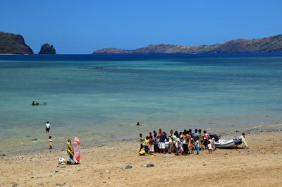
• Marquesas (Tahuata): Explore the unspoiled villages of Tahuata, get in touch with the locals and participate at one of their religious festivals with beautiful singing
• Marquesas (Ua Pou): Walk to the waterfalls and the chocolate farm up in the mountains
• Tuamotus (Raroia): Snorkel one of the reeflets inside the lagoon, with its clear water and the multi-colored untouched coral
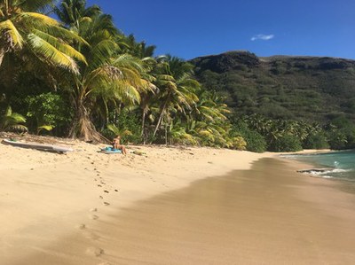
• Tuamotus (Tahanea): Enjoy the beauty and serenity of the pristine beaches and shallow waters
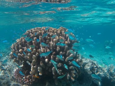
• Tuamotus (Fakarava): Drift snorkel the Fakarava south pass, swim with sharks and watch an abundance of reef fish
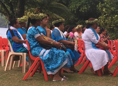
• Society Islands (Bora Bora): Watch traditional dancing and singing at the Heiva festival
• Society Islands (Maupiti): Climb the peak on the main island and enjoy the gorgeous views.
• Society Islands (Maupiti): Swim with the fascinating Manta Rays
• Enjoy a delicious Polynesian dinner e.g at Ti Pierro (Ua Pou)
 FRENCH POLYNESIA
Formalities
For Europeans obtaining inbound clearance in French Polynesia is very straight forward and can be obtained upon arrival within minutes at port of calls throughout French Polynesia. All crew members need to be present. Papers then need to be posted by regular mail to Papeete. For other nationalities, a bond may be required, which takes longer to obtain and might be expedited with the support of an agent.
Outbound clearance needs to be announced at least one day in advance. The local gendarmerie will contact Papeete prior to issuing an outbound clearance. Again all crew members need to be present and papers need to be posted to Papeete by regular mail prior to departure.
It is possible to obtain Duty-free fuel for yachts in transit at a number of fuel stations. We visited Papeete customs who issues a certificate to be shown at the fuel stations, alternatively, respective document can be gained by an agent also on other islands.
Safety
We experienced the Polynesian people as one of the most welcoming in the world. We always felt safe throughout our voyages without any reservation and never were concerned leaving Moya or our dingy.
 MARQUESAS
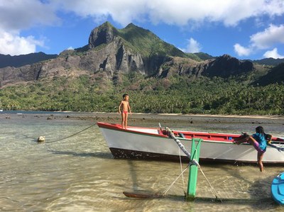
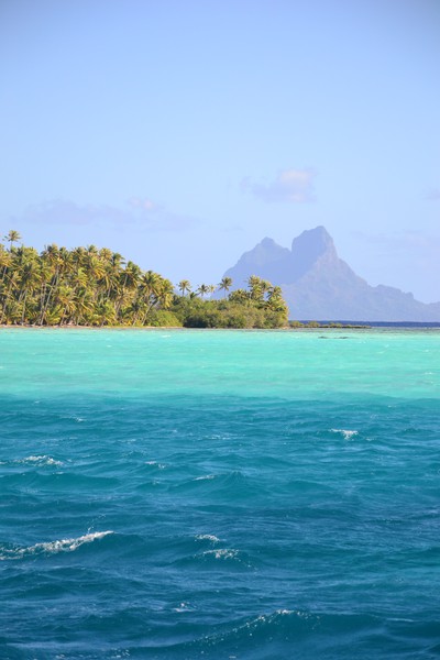
The Marquesean Islands are truly stunning, especially if you arrive from a long overseas passage. The green is much greener after seeing blue only for weeks. Nature on the islands is beautiful, great for hiking with abundant fruits at the side of the path. We enjoyed the laid back way of living away from mainstream tourism, the always smiling people and could have stayed much longer, there are so many things to explore.
Navigation
The Marquesas are volcano islands without associated barrier reefs, thus they are generally easy to navigate.
Mooring
Mooring in the Marquesas can be a little crowded, especially when traveling at the peak of the milk run. The bays of Atuona (Hiva Oa), as well as Taiohae (Nuku Hiva), are specifically highly frequented, as they are the home of the main villages and port of call. Cruisers meet here after their ocean passages to clear in and stock up. In most bays, especially on the southern or eastern sides of the islands, some swell is working into the bay, thus mooring often is a little rocky, thus some cruisers drop a stern anchor to hold the bow towards the swell. Holding in most bays we visited was good with either sand or mud bottom and they were well protected from prevailing winds.
Provisioning
On each of the islands we found small shops “magasins”, but not all of them have been well stocked. The magasins do have a basic supply of non-perishable groceries, but only a few have fresh produce. Best selection of fresh produce we found at the local market in Taiohae and at the Magasin opposite the post office in Atuona after the supply ship arrived. We have been told that best supplies can be gained in Hakahau on Ua Pou, which we did not visit.
Fuel, Water & Gas
We did not fuel or get water on the Marquesas, except for Gasoline for our outboard, which we obtained from the local fuel station in Taiohae. Kevin from Nuku Hiva Yacht Services offers re-filling of American and European Propane tanks at 500 CPF per kg.
Spare Parts & Marine Services
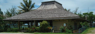
There are not chandleries on the Marquesas, however, spare parts may be organized by Kevin from Nuku Hiva Yacht Services or by Sandra from Hiva Oa Yacht Services upon request. Both shops also offer laundry services (800 CPF) and wifi (500 CPF/day)
Money & Internet
There are ATMs in Taiohae and Atuona, eventually also on other islands. We have not seen one on Tahuata and been told there is non on Faku Hiva. Wifi is generally slow throughout French Polynesia as it is transmitted via Satellite connection. Fasted internet we received in Atuona from Hiva Oa Yacht Services. We have been trying to purchase a local data SIM card for our mobile devices, however, cards are available only at the post offices in Atuona and Taiohae and have been sold out in both shops. Clarks did not know when they will be re-supplied. As next possibility to obtain a data SIM card was Papeete, Tahiti, we decided to obtain credit on hourly basis for the Vini and Mana Hotspots, available in the majority of villages, but not on remote bays. Hotspots worked well even though they have a restricted range, thus one needs to be close. Alternatively, we used wifi of bars and restaurants, who often provided wifi for their guests or even received wifi codes from private locals.
Clearance
We gained our inbound clearance in Atuona within 30 minutes, police officers were most welcoming, despite our visit just before closure. Alternatively, clearance can be gained in Taiohae on Nuku Hiva. In Faku Hiva there is no port of call and cruisers have reported to be fined.
Along Route
We traveled the islands from southeast to northwest to make use of the prevailing trade winds. As there was no possibility to clear in in Faku Hiva and we did not like to beat back against winds and waves, we skipped the island altogether. We traveled from Hiva Oa to Tahuata to Nuku Hiva and Ua Pos, from where we crossed to the Tuamotus.
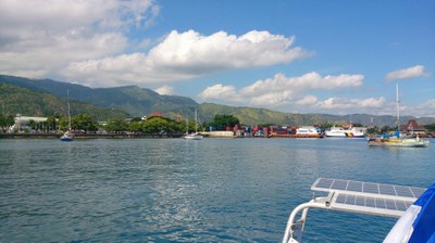
 Marquesas- Hiva Oa (Atuona)
Navigation: We approached Atuona after crossing the Pacific from Panama. The approach was straight forward without any hurdles.
Mooring: We moored in the inner habor behind the breakwater and the yellow signs marking the anchorage. The pier needs to stay clear when a supply ship comes (Thursday, every third week). Yachts mooring outside the anchoring zone are notified one or two days in advance prior to the arrival of the supply ship. We anchored in 8 meter over mud, holding was excellent with little swell due to the breakwater. As the anchorage was crowded most of the yachts have been mooring with an additional stern anchor to reduce the movement of the boats.
On land: We did a little hike along the coast on the east side of the bay, starting next to the boatyard. The walk was beautiful especially after a long time at sea. To Atuana village it is approximately a 3 km walk, but most cars are stopping if you put your thumb out. The village is very quiet during a Sunday, but it has a snack bar offering wifi during weekdays. There is also a restaurant selling pizza. The gendarmerie is open from 8 am to 5 pm during the week.
Services: There is a post office, two banks, a shop selling fishing gear and at least 2 magasins in the village. Fresh produce could be obtained in the magasin across the post office after the supply ship arrived. Wifi is available from restaurants, a Vinispot at the anchorage, or from Hiva Oa Yacht Services (500 CFP per day, wifi code is changing each day and can only be gained each morning between 9 and 10 am). Tahuata (Hanamoenoa, Vaitahu, Hapatoni)
 Marquesas – Hanamoenoa
Navigation: Hanamoenoa is located on the west side of Tahuata, approach is straight forward.
Mooring: As the bay was highly frequented, we moored on the outer end of the bay in approximately 10 meters over sand. There was almost no swell inside the bay despite significant surf on the easter side of the island. Holding was good. The bay is well protected from south easterly winds.
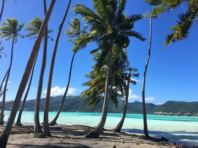
On land: There is a white sandy beach with palm trees, one of the few in the Marquesas.
Services: None (neither shops nor wifi)
 Marquesas – Vaitahu
Navigation: Vaitahu is located on the west side of Tahuata, approach is straight forward.
Mooring: We anchored just in front of the breakwater in 7 meters. We experienced no swell inside the bay but winds have been dropping from the mountains.
On land: We only stopped a few hours, thus did not do any walks, which would have been possible. The church is lovely and fits perfectly into the countryside.
Services: There is a small village with a magasin and a woman selling coffee and wifi. Additionally, locals are selling bananas and pomelo.
 Marquesas – Hapatoni
Navigation: Hapatoni is located on the west side of Tahuata, approach is straight forward.
Mooring: Anchoring in front of the village was not feasible, thus we anchored north of the village, below a crucifix on the hill over rocks. The anchorage was quiet with no swells and no wind.
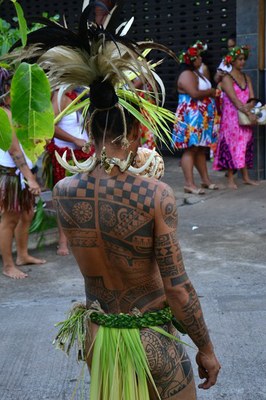
On land: There is a small village without restaurants or magasins. It is possible to walk to Vaitahu and to the eastern side of the islands. Up the hill, there are great views over the bay. We participated in the 3 days Whitsun festival, where also locals from Hiva Oa and Fatu Hiva participated. It was fascinating to watch the locals, who danced, sang and wore traditional cloth.
Services: None. But a local woman is happily sharing her wifi code with cruisers.
 Marquesas – Nuku Hiva
Anaho
Navigation: Anaho is located on the north side of Nuku Hiva, approach is straight forward until reaching the coral reef in front of the beach. The reef has a pass, which is accessible by dingy and small local boats.
Mooring: The bay was highly frequented. We moored the western side in 8 meters over sand. Holding was good. The bay is well protected from swells, but winds are gusting from the mountains.
On land: There is a restaurant at the beach offering lunch when pre-ordered a day in advance. It is possible to walk over a pass to Hatiheu (1.5 hrs) and to Haatuatua (0.5 hrs). In Haatuatua there is a small farm selling fresh produce. In Hatiheu there is a restaurant, a magasin with very limited selection and a vinispot at the church. We could organize baguette from the restaurant. On the way to Hatiheu there a dozens of Mango trees, fruit can be collected. From the pass one has brilliant views on the Anaho bay.
Services: None (neither shops nor wifi)
 Nuku Hiva – Taiohae
Navigation: The bay of Taiohae is deep, approach is straight forward.
Mooring: The bay was highly frequented. We moored just off the breakwater in 10 meters over mud. The bay is well protected from winds, but swells have been working in the bay.
On land: There is a cruiser snack at the harbor selling snacks and providing wifi to their guests. We rented a car to explore the different climate zones of Nuku Hiva, it has a multitude of facets and is beautiful with its archeological sides, the mountains and the bays. It is possible to visit dancing classes in Taiohae.
Services: There are 5 magasins in Taiohae, a gendarmerie, a dentist, a hospital, two banks and a post office. The magasins offer a limited selected of fresh produce, more can be gained at the farmers market close to the harbor. Nuku Hiva Yacht services is offering support with formalities, gas re-fills, wifi and car rentals. As there were no cars available, we rented a car with the help of the local tourist office. Consultation at the hospital can be gained in the morning (2000 CPF). Wifi can be accessed from the snack bar or a vinispot in the village.
 Marquesas – Ua Pou (Hakahetau)
Navigation: Hakahetau is located on the northwest side of Ua Pou, nevertheless there is a swell in the bay.
Mooring: We moored in front of the village with some swells, mooring on the northern side of the bay looked a little quieter. Holding was good.
On land: We walked up the mountains to a waterfall and afterwards to Manfred. He is selling his homemade organic chocolate (500 CPF a bar), which is excellent. At the waterfall, it is possible to take a bath and swim in the pool below, which was very nice and refreshing. In the village, there is a little restaurant Ti Pierro (just before entering the trails going up the mountains) selling delicious Polynesian food.
Services: There is a small magasin with very limited selection, no bread or fresh produce. No wifi.
 TUAMOTUS
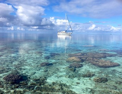
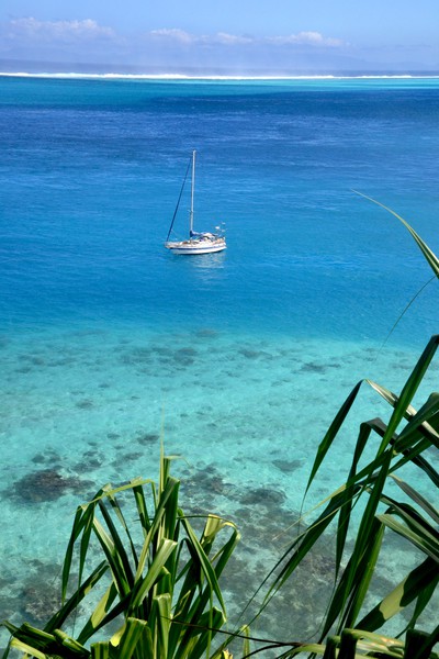
The Tuamotus are true atolls, meaning the volcanic island, located in the middle of the surrounding reef, is already eroded. They are the oldest of the islands of French Polynesia aged 10-40 Million years and often consist of many little motus located just inside the outer reef. The lagoon inside the reef is quite shallow (10-30 meters) with many reeflets and coral heads, which are not all charted, thus eyeball navigation is key. Entry to the lagoon can be tricky as most passes are subject to strong in and outgoing currents and are only recommended to pass during daytime. We spent a total of three weeks discovering 4 fabulous atolls, wonderfully supplementing each other: Raroia has the most colorful coral, Tahanea the best beaches, Fakarava most abundant reef fish and Taou the clearest waters.
Navigation
Not all atolls of the Tuamotus are accessible by sailboat. The ones which are, have passes in the outer reef for transit into the lagoon. Anchoring outside the lagoon is not possible for most of the atolls. Most of the times there are strong currents in the passes, either ingoing or outgoing depending on the tide and weather patterns. These currents may increase up to 6 knots or more and may cause water turbulences and large standing waves in wind against wave constellations. Therefore it is safer and more comfortable to time entries to the lagoon to slack water. In rough weather conditions, passes may become impassable at other times than slack water or all together.
As passes are often narrow and are surrounded by reefs it is advisable to enter lagoons only at good visibility during day time. Considering slack water, this often leaves only one or two possible time slots for entry. Tide information is not available for all of the atolls and slack water is affected also by other factors such as wind direction and strength, swell and geometry of the atoll. To our knowledge, there exist no tables predicting slack water, but cruisers are estimating the approximate time via excel sheets or other tools. We found the respective tools predicting slack water often not very accurate, thus we began to estimate slack water as described below. Slack times follow the tide, combined with a constant flow of water out of the lagoon, which has constantly been pushed over the reefs into the lagoon by swells.
We started to estimate the best time of entry based on the following rule of thumbs:
• Slack water at low tide is generally delayed approximately 30 min (meaning after low tide)
• Slack water at high tide is generally early approximately 30 min (before high tide)
• In case the wind is blowing more than 15 knots from southeasterly directions and/or the swell is more than 1.5 meters the delays against low and high tide increase to 1-2 hrs depending on the strength of winds and swells
We used tidal information of NOAA and Navionics. For atolls where no tidal information was available, we used the one from a neighboring atoll. Besides estimating slack water, we tried to avoid wind against wave conditions. For example, in case of a pass facing east and easterly winds, we tried to enter and leave the lagoon at slack water or at weak incoming current.
Once inside it is usually safe to navigate through the lagoon. But the many uncharted reeflets and coral heads require eyeball navigation and suitable light conditions. Best is sunlight from the back. We plotted our track inside the lagoon and marked all reeflets we passed by on the chart. This track was helpful if the light conditions are worse on the way out.
Winds & Swell
During the three weeks in June 2018 when we cruised the Tuomotus, we experienced light to moderate winds (gusting up to 30 knots) as well as calms. The prevailing wind direction was from the east, but we also experienced winds from the north, south and once even from westerly directions. Winds inside the lagoon in some cases built significant swell (more than a meter), which made anchoring in some places uncomfortable. In these cases, we moved the boat to the luv side of the atoll to anchor behind the reef for protection against swells. Respective spots were mostly not or only little protected against wind, but the water was calm making anchoring more comfortable.
Mooring
In the Tuamotus almost all anchorage have coral to a certain extent. We avoided dropping the anchor on coral and tried to find spots which are vastly free of boomies (coral heads), the latter was not always possible. At a bad anchor spot the chain can wrap around the coral heads in case of very light winds or changes in wind direction. This can damage the coral and might also result in an uncomfortable or even dangerous setting on the boat. A short chain length between the bow and the wrapped coral head might damage the bow, the windlass or other anchoring equipment in case of increasing winds and swells. Additionally, lifting the anchor is getting difficult to impossible. Some cruisers floated their anchor chain with buoys to avoid wrapping. We only anchored in water levels of less than 10 meters over sand, when possible, to enable free diving to disentangle the chain.
Provisioning
Provisioning generally is difficult as well as expensive on the Tuamotus. In Raroia there is a small magasin selling none perishable groceries. Fresh produce can only be obtained after the supply ship landed every 2-3 weeks. Tahanea is uninhabited, as is the southern part of Taou. Also at the Fakarava South pass, there are no facilities for provisioning, leaving Rotoava as the sole place on our route to stock up groceries and fresh produce. Rotoava has 3 magasins, 2 of them selling fresh produce, as well as a vegi lady. Onions, potatoes, apples, and carrots were available throughout the week, however zucchini, cabbage, and tomatoes we could only purchase after the supply ship arrived on each Wednesday. We also obtained lettuce, tomatoes, and peppers from a small farm next to Pakokota yacht services.
Fuel, Water, Gas & Laundry
Both yacht services at Fakarava offer laundry services.
Spare Parts & Marine Services
Difficult. Maybe yacht services at Fakurava are able to organize spare parts. On Raiora, Tahanea and Tahoa spare parts to our knowledge cannot be obtained.
Money & Internet
We did not find an ATM on the Tuamotus. Internet was available in Raroia from a recently installed Vinispot close to the school. In Fakarava, the yacht services in Pakokota and Rotoava offer wifi to their customers. Additionally, there is a WDG hotspot in Rotoava, accessible from the anchorage (credit can be obtained by credit card).
Along Route
We tried to make use of the prevailing winds, thus traveled from southeast to northwest within three weeks. We crossed from Ua Pou on the Marquesas to our first atoll Raroia, continued to Tahanea and Fakarava before visiting Taou and heading to Tahiti.
 Tuamotus – Raroia (Village, Fena Kon Tiki)
Raroia Village
Navigation: As Raroia was our first atoll we have been a little nervous. After a quiet night, we approached the pass at sunrise at slack water (exactly at low tide). With no wind and swell the water in the pass was dead flat and made an easy entry.
Mooring: We anchored in front of the pier in 15 meters. As there was no wind at all, Moya floated around and our anchor chain wrapped around a boomy. Christian free dived to rescue our anchor.
On land: We walked through the small village.
Services: We looked for fresh produce and baguette, but could get neither. There is a small magazine selling nonperishable stuff. Fresh produce can be obtained after the supply ship arrives every 2-3 weeks. Wifi is available from a Vinispot close to the school, but was not accessible from the anchorage.
 Fena Kon Tiki
Navigation: We crossed the lagoon in the afternoon with the sun at our stern. Not all reeflets are marked in our C-MAP charts or Navionics, but have been clearly visible via eyeball navigation. We left Raroia just before sunset and before high tide, the current was still outgoing, which caused some turbulences on the outside of the pass.
Mooring: We anchored in front of the Kon Tiki Island in 8 meters over sand with some coral around. Holding was good.
On land: We walked around the Motus, inspected the Kon Tiki monument and snorkeled the boomies close by. We also snorkeled a bit further to the south (position: 16°04.3S; 142°21.5W), where fish was abundant and spotted some black tip reef sharks. We also stopped at a reeflet on the way back across the lagoon to the pass (where we stopped as well). Snorkeling at the reeflet was pristine with lots of reef fish, huge clams and coral is most beautiful colors (position: 16°01.9S; 142°25.0W).
Services: None (neither wifi, nor shops)
Tuamotus – Tahanea (Pass Teavatapu, SE Anchorage)
 Pass Teavatapu
Navigation: We arrived in Tahanea 2 hrs after low water. After examining the pass, we decided to enter the lagoon instead of waiting for the next slack. Waters in the pass have been calm, only inside the pass there have been weak turbulences. Moya was accelerated by the incoming current of approximately 3 knots.
Mooring: We anchored in 8 Meters over sand just around the corner of the pass, a few boomies were close, but we haven’t had issues with our anchor chain (position: 16°50.9S; 144°41.6W ). Holding was good, and waters were well protected in northeasterly winds. The anchorage was becoming uncomfortable when winds shifted to northwestern directions raising significant swells in the lagoon.
On land: There are a few abandoned houses a shore. Beaches are all coral, but it is possible to walk to the pass and the outer reef, where cruisers piled up a few stone piles decorated with coral. There has been an army of small coconut crabs around. We didn´t spot much when snorkeling around the boomies.
Services: None (neither wifi, nor shops)
 Southeast Anchorage
Navigation: We crossed the lagoon in the morning with the sun at our port side. Most, but not all, boomies are well charted in Navionics charts, thus we made sure to have a lookout at the bow. With the sun from the side boomies on the starboard side have been easy to identify and the ones on the port side only visible a few meters ahead.
Mooring: We anchored on the SE side of the atoll in front of a chain of Motus (position: 16°58.3; 144°36.2W) in 10 meters over sand with quite some coral around. A few meters ahead water levels dropped to less than 3 meters, which could be easily identified by the turquoise color of the water. Also here we experienced significant swells at anchor with winds blowing from NW. Soon winds further shifted to the W and later SW to S, making the anchorage perfectly quite, despite a significant breeze (25 knots).
On land: Waters in front of the Motus are shallow, crystal clear with many small boomies around. The kids loved snorkeling along the Motus and playing at the white sandy beaches. The Motus are small and can easily rounded. We did some walks on the outer reef, which have been very nice. The colors of the water in the lagoon and on the reef and the green of the Motus are absolutely gorgeous among the best we have seen. We met a local family who came here on the weekend and fished a few groupers for lunch, but we didn´t dare to eat reef fish for the risk of ciguatera.
Services: None (neither wifi, nor shops)
 Tuamotus – Fakarava (S Pass, Pakokota, Rotoava)
South Pass (Tumakohua)
Navigation: We sailed the 50 nm from Tahanea during the night. It was an uncomfortable crossing as there has been significant swell from the southeast and 30 knots of wind from the east. Despite the strongly reefed sails we made too much speed and tacked downwind to arrive not before sunrise. We have been a little nervous given the wind and sea conditions, but entry to the pass at slack water was straight forward when keeping within the well-marked channel.
Mooring: We caught a mooring buoy (no fees) on the east side of the pass (position: 16°30.3S; 145°27.3W). The anchorage was well protected from easterly winds but was becoming uncomfortable when winds shifted to N and NW directions raising significant swells in the lagoon.
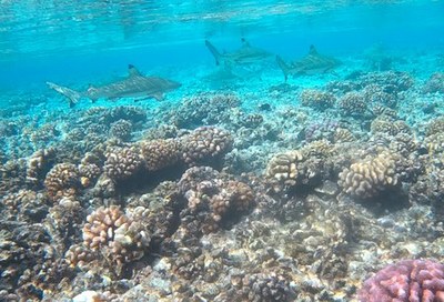
On land: Snorkeling the pass around slack water is an absolutely amazing experience. On the bottom of the pass, we spotted large (we assume) grey sharks from above. On the side of the pass (close to the dive shop), there have been many blacktip reef sharks and an abundant variety of fish. Even the kids were able to snorkel in this area and play in the sheltered inlets in shallow waters. Next to the dive shop, there is a hotel and a bar. Further to the east, it is possible to have pizza when pre-ordered one day before.
Services: None (neither wifi, nor shops except for the dive shop)
Pakokota
Navigation: Sailing through the well-marked channel was straight forward.
Mooring: We caught a mooring buoy at Pakokota yacht services (position: 16°13.6S; 145°33.4W), which was free of charge. The anchorage was better protected from NW winds and equally well protected from easterly directions.
On land: We mainly came for the wifi, but did also some nice walks on the outer reef.
Services: Wifi was available for customers of Pakokota yacht services. They sell ice cream and drinks and also dinner if booked in advance. Additionally, they offer laundry services, rides for provisioning to Rotoava and might be able to organize spare parts from Tahiti. It is possible to leave the boat here for longer durations on the heavy-duty moorings. A 5-10 min. walk to the south, there is a small farm selling a small selection of fresh produce (tomatoes, peppers, eggplant) at a reasonable price.
 Rotoava
Navigation: We sailed to Rotoava through the well-marked channel at the east side of the lagoon. Leaving Rotoava through the Fakarava N pass was straight forward. The Fakarava N pass is wide, deep and well marked. We left the atoll 1.5 hrs after low water with approximately 3 knots of incoming current without any issue.
Mooring: We anchored in front of the dive shop in 7 meters over sand with some coral around (position: 16°03.8S; 145°37.1W). The anchorage was well protected from E and S winds. Holding was good.
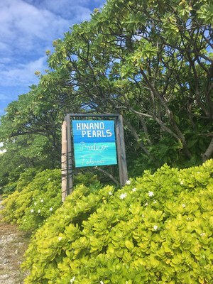
On land: Rotoava has a few shops, snacks and restaurants. It is possible to rent bikes (at Fakarava yacht services at the southern end of the village) and visit one of the pearl farms. We visited Hinano Perl farm located approximately 9 km south of the village and got a very interesting tour of how to produce pearls (at no cost). Prices of pearls are less expensive compared to Tahiti and Bora Bora.
Services: Wifi was available for customers of Fakarava yacht services. They also sell drinks, eggs and rent bikes. Additionally, they offer laundry services. At the anchorage, we accessed the WDG hotspot (credit can be obtained via credit card). Groceries can be purchased in a brand new magasin at the pier, and two older ones in the village. Additionally, there is the vegi lady selling a selection of fruits and vegetables. Selection in all shops are best on Wednesday after the supply ship arrived, prices of fresh produce are high.
Tuamotus – Taou
South Anchorage
Navigation: From Fakarava N it is only a quick 15 nm ride to the pass of Taou. We entered the pass at slack water before high tide.
Mooring: We anchored on the south side of the atoll in 10 meters over sand (position 15°57.8; 145°52.2W) with few coral around. Anchorage was well protected from S swells.
On land: A score we saw a well-maintained house, but obviously, the owners have not been around. We snorkeled in the shallow, crystal clear waters of the lagoon and walked the outer reef.
Services: None (neither wifi, nor shops).
 SOCIETY ISLANDS
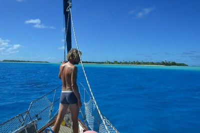
Most of the islands are volcanic origin with the volcano still remaining in the middle forming stunning lush green islands. These are encircled by a barrier reef, thus have to be entered via passes. Passes are generally well marked and most are less challenging to navigate as compared to the passes in the Tuamotus. The majority of Polynesian citizens are living in the Society islands, thus islands are less quiet as compared to the Marquesas and Tuamotus and are generally better supplied. Several Marinas, boatyards, and charter companies are located on the islands, thus also Maritim services are the best of French Polynesia. We made use of the relatively good selection of marine equipment available in Papeete as well as the nautical experts of Raiatea to fix a few broken items. We visited Tahiti, Huahine, Raiatea, Tahaa, Bora Bora and Maupiti within 3 weeks.
Navigation
Navigation in the society islands is relatively straight forward, as most passes and channels within the lagoons are buoyed and lit. We did not encounter strong currents in the passes (except in Maupiti), even though we didn’t time transits based on the tide as we did on the Tuamotus. After gaining some experience under engine we sailed through the passes without any issues. Several times we encountered big swells outside the passes, which led to large breaking surf at the reef including both sides of the passes and made us feel a little uneasy the first time. Besides cruising boats, there is a significant chance that also commercial traffic can be encountered. When entering Papeete port and airport area all movements have to be approved by Papeete port control (VHF Chanel 12).
Winds & Swell
During our stay, we experienced light winds from mostly northerly to easterly directions most of the time. There were also days with trade winds blowing from east or southeast 20 to 25 knots. Anchorages might be affected by wind gusts dropping from the mountains, but we did not experience strong ones. Swell was usually long and coming from the South at significant height.
 Mooring
Despite the calm waters inside the lagoons, we found anchoring on the society islands a bit challenging, as water levels inside the lagoons drop rapidly from 1-2 meters at the outer or inner reef to 20-30 meters. Only in a few places, we managed to anchor in less than 15 meters, which is our limit in case we have to free dive to release our anchor from coral heads which we encountered at almost all locations.
Since anchoring can be difficult, restaurants, marinas, private companies, and Polynesian administration installed mooring buoys in most of the bays. We saw both well-maintained buoys as well as insecure ones and decided on a case by case basis whether to take them or not. Most, but not all buoys are charged between 1000 and 3000 CPF or more depending on the location and owner. Some buoys are also private and not intended for cruising boats, these are marked “prive”.
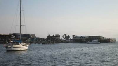
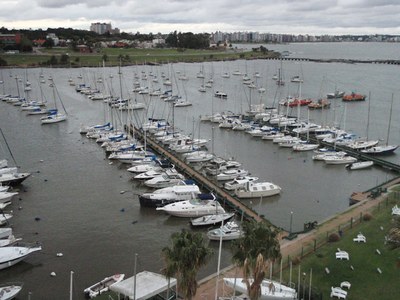
Additionally, there a number of opportunities to tie up in a marina. In Tahiti we saw two “Papeete Marina” and “Marina Tahina”, there might be more. In Raiatea, there are also a few marinas around.
Provisioning
After the very limited selection of groceries in the Tuamotus, provisioning in Tahiti was a pleasure (except for the price). There are several American style supermarkets around with a broad selection of French, Australian, and New Zealand products. Moreover, Papeete has a farmers market in the city center, where local fresh produce is available at reasonable prices. Additionally, we bought imported fruits we haven´t had for months in the supermarkets.
We were surprised to find well-stocked supermarkets including fresh produce and dairy products also in Huahine, Tahaa and Bora Bora. Selection was limited on Maupiti.
Fuel, Water, Gas & Laundry
Duty-free fuel can be obtained from fuel stations accepting the yacht in transit fuel certificate only. Respective certificate can be obtained by an agent (also in the Marquesas) or directly by visiting customs in Papeete, which for us was a quick and straight forward process. Afterwards, we took duty-free fuel from the fuel dock in Tahina Marina at Maeva Beach prices 84 CFP a liter instead of 130 CFP a liter normal price. We heard from other cruisers that there are also fuel stations accepting the yacht in transit fuel certificate on other islands such as Moorea or Raiatea.
Water is available at the pontoon in Marina Papeete and is charged by the liter (minimum 500 CFP corresponding to approximately 1750 liter water). There are most likely other sources, but we only used this one.
We did not require to re-fill gas, thus cannot comment.
Papeete Marina offers self-service laundry (1000 CPF each load plus 800 CPF drying).
Spare Parts & Marine Services
There are a number of chandleries available in Papeete, some of them are located in an industrial area close to the fishing harbor. In the same area, we found also shops selling marine engine spares and paintings. We visited a few shops as we looked for anodes and other spare parts, we found the best selection and qualified services at Sin Tung Marine. In Papeete, we noticed a few ads for sail repairs but we decided to get our ripped cruising cute repaired in Raiatea as both sailmakers Regine and Nicolas located in marina Apooti and CNI boatyard were recommended by other cruisers. Regine from Voilerie Aveia conducted high-quality repairs of our sail, our binimi, and sprayhood at a reasonable price within 3 working days.
Money & Internet
We found ATMs on all islands (despite Maupiti) and most of the villages. Even though we did not have a local data SIM card for our mobile phones (as they were sold out in the Marquesas, not available at all in the Tuamotus and we didn´t bother to purchase one in Tahiti) Wifi was available in many locations. Restaurants and bars usually distribute the wifi key to their guests, and signals often could be received on board with our on board wifi system. Moreover, in the not so remote places hotspots often were available, either from Vini (prepaid hourly rates) or WDG (prepaid hourly rates, online registration and payment by credit card possible), which were the fastest connections in our experience.
Clearance
When leaving Tahiti or Moorea for the Leeward islands clearance from the port captain is required and can be obtained via email. We cleared out of French Polynesia in Vaitape. At our first visit at the gendarmerie we received 5 forms, which needed to be filled out. The officer requested clearance from Papeete. After two days we gained clearance to leave for Tonga together with the customs declaration, which we were asked to post to Papeete by regular mail. A stopover at Maupiti after outbound clearance was accepted.
Along Route
We traveled the society islands downwind starting with Tahiti. After an overnights sail, we reached the leeward islands and visited Huahine first, followed by Raiatea, Tahaa, Bora Bora and Maupiti.
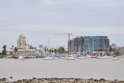
Society Islands – Tahiti (Papeete, Maeva Beach)
Tahiti – Papeete
Navigation: Before entering the port of Papeete we asked for approval from the port captain VHF Chanel 12. As no commercial or air traffic was expected, we could enter the pass straight away and headed for Papeete Marina on the port side.
Mooring: After spending several months at sea and at anchor, it was nice to tie up in the center of the city in Papeete Marina. Even though it was noisy, with construction works going on during the night and a very busy road, we appreciated easy access to land, short walks in the city center and the services of the marina. Water and power (1750 liters water or 7 kWh for 500 CFP) is available at the pontoon, wifi, and laundry (1000 CFP per washing) at the office. Berthes are paid by size, we took one of the smallest prized, approximately 5000 CFP/night. The marina office is opened 7 am to 4 pm and can be reached via VHF Chanel 9.
On land: In the evening food trucks are selling a variety of fresh meals at reasonable prices only a few hundred meters north of the marina. Also, shops and restaurants are close. Cars can be rented for traveling the island on land.
Services: We purchased a few marine spare parts, several shops are located in proximity to the fishing harbour approximately 2 kilometers from the marina. Duty-free fuel certificate can be obtained from the customs office in Papeete. Several well-stocked supermarkets are around for provisioning, fresh produce can be obtained at the farmers market in the city center. Wifi is available in the marina, in restaurants or from Vini or WDG hotspots.
 Tahiti – Maeva Beach
Navigation: After waiting for a taking off plane and clearance from the port captain (VHF 12) to enter the channel towards Maeva beach, we passed the airport. We left Papeete through the well-marked Passe de Taapuna.
Mooring: Shortly after we arrived in a huge mooring field between marina Tahina and the outer reef. Boats were lying at anchor in 15-20 meters or at mooring buoys. We anchored at position 17°34.8S; 149°37.3W 17 meters above sand with few coral. The anchorage was well protected from the prevailing trade winds. Boats at anchor and at mooring were moving differently, which was difficult to predict at the time of anchoring.
Services: We fueled at marina Tahina before leaving for Huahine. Wifi was accessible by WDG hotspot.
Society Islands – Huahine (Port Bourayne, Fare)
After an overnight passage from Tahiti, we arrived in Huahine around noon. On the outer reef, we have seen large breaking surf as a result of the big swells approaching from the south. We were a bit worried about sea conditions in the passes, but despite the surf on both sides of the southern of the two passes, water in the pass was tranquil. The pass is buoyed and lit during the night as is the channel leading south, which we took to head for Port Bourayne.
 Huahine – Port Bourayne
Mooring: Port Bourayne is a wide bay in between the two islands of Huahine which is leading into a shallow channel. Through the channel one can dingy to the east coast of Huahine. The bay itself is at most locations around 30 meters deep, in some areas there is coral reef, where water levels drop to only a few feet. These areas were too shallow for us for anchoring. In front of the bay, there is a little island Motu Vaiorea. On the south of it, the water is less deep. Several yachts have been anchoring here. We were glad to find one of three well-maintained moorings unoccupied, caught the buoy and stood several days at no cost. There is some coral around the motu and at the coast. The mooring spot is well protected from all but westerly winds. However, when the water level inside the lagoon is rising due to surf pushing over the reef, the spot is affected by two currents one coming from the south and one from the east (out of Port Bourayne) causing water turbulences.
On land: There is a little beach, which is kept clean by a nice Polynesian guy who also sells self-made necklaces and gives advise where one can go for a walk. We did a short hike through the jungle and saw remains of old housing, huge jungle trees, and bamboo and climbed a rock, which used to be a lookout. From up there we had beautiful views over the bay, the outer reef and Raiatea in the distance. We also snorkeled in the bay around several coral heads, but most coral was dead with only a few fish around.
Services: Neither shops, nor wifi hotspots
Huahine – Fare
Mooring: We headed up to the main village Fare and anchored just in front of the yacht club Huahine, where the dingy dock is. Water in front of the town in most locations is between 15 to 20 meters deep. Several mooring buoys are installed, but all were taken as we arrived. We finally anchored at position 16°42.95 S; 151°02.36W in 8 meters. The bottom is quite hard, but holding was ok in moderate winds and a light outgoing current.
On land: The yacht club Huahine offers cocktails at half price in the happy hour between 5 and 6 pm.
Services: Wifi can be obtained by a WDG hotspot. There is a well-supplied supermarket, a bank and several other shops.
Navigation: We left Huahine through the northern pass without any issue in 25 knots of wind. Also, the northern pass is well marked and lit during the night.
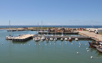
Society Islands – Raiatea (CNI)
Navigation: We entered the shared lagoon of Raiatea and Tahaa via the passe Teavapiti on the east coast of Raiatea. Despite significant swell and 25 knots of wind the approach was straight forward. The pass is well marked as is the channel leading to the northwest side of Raiatea.
Mooring: Close to the airport there is a yellow buoyed area, where anchoring is prohibited. Just south of it we tried to anchor in front of Marina Apooti. Anchoring was not possible in the bay as we didn´t want to block or take one of the expensive mooring buoys. We headed one mile further south and anchored in front of two boatyards. The water in this area is generally deep, but south to the entrance of the yard we found a spot at the position 16°44.22S; 151°29.25W in 7 meters above sand. There are also mooring buoys available for rent.
Services: Wifi can be obtained by a WDG hotspot or from the boatyard. The boatyard has a small shop selling basic nautical supplies such as lines, anodes, painting and so on. Next to the yard a sailmaker is located. There are no grocery shops close by, the next Magasin selling basic supplies is next to the Apooti Marina. At the Marina, there is also a dive shop and another sailmaker.
Society Islands – Tahaa (Haamene, Tapuamu/ Ilot Tautau)
Tahaa – Haamene
Navigation: Haamene is located at the east coast of Tahaa, at the end of a very deep bay. The entry to the bay and all foul grounds are well marked.
Mooring: In front of the village of Haamene we found the remainder of some mooring buoys. We didn´t mind, as the anchoring ground here is great. We anchored in 5 meters over good holding mud in front of the pier. When we arrived winds have been light blowing from north. At departure, winds were gusting up to 40 knots from southeast. The bay basically offers zero protection to easterlies, thus it was a bit rocky.
On land: Tahaa Maitai is located close to the bridge with an excellent menu. Additionally, there are two snacks in the village. There are at least two hike opportunities. One to Maison du Vanillia and one to Patio. The first one is easy, the second one has beautiful views and is more challenging. With the kids we only did the easy one: Behind Tahaa Maitai turned left and followed the road in westerly direction. At a T-crossing, we turned right up the hill. We first missed the farm and walked all the way to the Bay of Apu. On the way back we found it approximately 2 km from Haamene, but it was closed. We don´t know whether it was only temporarily closed or shut down altogether, previously the owner did a tour and explained vanilla production and offered vanilla for purchase.
Services: Wifi can be obtained from Tahaa Maitai restaurant (if one is a guest) alternatively a Vini Spot is situated at the post office. Haamene has a Magasin stocked with basic supplies and also some basic hardware. At the market hall, few fresh produce is offered.
 Tahaa – Tapuamu/ Illot Tautau
Mooring: With the strong southeasterly winds, we hoped to find a sheltered anchorage on the Lee side of Tahaa in Tapuamu. The bay offered some protection, but surprisingly winds still were blowing around 25 knots. In the bay there are two or three moorings, but all were taken at our visit. The bay in most locations is either quite deep >20 meters or too shallow for anchoring. We couldn’t manage to find a suitable space and left for Illot Tautau, approximately 1 mile to the west. We anchored east of Ilot Tautau in 8 meters over sand with lots of coral relatively close to the reef (position 16°36.3S; 151°33.4W). The anchorage is still a bit protected from south easterly winds, but swells were building inside the lagoon and make it a bit rolly. When we left the anchorage we experienced approximately 15 knots of wind from SE, which increased to 30 knots as we passed Baie Hurepiti on the southwestern side of Tahaa.
On land: Ilot Tautau is privat. A Hotel with water bungalows is located here. It is possible to land by dingy at the small motu to the right Ilot Maharare or anchor in shallow water over sand next to the motu. We left the Dingi on the east side of Ilot Maharare, went ashore and walked all the way to the outer reef, where the four of us dropped into the water and drifted back to the east side. The snorkeling was superb. The water is only about 1.5 to 2 meters deep, thus also the kids were having a great time as fish and coral were close. As for the weak ingoing current, we enjoyed watching various kind of abundant reef fish while drifting through the coral gardens. The coral formed kind of a maze with the majority of it being viable. Despite the 20+ kts of wind, we had a great time snorkeling as the shallow waters in between the Motus is protected from both sides.
Services: No hotspot close by.
Navigation: We left the lagoon of Raiatea/Tahaa through the pass Paipai with 20-25 knots of wind. The pass is wide and well marked, thus the departure was not an issue.
 Society Islands – Bora Bora (Toopua, Airport, Vaitape)
Bora Bora – Toopua
Navigation: We entered the lagoon of Bora Bora through to the sole pass Teavanu on the western side of the island. Swells were moderate and the pass is wide and well marked, thus entry was straight forward.
Mooring: We anchored in 9 meters over sand on the western side of Motu Toopua (position 16°30.8S; 151°46.2W) between the Motu and the buoyed channel. Holding was good, the spot was well protected from prevailing southeasterlies and waters were calm.
On land: The Hilton Hotel is located on Motu Toopua. As we didn´t try, we don´t know whether landing by dingy should be possible. From our anchorage, we saw a number of boats carrying tourists to a spot close to the outer reef. We dingied there and figured that the boats have been feeding stingrays and blacktip reef sharks for photos and snorkeling with their guests (approximate position 16°30.7S; 151°47.2W). On the way back we stopped at a sunken sailboat close to our anchorage, the mast was still visible. Close to the wreck, we saw some reef fish and growing coral.
Services: No hotspot closeby.
Airport
Mooring: We anchored in 5 meters over sand, no coral (position 16°27.6S; 151°45.4W). Holding was good, the spot was protected from prevailing southeasterlies and waters were calm.
On land: The Motus closeby are private and visiting not wanted. We snorkeled close to the outer reef behind Motu Tane (approximate position 16°26.9″; 151°45.9W). Snorkeling was great with lots of viable coral, reef fish and even a Manta Ray (which was not attracted by feeding).
Services: No hotspot close by.
Bora Bora – Vaitape
Mooring: We caught a mooring buoy in front of the Maikai yacht club. The mooring was 2000 CPF a night or 5000 CPF a week. Protection from southesterlies is not too good with swells in the bay. Maikai yacht club has a dingy dock, which actually is not connected to land, but a floating dock. To access land one has to cross 0.5 meters of water, making provisioning a bit tricky.
On land: From Maikai it is a 10 min. walk on the street (not sidewalks) into town. We also did a short hike up to the canons installed by the Americans during world war II. It is possible to hire bikes or cars in the center. Vaitape has several restaurants, we ate at St. James which we highly recommend.
Services: Wifi can be obtained from Maikai yacht club and is included in the mooring fee. However, the connection was poor or not working at all. There is also a Vinispot, which is only accessible with a strong wifi antenna. Maikai has a small pool which we were free to use.
In town, there are 2 supermarkets, several souvenir shops, a hardware store, the post office, the police station and a chandlery.
Heiva: We have been in Bora Bora during Heiva. The celebrations were in the town center partially on the street, athletics on the sports ground and traditional singing and dance in the stadium. There were many food shops around. Tickets were available starting from 500 CPF to 2500 CPF, but one could also watch the contests free of charge if one doesn’t mind standing. For us the show was one of the highlights of French Polynesia, we enjoyed it a lot.
Clearance: We cleared out of French Polynesia in Vaitape. At our first visit at the gendarmerie we received 5 forms, which needed to be filled out. The officer requested clearance from Papeete. After two days we gained clearance to leave for Tonga together with the customs declaration, which we were asked to post to Papeete. A stamp could be obtained at the post office (80 CPF). A stopover at Maupiti after outbound clearance was accepted.
Society Islands – Maupiti (Tiriano)
Navigation: The approach to Maupiti in settled conditions may be straight forward, but as the only pass is narrow and open to the south, were the prevailing swell is coming from, entry to the lagoon was rather intimidating for us. With approximately 2.5m swell and 20kt wind we entered the pass in turbulent waters and large breakers on both sides. The pass is well buoyed and additionally has two markers indicating the approach from outside and the location when to turn left. The scariest part for us was the draining reef after each wave only a few meters to our starboard side. With large swells outside, there is a constant outflow through the pass, and a significant outgoing current accordingly, which was 4-4.5 knots in our case. After the second pair of buoys waters were calm and the current decreased, the remaining passage to the town is well marked, too. We do NOT recommend to enter the pass in these conditions and would not do it again. Given the large southerly swells, it was not possible to exit the lagoon for 4 days.
Mooring: In Tiriano we anchored in front of the church in 5 meters over sand, holding was excellent, even in >30 knots of wind. There are a few reefs close by, which are marked by black or white sticks on top of them.
At Motu Pitiahe we first tried to anchor next to the channel, but currents were too strong. Afterwards, we tried further south, closer to the motu and found a good holding spot in 9 meters over sand (position 16°28.7S; 152°14.7W) just next to the manta ray protection area marked by yellow buoys.
 On land: The village of Tiriano is spread along the western coast of Maupiti. From the village, it is possible to climb the mont Pahahere (385m). The trail starts close to the restaurant with steps on the hillside of the road, later the path is marked by a yellow-white-yellow flag painted on rocks. We did the walk with the kids, however, in the upper part it was difficult for Joshua (5) and impossible for Jonathan (3) to continue. We, therefore, carried Jonathan with the support of a carrier and closely guided Joshua. On the upper bit, there are a few climbing passages supported by ropes. After a few strong squalls the previous day, the trail partially
was a little slippery. The views from the top are absolutely gorgeous.
On the eastern Motu Tuanai (opposite to the church) there are beautiful white sandy beaches. Snorkeling is basically possible everywhere on the various reefs. In the morning Manta Rays are coming into the lagoon and can be watched close to Pointe Tamaupiti (north of Motu Pitiahe), the manta ray protection area is marked by yellow buoys.
Services: There is a Manaspot (Vini) which we used at anchor via our external wifi antenna. In the village, there is a post office and at least 2 magazines (limited selection). Baguette can be purchased only after ordering one day before.
Sabrina
SY Moya
Related content
Portrait of a Cruiser: German crew Christian, Sabrina, Joshua and Jonathan of Yacht Moya
Leave a comment
You must Login or Register to submit comments.