Colombia Cruising Notes
Mark and Amanda of SV Balvenie are now in year 9 of their circumnavigation. They entered Colombia at Providencia from Panama at the beginning of December 2012. Previously, in April 2012, they visited Santa Marta, Rosario’s and San Bernados. Read their cruising notes below.
Published 11 years ago, updated 6 years ago
PROVIDENCIA
Passage to Providencia
We ended up in Panama for the summer/hurricane season. We had carefully watched the weather for this dead-end corner of the Caribbean for many months and knew that there was a small window to get north from Panama, with the least amount of pain. The hurricane season “officially” ends 01 Dec, many boats start heading north during November as there are sometimes westerly winds, although they are very fickle. You also run the risk of a late-season hurricane forming in the Western Caribbean, which is possible, and are left with nowhere to run.
The weather had been appalling in Shelter Bay Marina, Colon during November – days and days of rain – so we weren’t inspired to leave. We finally pulled out 30 Nov and did a short sail east to Portobelo, this improves the angle ever so slightly for laying Providencia. We had originally wanted to explore the Boco del Toros area of Panama, but as it lies further west it tightens the angle even more for the trip to Providencia, so we ended up missing it. We left Portobelo 7.30am on December 01 and did a night arrival into Providencia on December 04 at 1.30am, it took us 66 hours to cover the 255 miles direct route, we put in several tacks, sailed hard on the wind every inch of the way in very light winds and moderate seas except for the occasional 25knot squall. Friends that left a day before us had very squally conditions and uncomfortable seas, a yacht that left a week after us from Boco del Toros was dismasted. This is definitely a passage to pick a good weather window for and to try and get done before the infamous Christmas Trades set in. The other option is to try for a window across to Cartagena on the Colombian Mainland and then have more of a downwind passage to Providencia. That stretch of water can get very lively when the trades are blowing and some very big seas are not unusual.
Entry into Providencia
Looking at the charts it shows miles of shallows, several markers that don’t appear to go anywhere and it is very confusing. We did a night arrival and it was straightforward. There is a lit sea buoy (shows on CMaps) at 13 24.00N 81 23 .71W, it flashes white. Head to it keeping well offshore then you turn towards land down a wide entry channel (approx 143 mags, there were leading lights onshore but they were hard to pick out as they were the same yellowish colour as other lights nearby). Coastal traders and the small Navy ship come in this channel, there are 3 red markers on starboard and 2 green markers on the port. One was not working on our arrival but it was repaired within two days. The chart shows this channel going over a reef, it shallowed down to around 4 metres at this point. At the last green marker (approx 13 22.61N 81 22.68W) turn left towards Santa Catalina (almost due north). Try to stay left keeping out of the channel to the dock (used day and night). This is around 3.5m – 4m and it holds this depth quite some distance in, so take it slowly and nudge in. We anchored at 13 22.70N 81 22.50W in the 3.5m thick mud. Try to tuck up as far as you can, when the wind went to the North a slight swell did creep into the back of the anchorage.
Checking In
At anchor 04 – 16 December 2012. Call Bush Agency on VHF 16 on arrival. Mr Bush (English speaking) seems to be the only local agent and it didn’t seem an option to sidestep him and try to check in independently. There are several opinions of his service and costs on various sites, he is quite abrupt on the radio but well mannered, pleasant and helpful in person. He will arrange a time to meet you on the dock to process your papers. He asked for us to come in a couple of times during our stay, but we didn’t until we wanted to arrange our departure, this didn’t create a problem. You need to give him at least a days notice of departure. No payment until you leave, we were charged USD140, Colombia is not a cheap place to check in and out of!
Ashore
Take dinghy to the left of the big dock and tie up at a long dock that runs across the front of the town square. The town is right there, takes 10 minutes to see it all. Exchange rate Dec 2012 USD10 = COP16,500. A few small supermarkets on the road that runs inland slightly up the hill have reasonable provisions but poor fresh produce, most appeared dead on arrival ~ may well come from the mainland on unrefrigerated trader. Three supermarkets up here. One on right will exchange USD, or there is an ATM at Bank on town square by dinghy dock. Bakery on road up the hill on the right side has very good wholemeal bread. A couple of small hardware stores also up here, and keep walking about 500metres for the small hospital on left.
Back down by the dinghy dock looking towards land on right side, ground floor, old very handsome but rather dilapidated wooden building – there is a small kiosk that you can buy a Simcard or Chip as they call them, for phone/internet. The chip cost 19,000 (may get English or Spanish speaker) can buy credit here OR, go across road to Internet Cafe and very helpful English speaking lady activated it and sold the credit which was 20,000 for one weeks/1.5GB internet, daily was 3,500 and we when we activated for another day it gave us three days which was good as we also picked up the signal after we left when anchored up at Low Cay. We did pick up an unlocked WIFI signal at anchor, but it was very fluky.
Petrol/Diesel. Can take dinghy across to far right end of the boardwalk, might need to paddle last part, tie up, walk along road maybe 150 metres to Gas Station, or get while you have your mule (see below under activities). Petrol was 10,000COP a gallon, didn’t need a diesel but it was less.
Eating Out. A real lack of choice, Bamboo Hut has closed down, we had dinner ashore one night but it was very average.
All up Providencia was a great stopover, a very clean, well-kept island with the Islanders seemingly proud of their home ~ after Panama is was very refreshing.
Activities
Mule Hire (has 4 wheels, not 4 legs). To see the island you either hire a mule (sort of a dune buggy) or a motorbike, we shared a mule its 100,000COP total so not cheap (our half 50,000) includes fuel, we got ours from Camila Rentals which was in a hardware store on road uphill just by the bakery. Loads of places had them for hire, all same price. You can drive around the island in no time, but there are little side roads to explore, stunning South West Bay to linger over a very long lunch, photos to take and a few short walks to stretch the legs or the big hike up to the summit.
Make sure you do the walk across “Lover Lane” bridge that joins Providencia and Santa Catalina, turn left and do the walk all the way out to Morgans Head. BoardWalk first, then steps up and down, then lovely well tended bush walk along the coast to end, return the same way, allow 3 hours with loads of time for stops and swim at Pirates Cove.
Then take the dinghy out to Morgans Head and snorkel all the way back to headland under the steps, sawfish we hadn’t seen before, a big eel, a yellow spotted ray, the most beautiful shell ever, some lovely corals and reasonable amount and a mix of fish. We did this most days as it was sheltered from the wind and a very pleasant way to get exercise.
Other Anchorages
Anchoring before the last green channel buoy just off the cute little beach on Santa Catalina before the main anchorage looked feasible, there was plenty of depth and would be a good option in stronger Northers, although when the wind was from the north there was a swell creeping in, so maybe a little rolly.
Low Cay – There are not too many places on the CMap charts it notes “Good Anchorage”, but inside the reef to the east of the lighthouse at Low Cay it does, so we decided to spend one night there on our journey to Honduras. We anchored at 13 31.147N 81 20.085W in 10m on a sandy patch. The reef is not as solid as we would have hoped and there was a lot of water coming over and through gaps in the reef. We were there in light easterlies and didn’t think much of it. Snorkelling was ok but very choppy and hard work. Still had phone coverage – good enough for internet.
SANTA MARTA, ROSSARIOS AND SAN BERNADOS
Passage Aruba to Colombia
We spent many mornings during February and March listening to fellow cruisers checking in on our morning net who were underway from the ABC’s to either Colombia or Panama. During a good part of the trade wind season, this piece of water at the top of Colombia has the reputation as being the 5th worst in the world, from the conditions encountered by almost all of the fleet that went through at this time it lived up to its reputation. All of them were very experienced sailors. Very big seas were reported, combining with some mean winds whipping down off the Andes, and sometimes an adverse current produced very confused seas. It certainly wasn’t a passage we were looking forward to, but as we were not under a timeframe pressure to transit the Panama Canal we had the luxury of waiting until the winds eased and the swell settled.
We departed from the southern anchorage on Aruba 8.30am 05/04/2012 and arrived into the marina in Santa Marta, Colombia 4 pm 07/04/2012, we only motored one hour off the 281-mile passage. We left with a weather window indicating no more than 15 knots from the Northeast, most of the time we had less until we closed on Santa Marta and had over 20 knots with the afternoon sea breeze while trying to douse the cruising chute! The sea state was changeable, very flat and comfortable for the most part, but we also went across some very agitated patches that we imagine could have been quite nasty in strong winds. For a lot of the time, we had current against us, sometimes over 2 knots.
Arrival into Santa Marta, Colombia
We chose not to stop en route down the Colombian coast, although we had looked at the options. Our weather window was so good we decided to keep going and get the miles behind us. The winds accelerated as we neared the islands just off Santa Marta, but once we rounded them we were in the relatively flat water. We went between the mainland and Isla El Morro and came around into the lee of the headland.
The Commercial Port is tucked up in the northern head of the bay, the marina is off the beach to the south of the port behind the marina breakwater, the entrance is on the northern end (more info below).
You must use an agent to clear into Colombia. Dino is the local agent, he is based at the marina and will find you. He speaks reasonable English, brings all the forms for filling in and takes everything away to have it processed then brings it back. There is a “temporary importation” customs form that is very important, if you are staying longer than a week or so (not exactly sure of length) make sure that this is all processed correctly, we have spoken with a catamaran owner who had his boat impounded here because Dino didn’t process the paperwork correctly or in time (not sure which, but beware). Our total cost for checking in/out was US$75, paid when we departed and could be paid in either USD or local or a mixture.
The local money is Colombian Pesos and it’s easy to be a millionaire! Approx rates were USD1 = COP1800, EUR1 = 2240COP or NZD1 = 1400COP. (Apr 2012)
Reference Materials
There are no cruising guides to Colombia. It seems that Colombia is getting safer and safer all the time so maybe it will open up more for cruising. We did a lot of research before we left and found the Tashtego website and articles by Pizzazz on the Caribbean Compass site most helpful.
Santa Marta Marina
Contact on VHF 16 or 72 (excellent English is spoken by some staff). Approx marina entrance was 11 14.67N 74 13.053W. This varies to the waypoint advertised by the marina, their one is possibly the location of the office! There was shallow water on the final approaches, around 2.5m close in, you head at right angles for the northern end of the wall (i.e. straight for the beach) and there was a buoy you keep to starboard then turn right and go in through the entrance. Night arrival, as always not something we would recommend but could be done. The outer breakwater wall that is running parallel with the beach had purple/blue lights (not very bright) along the top of it. We don’t recall port/starboard entrance lights. If conditions were calm you could anchor north of the marina entrance, between it and the small fishing port, but this would be in around 3m, give yourself swing room as sometimes a light breeze from the south-west comes in overnight.
Remember this is a working port with a couple of big ships coming and going a day. If visibility was good enough, conditions calm and you can’t get anyone on the VHF then enters the marina and sneak onto the fuel dock, it’s a very long dock. The fuel dock is on the left (at present no pumps but a truck comes down, not sure of price). The marina berths are side-on to the prevailing winds which can make for interesting docking, luckily it was not full and we had a double finger berth, floating dock pen to ourselves.
The marina facilities are excellent, air-conditioned bathrooms are of 5-star hotel standard, laundry with 2 washing machines and 2 dryers, and a tiny book exchange. Get laundry tokens from the staff in the Security Hut at the road entrance for 5000COP each (make sure you put money in the correct slot, easy to put it in the dryer by mistake!) 24-hour security, felt very safe and secure, we left the boat here whilst travelling with no hesitation.
WIFI. The marina WIFI signal was good enough on the boat but to use Skype we needed to head up and sit by the office. It is also possible to buy a Digicel Simcard (or chip as they call them), Sim costs 19,000COP and one week’s internet access is 25,000COP with 1.5GB I think.
In and around Santa Marta
There is an excellent 2-page handout, written by cruisers for cruisers, that you can get from the office or link to it here. It really does tell you everything you need to know. ATM machines would give a maximum of COP400,000 each time, which even in Colombia doesn’t go very far. They did not give USD.
Provisioning. We found the Exito Supermarket (more a Hypermarket) very good for everything but fresh vegetables. They have superb whole beef eye fillets fresh/vacuum packed in their butchery for about USD28, sublime! Carrefour fruit and veg was good, it’s 4,000COP each way in a taxi, or minibuses go too from just outside the marina, they have Carrefour in their window. There are many stalls around the Exito selling fresh produce. A bakery is just down the main street going inland opposite the marina on the left. DHL is also on this street, before the bakery, the post office is opposite DHL.
We took a taxi up to the mountain village of Minca, either get taxi to Minca taxi station or walk along waterfront till Calle 11, walk up thru all the market stalls along here till you get to the hardware shops, the Minca taxis leave from outside Surtiferreterias No 11A-50 which is on the right side and does actually have a sign up saying Estacion Minca. There were 4 of us and it cost 6000COP pp each way, he waited for us up there. We also took a taxi to the nearby bay of Taganga, (but easy to get a minibus) – the taxi was 8000COP each way. It’s a cruisy little backpackers hangout with pleasant enough beach. Some boats have anchored in there, but there have been some security issues.
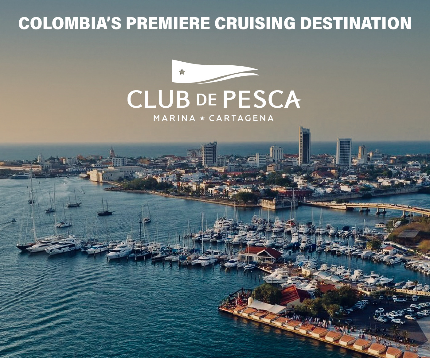
Side Trip to Cartagena
We chose to do Cartagena by bus instead of taking the boat down, as we originally planned to head across to Providencia and onto Guatemala from Santa Marta. As it happens our plans changed and we went south instead so sailed straight past Cartagena without stopping. We booked a shuttle minibus through the marina office for 42,000COP pp each way, on the way down it picked us up from the marina and dropped us off just outside the entrance to the old town and we walked to our hotel. On the way back we booked with the same company but we had to get a taxi to their office in Cartagena and there was no way the driver was dropping us at the marina even though we were the only passengers left and it was only 4 blocks. Don’t remember shuttle company used but still much easier than getting local buses and not much more in cost.
Our visit to Cartagena coincided with a Heads of State Summit and President Obama was in town – bad timing on our part. The bad part was that accommodation was at a premium and prices highly inflated. We stayed at the Hotel Zaguán de la Huerta on Calle del Jardin in a pleasant part of the old walled town, our room was very nice but 237,900COP per night (USD132 – way over our normal budget). It was within easy walking distance to everything within the walled town. The upside of arriving with President Obama was that security was at an absolute peak, heavily armed police everywhere, I suspect all the street people had been rounded up and relocated, buildings everywhere had just had a very quick lick of fresh paint, hanging baskets full of flowers adorned balconies – it was incredibly beautiful and we wondered why we had ever left Europe and realised how much we missed the glorious architecture of so many of the old towns and cities there. We stayed 2 nights and saw everything we wanted to.
Heading South to the Rosarios
On our exit Zarpe we stated Porvenir in Panama as our next Port of Call and asked for “all stops in between” to be noted, Dino said this would be done but it was not put on the Zarpe, oh well. We left Santa Marta at 9.30am and arrived into the Rosarios 24 hours and 135 miles later, we motored for an hour to start before the breeze filled in and then for the last 2 hours in glassy seas. It was a very pleasant and uneventful trip, we passed the Magdalena River mouth in daylight and saw very little shipping or logs – we had been warned about the logs. The watercolour certainly changed to a murky muddy brown for many hours. The wind died completely just after dawn and we motored the last 10 miles to the Rosarios.
We anchored on the northern side inside the reef. This is NOT an anchorage you would want to head for with ANY following sea, you would also not want to get caught in there if northerlies came up as the reef is below water level so protection would not be good. We had perfect conditions for our stay.
Waypoints for entry (use at your own risk – try to have good visibility – go slow – and remember we draw 2.4m so we don’t cut corners!)
There were a few posts that we could see on our final approach, the one you want is at 10 11.07N 75 44.50W, it lines up quite well with an olive green two storey house on the shore. Keep this post to starboard, it is on the reef but stays reasonably close as there is also reef on the left. Turn quite sharply after it to the right heading for 10 11.01N 75 44.65W then you go between 2 posts and turn sharply to the left. The following 3 waypoints are close together and give you a general line to follow 10 10.97N 75 44.64W – 10 10.90N 75 44.47W – 10 10.90N 75 44.31W, this is all quite close to shore and inside some more posts. We anchored at 10 10.921N 75 44.299W in 5.5m sand. A local yacht came in from the other direction between the house on the island and the mainland, but we did not see where they came through the reef.
This is a very interesting group of islands, some just tiny rocks, others the size of a football field, some even bigger but nearly every one had some sort of structure on it, whether it be a tin shack or a palatial holiday home. We explored them all by dinghy, there certainly looked to be an opportunity to anchor on the southern shore but it is reef strewn so you would need to do an exploratory trip first with GPS and depth sounder in the dinghy before taking the big boat. I don’t remember if we had cell phone coverage there, but there were no free WIFI signals. There was a small resort just along from the anchorage and a much bigger one on the south shore, we didn’t go into either. No visits from any officials. The snorkelling on the outside of the reef where the first post is (where you did the sharp right) was very good, interesting seabed contours worth a look if calm and sunny.
Further South to the San Bernados
We exited the Rossario’s the same way we entered and did a big loop around the shoals to the west before we headed south. We encountered a very solid pole sticking out at 10 02.407N 75 48.577W, it was in the middle of nowhere in very deep water. We went around the eastern end of Isla Tintipan and made our way along the southern shore.
We had total cloud cover when we arrived and dropped anchor at 09 47.258N 75 50.329W in 7.5m sand and rock. With better visibility, we may have chosen a spot further in. Conditions while we were there were squally and the anchorage a little choppy. We did take the dinghy almost along to the tiny island where everyone lives, we didn’t go right there as there was a small Navy boat on the dock and we didn’t want to draw attention to ourselves. The main island seems to be exclusively owned by a few rich Colombians who come down to entertain and party in their waterfront mansions on occasion.
Officials. We were woken at 6 am by a boarding party from the Navy/Coast Guard, all in full combat gear with machine guns. One spoke reasonable English and they asked for our papers. It was now 6 days since we had checked out of Colombia, but this was not raised as a problem, they asked when we were leaving and we said the following day as the weather was not favourable that day. They radioed all our information to their “Mother Ship”, filled in a few forms, and were extremely polite and professional and left after about 20 minutes.
No WIFI signals, can’t remember about phone coverage but there probably was a tower on the little island.
Onto the San Blas/Kuna Yala
We retraced our track around the east then north of Isla Tintapan before setting sail westwards to Isla Pina in Kuna Yala, Panama, 136 miles and 25 hours later. We sailed until we were 10 miles out when we motored into 20 knots on the nose, we were NOT supposed to get a westerly!
To see all our main blog postings with photos visit www.yachtbalvenie.blogspot.com and for our, Cruising Information visit www.balveniescruisinginfo.blogspot.com. There is also a separate posting for Providencia which we visited in December 2012.
Related content
Related to following destinations: Caribbean Coast (Colombia), Cartagena, Colombia, Isla de Providencia, Islas del Rossario, Off Lying Islands Caribbean (Colombia), Santa Marta
Comments