Caribbean: Consider Southern Puerto Rico for your Hurricane Season Migration
Joan Conover (SSCA) and José Mendez (Marina Pescaderia) give a round up of options for boats migrating north this hurricane season, in particular focusing on stops along the southern and western coastline of Puerto Rico. Reprinted with permission from the March 2021 issue of Caribbean Compass – the must-read free monthly magazine for sailors in the Caribbean.
Published 3 years ago
 Since the start of more active hurricane seasons, cruisers have found many changes in their favorite Caribbean anchorages. In 2017-2018 the islands from Cuba to St. Barths, and also Dominica, suffered badly from Hurricanes Irma and Maria. Recovering from these disasters and from the pandemic and its restrictions, we find the eastern, southern and western coastlines of Puerto Rico an increasingly attractive cruising area, part of the northern Caribbean sailing triangle composed of the Virgin Islands, southern mainland Puerto Rico and St. Croix.
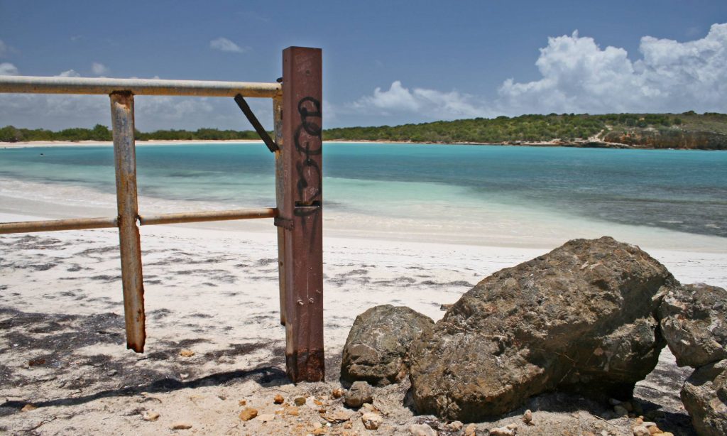
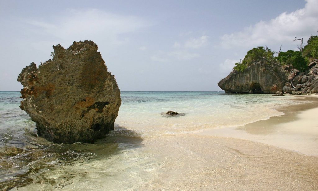
Similar to the geography of Cuba, the south coast of Puerto Rico boasts offshore reefs and cays with white sand beaches, with the mainland rising up to mountains. As with most of the northern Caribbean islands, Puerto Rico’s rainforests offer hiking and climbing opportunities and the northwest and western coasts have tremendous kite and surfing opportunities. There are more cruisers than charterers here, harbors are quiet, mostly fishing villages with strong family traditions.
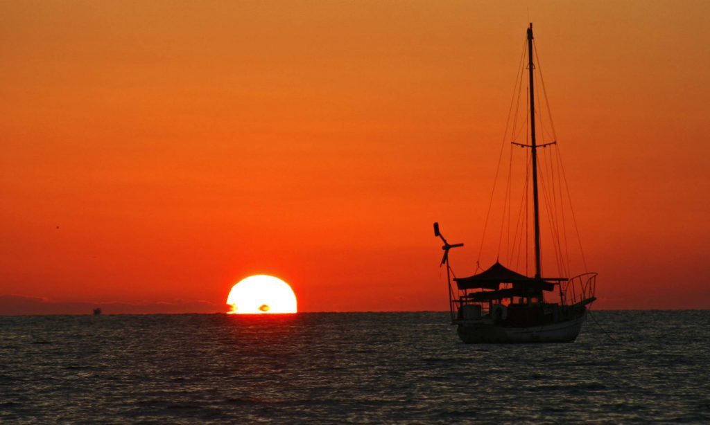
Although a less traveled route for boaters, this cruising area provides an excellent opportunity for hopping along a coastline during the annual spring migration out of hurricane-prone areas. Destinations are all within easy day sails, or in some cases, overnight sails, with comfortable passages and stopovers. All anchorages offer good holding.
This article features stops along the southern and western coastline of Puerto Rico, as of 2021. Other areas, such as Puerto Rico’s east coast, will be covered in a series of articles for Caribbean Compass. As always, with the new COVID requirements, contact locals, and see Noonsite for the most up to date entry requirements for all the islands.
For boats sailing the northern side of Puerto Rico, it’s wise to watch weather patterns, as finding good places to stop and anchor is more difficult compared to the more sheltered southern coastline. The northern side of the island can experience increased winds from the east, and becomes a lee shore during north winds caused by fronts.
Plan your trip:
Plan your trip by reviewing harbors, learning the weather patterns, and establishing a passage plan with easy legs within day sails (or overnights) to wonderful areas of south and southwest Puerto Rico. Day/night hops, with quiet anchorages found at the end of each passage, make shorthanded sailing very feasible.
All boaters need to take the mountain wind (katabatic) effects into consideration on the coastlines of all large, mountainous Caribbean islands. A katabatic wind carries high-density air from a higher elevation down a slope under the force of gravity. It occurs mainly at night, when the highlands radiate heat and are cooled. The air in contact with these highlands is thus also cooled, and it becomes denser than the air at the same elevation but away from the slope; it therefore begins to flow downhill. Using these katabatic winds, sailors can find good lifts during light wind patterns. Chris Parker (Marine Weather Center/www.mwxc.com) suggests deliberately catching them to sail, or at least being aware they can impact your voyage. In fact, these winds may also allow eastward passage along southern shorelines even during tradewinds.
Be advised that adverse current is possible in the channels between islands such as mainland Puerto Rico and Vieques, and in the Mona Passage. We observe there are a lot of fishing vessels in these areas, small and without AIS. For viability, a full moon helps, as does radar. But due to the size of some of the vessels, there is not much difference between daylight or night vision for identification: as elsewhere in the Caribbean, local fishing boats are small and often hidden by waves.
On the way to Puerto Rico:
For those planning to island-hop north from the Windwards and Leewards, note that reports from the US Virgin Islands suggest a rather full house. Normally empty anchorages have become more used by charter vessels as they cruise St. Thomas and St. John, staying within the US territory. There is still room in marinas, but favorites may be difficult to get into immediately. Check in with Crown Bay Marina (www.crownbay.com/the-marina), a favorite cruiser stop with good facilities, fuel, dinghy dock and nearby grocery, located to the west of the harbor at Charlotte Amalie.
Sailing westward from St. Thomas or St. John, stops in Culebra are possible. Again, check carefully for the most recent situation reports. Sailing westward along Puerto Rico’s southern coast, a natural stopping point is Salinas.
From St. Croix, transit along the coastline of Vieques to the southern mainland of Puerto Rico. An overnight allows a morning arrival at Salinas with the tides. (Roosevelt Roads, the former US Navy base, seems to be still in a “construction” stage. It’s not clear, talking with locals, what will become of Roosevelt Roads; plans mentioned condos and marinas, but no major progress was seen when we sailed by. As of 2021 no work has been done, even though it has been almost ten years since the Navy left.)
Puerto Rico
Salinas:
Salinas Bay is a good stop comprising a large natural harbor with nearby waterways. Access is around Cayo Matías, a large mangrove-covered island; approach on the east side of the island. From mangrove swamps and small coral cays, the bay opens up to the harbor which has good depths. The channel into Salinas averages 9 to 11ft deep. Facilities have been restored since the 2017 hurricanes of 2017 and Marina de Salinas ([787] 824-3185) has slips available, fuel service, a pool, restaurant, and a newly built deck with live music all throughout the weekend. El Dorado restaurant, a typical local seafood place with fresh catch every day, has its own dock where you can tie up for lunch or dinner and even stay when empty. Full Moon is a small hotel with a nice restaurant and a shallow dock where you can tie up your dinghy. Cayo Matías is the local boaters’ hangout anchorage during weekends although you can also spend the day on the many islands south of Salinas. For land transportation you can contact Sidney at (787) 473-7037. Cruisers can easily drive from Marina de Salinas to explore areas such as San Juan, as the pandemic situation allows. Over the years many transients have anchored at the bay, some even using the mangrove areas as shelter during adverse weather.
Ponce, San Jacinto and La Parguera:
After Salinas, take a short hop to Ponce Bay, with the anchorage at Coffin Island. The Ponce Yacht and Fishing Club [(787) 842-9003] offers slips with all services and a boatyard with a high capacity trave lift. There are many food kiosks in La Guancha and easy access to the Historical District of San Jacinto and “Gilligan’s Island” (Cayo Aurora), part of the Biosphere Reserve of Guánica.
Past Ponce and before you reach La Parguera, the next stop is San Jacinto. There’s nothing really facility-wise and no restaurants nearby, but a nice anchorage with crystal clear water and a great “hop in the water spot” near Gilligan’s.
Farther west is La Parguera Lajas. As you near the Cabo Rojo lighthouse corner, find La Parguera. Take care navigating past several visible reefs until you reach the entrance marked with red markers. Be on the lookout both visually and with the aid of your GPS, since the area is very treacherous. After passing the first pair of buoys, look for the free mooring buoys on both sides: at Caracoles Cay and Enrique Cay. Both are great places to tie up and/or anchor during your stay, again realizing the challenge presented by reef structures. Plan a daylight entry, and only during settled weather. Feel free to leave your vessel at the cay and hop in your dinghy to the Club Náutico de La Parguera restaurant, El Turrumote. To access the mainland there is a dinghy dock right beside the Porlamar Hotel. The owner of the dock is Frank Torres [(787) 224-0752]. He is also a licensed captain with both fishing and diving trips available on his boat. The dock is located in coordinates 17°58.410’N, 67°3.078’W.
Finally turning the corner of western Puerto Rico, this attractive migration path north offers some excellent sport, sightseeing and more. This location is a good positioning point for a cruise to the Dominican Republic (Luperón or Samaná) or directly up the Old Bahama Channel to Great Inagua and the Bahamas and then the USA.
Puerto Real:
At the west coast town of Cabo Rojo, overlooking the Mona Channel and the protected Puerto Real Bay, you will find Blue Flag certified Marina Pescaderia (https://marinapescaderia.com), which has been hosting cruisers for the better part of the last ten years. Marina Pescaderia is also a US port of entry so you can do both your check-in as well as your check-out from marina facilities. The staff has knowledge of the most recent rules and regulations, and even the COVID testing situation.
The neighborhood of Puerto Real is a very local and picturesque, with a fishermen’s village in Cabo Rojo. In Puerto Real, you will find very good seafood restaurants, several fisheries, lively neighborhood bars, a brick oven pizzeria restaurant, bakeries and mini markets, among other facilities. Boaters use the marina as a hub, and visit an array of very interesting/exciting spots along the southwest and central regions of Puerto Rico such as the surfing beaches of Rincón and Aguadilla, the coffee-growing haciendas of Adjuntas and Jayuya, the lively nightlife of La Parguera and Boquerón, and the historical district of San Germán.
From Puerto Real, cruisers can transit north via the Mona Passage to the Turks & Caicos, Dominican Republic or Bahamas, and points north for hurricane season — but wait for good weather windows.
For the autumn migration south after hurricane season, sail this same route in reverse, using the katabalic winds to head eastward toward the Virgin Islands and onward.
This is just a small part of the Puerto Rico harbors and anchorages found in the north Caribbean sailing triangle. It is a passage route to sail, savor and enjoy. Sailing both west and east, we found this southern route undeveloped, or maybe just not discovered yet!
Reprinted from the March 2021 issue of Caribbean Compass, the must-read free monthly magazine for sailors in the Caribbean. For more information visit www.caribbeancompass.com. Images from https://marinapescaderia.com.
About the Authors:
Joan Conover is the Vice President and Cruising Host Coordinator of the international Seven Seas Cruising Association. The SSCA has identified several excellent
contacts for Puerto Rico cruising. These local experts, when contacted,
provide current situation information as part of the SSCA Cruising Host
program. Information is critical as destinations never seem to quite
match the cruising guides, and updates can be slightly delayed. (This
article’s co-author, José Mendez, continues to be
an excellent contact and provides timely inputs to many sailors.) Find out more at https://www.ssca.org/
José Mendez is the owner and manager of Puerto Rico’s Marina Pescaderia (https://marinapescaderia.com). José takes the time and effort to support transient and long-term sailing visitors to this area by sharing his knowledge of the area, providing a welcome package with maps for visitors, helping with paperwork, repairs and provisioning.
Related to following destinations: Culebra, Main Island, Ponce, Puerto Real, Puerto Rico, Salinas, Spanish Virgin Islands, St. Croix, St. John, St. Thomas, US Virgin Islands
Related to the following Cruising Resources: Caribbean Sea, Hurricanes and Tropical Cyclones, Routing, Weather
Comments