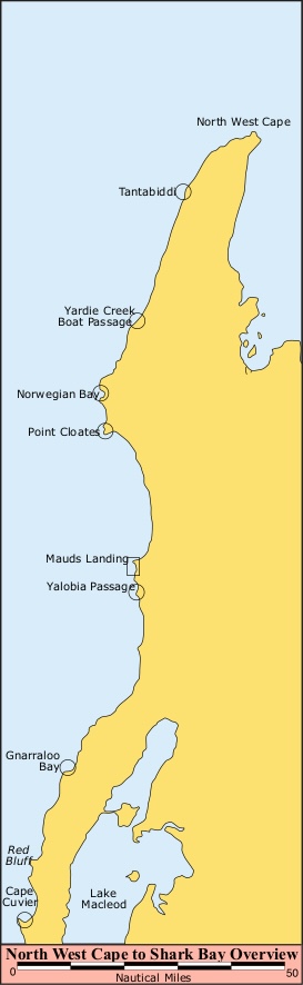
Western Australia, Ningaloo Reef: The World’s Best Kept Secret?
Almost all sailors know about the Great Barrier Reef on the east coast of Australia. However, on the other side of the country there is a similar pristine coral reef that lies only a few miles offshore. Ningaloo Reef is the largest coral fringing reef in the world and a UNESCO Heritage Listed site. In this report, Kim Klaka, author of the Fremantle Sailing Club’s Western Australia Cruising Guide says the abundance of marine life is a major drawcard for the reef.
Published 4 months ago

Remote and Isolated Part of the World
This is a remote part of the world, with no towns and only one tiny settlement. The only consistently reliable means of communicating with the mainland is by VHF (or satphone). Mobile phone coverage is at best patchy. This isolation forms part of its attraction, but the bigger drawcard is its accessibility to the remarkable abundance of marine life.
Marine Life
The entire Ningaloo Reef is a marine park. This is a beautiful, unique and fragile environment to explore, supporting over 550 species of fish and more than 200 species of coral.
Consequently, the Ningaloo Coast is a mecca for scuba divers and snorkelers. It is visited by giant whale sharks – the world’s largest fish, growing up to 21.5 tonnes and 12.5 m long. An estimated 300-500 whale sharks come to feed on the plankton and coral blooms from March through May, attracted by the mass coral spawning event and seasonal nutrient upwellings.
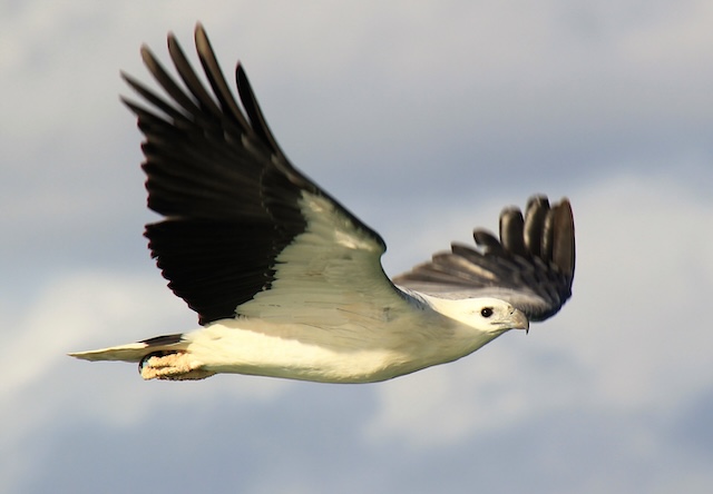
The Ningaloo coast is a migratory route for humpback whales and other whales. Other globally important and threatened mega marine life are also found here including dolphins, manta rays, dugongs, orcas, sharks, turtles and large fish such as tuna and billfish.
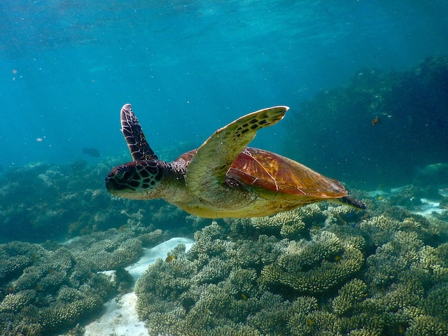
Three of the world’s seven species of marine turtle mate in the shallows and nest along the Ningaloo coast: the endangered loggerhead turtle, the vulnerable green turtle and the vulnerable hawksbill turtle.
Weather and winds
The Ningaloo coast has a warm, dry, tropical climate with plenty of sunshine throughout the year. The summer months (December-February) are hot, with average maximum temperatures around 38°C and minima around 18°C. Winter (June-August) is mild, with average maximum temperatures around 25°C and minimums around 10°C. Annual rainfall is less than 250mm and there is no official wet season, but rainfall is more common from January to July.
The overall weather pattern of the Ningaloo coast is for winds from the southerly quadrant to dominate year-round. Heading south along this part of the coast is likely to involve sailing to windward at any time of year.
During winter the southerlies are occasionally interrupted by the northern remnants of a strong cold front. This may bring a period of NW or W winds accompanied by rain, backing SW to S after the passage of the front. However, winter may sometimes have periods of easterlies and the shoulder season of April-May tends to have the best chance of lighter winds.
During summer the winds are almost constant from the southern sector, with SW sea breezes reinforcing them. Cyclones are possible in the summer. A weather pattern to be wary of is when a west coast trough moves off the coast. This causes the southerlies to stop quite suddenly, to be replaced by strong north winds for a few hours, sometimes accompanied by thunderstorms. Many of the traditional anchorages sheltered from the southerlies can then become very exposed.
Tides and Currents
Tidal range is less than a metre, with two high tides per day (unlike the coast south of Ningaloo, which has just one high tide per day). Tidal streams are mostly weak except off some the coast’s headlands.
The main current is the Leeuwin Current, which runs all the way down from Indonesia to the Southern Ocean. It is therefore a warm current and is the world’s only poleward running current on a western coast. The Leeuwin Current is a jet-like stream of warm water flowing southwards along the edge of the continental shelf (the 200 m depth contour).
However, it periodically meanders offshore in the form of large loops and eddies, which can carry the warm tropical waters over 100 nm away from the coast. Three or four of these loops can be present at any one time along the western Australian coast.
As the continental shelf along the Ningaloo Coast is very narrow, the current can be present as little as 5 nm off the coast. Currents measured near the seabed at the edge of the continental shelf were generally southward with speeds of 0.5 to 1 knot.
Besides weak tidal streams and the Leeuwin current, there is another source of horizontal water flow – waves. The persistent southwest swell breaks over the reef, dumping surplus water inside the reef. This process is sometimes called overtopping. It creates a slightly higher water level inside the reef than outside, so the water flows downhill and escapes through any gaps in the reef. It is predominantly north-flowing inside the reef and it can reach up to two knots at times.
Pilotage
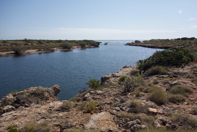
The reef lies one to three miles offshore and the swell breaks on it heavily. The coast and off-lying reef is hazardous and requires careful pilotage. The reef is steep-to on its west side, rising without warning from relatively deep water and can remain unseen until close by. Even today, some charting packages do not show the reefs correctly and more than one yacht has hit a reef as a result of relying solely on one source of information. Always work with at least two independent sources of pilotage information and use your eyes.
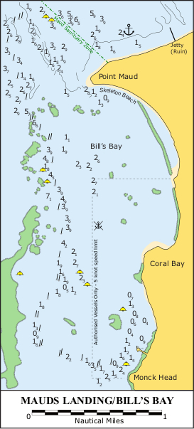
Moorings and anchoring
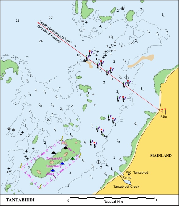
There are no jetties or marinas along the Ningaloo coast. There are a total of just five public moorings: three at Tantabiddi in the north, and two at Mauds Landing in the south.
Everywhere else you must anchor behind the reef to shelter from the prevailing southerlies, though offering limited protection from the north. The seabed is often a thin layer of sand over limestone, which is less than ideal for anchoring. Someone once described it as like trying to anchor on the pavement.
The sheltered areas are littered with “bommies” – rocky pillars extending to just below sea level. Good ground tackle is essential, preferably with an all-chain rode. A typical inshore cruising setup of 30 m chain + 20 m rope is likely to be inadequate. It is best to carry at least two different types of anchor, for example one suited to sand and one suited to weed. In desperation to stop dragging, some yachts have wound their anchor chain a few times around a bommie. Not only is this damaging to the seabed, you also have to remember which way you wound it when it comes to raising anchor the next day.
Facilities
Facilities? Not many. Yachts should be self-sufficient in all respects until they reach either Exmouth (population 3,000) in the north, or Carnarvon (population 5,500) in the south. The distance from Exmouth to Carnarvon is 370 kms (230 miles). A few of the anchorages have camping sites with toilets and rubbish bins, Fresh water is scarce.
Fuel, water, food and other necessities are available at Coral Bay township (population 250, but it grows to 4,000 during school holidays). Coral Bay is too shallow for cruising yachts but the township is accessible by either a long dinghy ride or a half-hour walk along a gravel track from the nearest anchorage at Mauds Landing. There is a nursing post at Coral Bay and the nearest hospitals are at Exmouth and Carnarvon.
There are no UK style Royal National Lifeboat Institution (RNLI) lifeboats along this coast. Instead, volunteer marine rescue groups operate out of bays and inlets, usually with small, fast powerboats. If rescue is required further afield, the local fishing boats are often called on to help. There are three marine rescue groups, at Exmouth, Coral Bay (April- October only) and Carnarvon.
Fishing and Diving
There are many dive sites behind the reef with excellent coral and fish and minimal swell. Take care, as sharks are often seen, and there may be strong currents behind the reef due to overtopping. The surrounding waters support an unusual coexistence of tropical and temperate species with magnificent coral gardens, fish, anemones and seagrass meadows. There are several sanctuary zones along the Ningaloo coast, some of which extend several miles offshore. Fishing, including trolling, is prohibited in those zones.
History of the area
The earliest recorded European activity in the region is the landing of the schooner Maud in 1884. In 1896 a townsite reserve was gazetted to protect the site of an existing jetty and government goods shed. In 1915 the town was officially named Mauds Landing.
Mauds Landing played an important role in the settlement and development of the northwest of Western Australia. The wool shed, jetty and tramway served the local pastoralists in the provision of supplies and in the outward shipment of wool and sheep from 1898 until 1947.
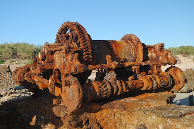
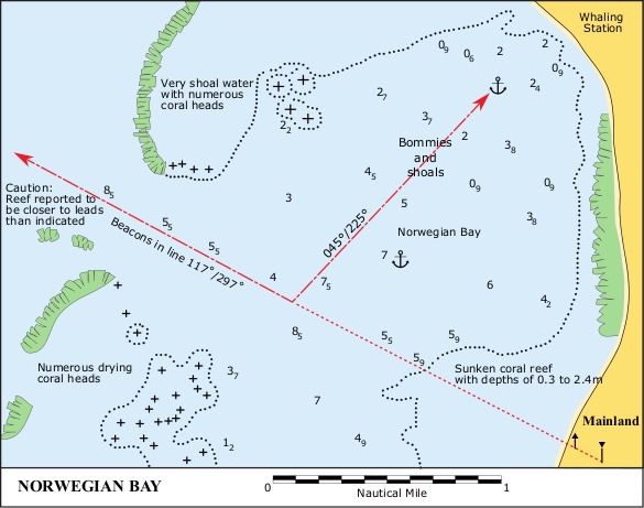
The settlement no longer exists and only old pilings from the jetty remain today. The remains of the old whaling station at Norwegian Bay are worth a visit. The whaling station was established in 1912 and closed in 1957 due to pressure to reduce the kill of humpbacks.
In the first year, whalers killed 2,000 whales and in the four year period 1925-28 they took nearly 3,500 whales.
Coral Bay was known as Bill’s Bay until 1968, when, the formal settlement began with the establishment of a hotel named the Coral Bay Hotel. Consequently the settlement became known as Coral Bay.
More information
Fremantle Sailing Club’s Western Australian Cruising Guide is regarded as the sailing bible for Western Australia, covering the entire coas. This 650-page book is a definite “must have” for cruising the Abrolhos. It is available as a free download from the Fremantle Sailing Club.
Information on wildlife and fishing can be found at the following WA Government websites:
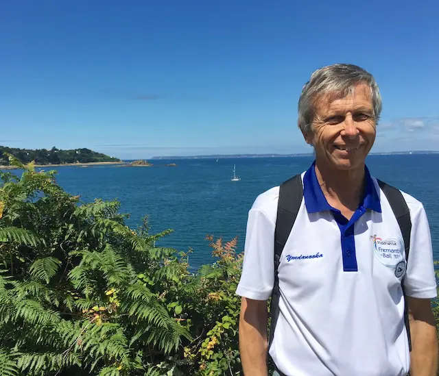
Kim Klaka
Editor
Western Australia Cruising Guide
………………………………
About the Author
Kim Klaka has sailed over 30,000 miles offshore and is the current editor of the Fremantle Sailing Club’s Western Australian Cruising Guide. He is a naval architect with 50 years’ experience in yacht design, holding a Masters degree and a Doctorate in sailing yacht performance. He is a recipient of the Yachting WA David Walters Memorial Medallion for services to yachting safety, only the fifth person ever to receive this award.
………………………………
Other Reports by Kim Klaka:
- Western Australia, Houtman Abrolhos Islands: An Extraordinary Place to Visit
- Western Australia: A Coast Less Travelled.
………………………………
Related Links
- Western Australia Parks and Wildlife Service – Ningaloo Reef
- UNESCO World Heritage Convention – Ningaloo Coast
………………………………
© 2025 Noonsite. This content was edited by Noonsite. Do not reproduce without permission. All rights reserved.
The opinions expressed in this article are the author’s own and do not reflect the view of Noonsite.com or World Cruising Club.
……………………………
Find out all news, reports, links and comments posted on Noonsite, plus cruising information from around the world, by subscribing to our FREE monthly newsletter.
If you have found this information useful, become a paid member to enjoy unlimited use of Noonsite plus many other perks. Your membership fees really help our small, dedicated team keep country information up-to-date in support of cruisers worldwide. Find out more about Noonsite Membership levels and benefits here.
Related to following destinations: Carnarvon, Exmouth, Fremantle & Perth, Geraldton, Western Australia
Related to the following Cruising Resources: Circumnavigation, Cruising Information, Indian Ocean, Routing, Travel Information, World Regions Information
Comments