The rich variety of Turkey’s cruising grounds
A useful summary of each cruising area in Turkey.
Published 22 years ago, updated 5 years ago
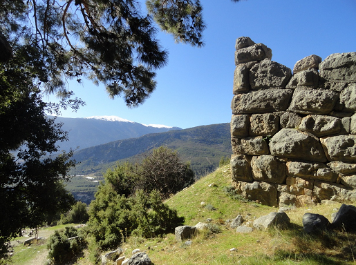 Turkey’s history spans almost 10,000 years. Along the Aegean and Mediterranean coasts, there are acres of ancient ruins – many world-renowned. Cities of substantial size, developed from 2600-1900 BC, were taken over by the Hittites, an Indo-European people who ruled central and Southeastern Anatolia until about 1200 BC. Invaders from Greek islands and city-states ultimately ousted the Hittites. The Ionians colonized the Northern Aegean developing great cities (Ephesus, Teos, Priene, and Miletus) and laying the foundations of Hellenic culture. Caria developed in the South Aegean dominating the area East to Fethiye. East of Caria, the Lycian kingdom spread along the Mediterranean coast from Fethiye to Antalya and Pamphylia. All were taken by Alexander the Great when he conquered Asia Minor and centuries later the Romans.
Mediterranean Coast
Turkey’s Mediterranean Coast, over 1,000 kilometers long, is wild and rugged. Steep-to mountains fall into the sea; rocky escarpments give way to pine-clad slopes. A fertile plain opens up between Antalya and Alanya. All along the coast, mountains loom to the north.
The Mediterranean Coast is humid with temperatures above 30°C during the summer months. The Meltemi dissipates East Finike and there are land and sea breezes from the Gulf of Antalya to the Syrian border. Sea breezes tend to come from the south or southwest. This coast is vexed by a heavy swell – which can be dangerous – caused by the long fetch across the Eastern Med from Tunisia and Libya. While there is little rain during July and August, there is a rainy season from December through February that is wetter than any other region of Turkey.
Aegean Coast
Turkey’s stunning Aegean Coast stretches from the Trojan Plain at the mouth of the Dardanelles in the North to the pine-clad slopes of the Bay of Marmaris in the South – a distance of approximately 2800 kilometers. A rich agricultural region, the fertile plains of ancient Thrace extend South to Ayvalik and Izmir (ancient Smyrna, possibly Homer’s birthplace). South of Cesme you will sail by gentle hills covered with olive, fig and fruit orchards, great plains and a wild mountainous stretch from Gumusluk to Marmaris.
Temperatures in the Aegean are slightly cooler than those of the Mediterranean and there is usually a sailing breeze. The Meltemi prevails from June through August. It comes from the North or Northwest and follows the contours of the coast. It starts around midday and blows until sunset. (Gusts off hills and mountains are stronger than the wind on the open sea.) With many mountainous Greek Islands only a stone’s throw from the Turkish coast, wind tunnels between the two countries form in a number of places kicking up considerable seas. Despite the Meltemi, there are occasional Southerlies. Gales come from both the North and the South.
The strong current flowing from the Black Sea through the Sea of Marmara and Dardanelles affects the North Aegean. Other than that, the current in the Aegean flows from South to North.
Dardanelles Strait
The narrow Dardanelles Strait (Canakkale Bogazi) is one of the busiest shipping areas in the world. Ships entering the Strait keep to starboard and vice versa. The high ridges of the Gelibolu (Gallipoli) Peninsula form the Northern shore of the Strait. The relatively flat Southern shore is predominantly farming and grazing land. The prevailing Northeast wind and one- to two-knot Southerly current in the Dardanelles are contrary to yachts heading North to the Sea of Marmara and Istanbul.
Sea of Marmara
The Sea of Marmara is an idyllic cruising ground with islands, mountain scenery and farming, and grazing land. Anchoring is possible in some bays and med-mooring in the small fishing and commercial harbors. On the southern shore inland from commercial Bandirma or Erdeck harbors, Bursa, with its particularly fine mosques was the Ottoman Empire’s first capital city before Edirne and Istanbul. Bursa’s Mt Uludag is snowcapped most of the year.
The Northeast winds in the Sea of Marmara are generally light in spring and early summer but increase as autumn approaches and can be strong in September and October. There are occasional Southerlies. Temperatures become chilly in September and October with thunder and lightning storms signaling the end of the sailing season.
Bosphorous
The prevailing Northeast wind and Southerly current in the 32-kilometer long, suburb-lined Bosphorous (Istanbul Bogazi) are stronger than that encountered in the Dardanelles with current in some places reaching four to five knots. Going North to the Black Sea, most yachts try to hug the European shore where the current is reduced.
Black Sea coast
Turkey’s 1700-kilometer long, lush Black Sea coast was inhabited as early as 7000 to 5000 BC. The Hittites, Miletians, Phrygians, and Amazons (according to Homer) colonized parts of the coast. It later fell under the sovereignty of Alexander the Great and eventually the Roman, Byzantine and Ottoman Empires. Some of the earliest settlements were at Amasra, Sinop, Samsun, and Trabzon.
The coast enjoys moderate temperatures (-8°C to 40.5°C). Rainfall exceeds any other region. The flat farmland at the top of the Bosphorous shortly becomes hilly and then mountainous. East of Samsun mountains 2.5 to three thousand meters high crowd the shoreline framing beaches, quaint fishing villages, orchards, and tea plantations. At the far eastern end of the country is the Kackar Daglari mountain range with Mt. Kackar at 3.937 meters.
While there are few natural harbors on this coast (Sinop, Sutluce aka Gideros Cove, and Amasra are exceptions), stone breakwaters have been built for local fishing boats, small coasters and the few visiting yachts that come here.
Despite the man-made shelter, Turkey’s Black Sea Coast is a lee shore. If there is a significant storm, a yacht may be safer going out to sea than riding it out in the harbor.
While there are exceptions (i.e. the Samsun Sailing Club tucked in the corner of a large commercial port), most harbors in the Blac Sea are either commercial or fishing. Many are quite charming – Sinop, Cayliglu, Amasra with good fish restaurants. Yachts can Med-moor to the quay in most places or free anchor in many. Electricity is generally not available. Cruise the Black Sea by Doreen and Archie Annan (published by Atakoy Marina in late 2001) includes mud charts of these and other harbors and anchorages suitable for yachts.
Margaret Reichenbach, Matt Rollberg, s/y Santana
Related to following destinations: Aegean Sea, Black Sea, Bosphorus, Dardanelles, Eastern Med, Marmara Sea, Turkey, Western Med
Comments