Caribbean: When to Leave and Which Way to Go?

The middle of May is the ideal time to leave the Caribbean and head either north to the east coast of the United States or head back across the Atlantic to Europe. Experienced sailor and author Don Street has some sage advice for those planning their voyage, having been discussing the routes and timing with sailors ever since he arrived in the Caribbean in 1956.
Published 3 years ago
It’s May, Spring is in the air and for many boats it’s time to leave the Caribbean.
A study of the weather charts has led me and every really experienced off shore sailor I know, to agree with me when I say that anyone heading north or north east from Antigua before the end of the first week in May, is playing Russian roulette with three bullets in the cylinder.
This is my conclusion based on 70 years of reading about disasters, being told of disasters first hand, many second hand reports, backed up by 12 trans Atlantic crossings (seven on the engineless Iolaire) plus almost 40 trips between the Caribbean and the United States.
Preparing for Hurricane Season
For yachts not leaving the Caribbean for hurricane season, I recommend my website [https://www.street-iolaire.com/] where I have lots of advice based on more than 60 years experience. You’ll find information on hurricane tracking, preparation, hurricane holes and tips on cruising during this time of year.
I feel very strongly that all sailors who have boats in the Eastern Caribbean either afloat or ashore, as well as marina and yacht yard managers should read the Hurricane Section. I believe that if my advice is followed, it will do much to minimize the damage caused by hurricanes and the amount of money insurance underwriters will have to pay out as a result of hurricane damage.
Imray Iolaire Passage Charts
The first thing that should be done is to purchase the Imray Iolaire passage chart 100.
It is a gnonomic projection where a straight line is a great circle course. It covers the whole North Atlantic and also the Caribbean. It is a real eye opener. The Great Circle course from Bermuda to Falmouth UK leads through the southern edge of the area of icebergs and boats heading from Bermuda to the Azores that take the northern route looking for wind, are skirting the iceberg area.
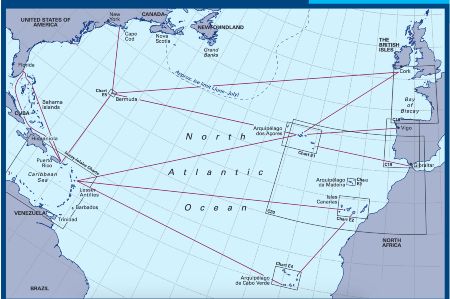
- Screen shot of the North Atlantic ocean passages.
The chart shows positions of icebergs that have been seen well south of the normal area. On the front of the chart are shown all the normal great circle courses that are likely to be sailed by a yacht with the distance to be sailed.
The old version of chart 100 was printed on both sides. On the backside were weather and wave height charts for the entire year except for the months of January, February and March, months yachts should not be sailing in the north Atlantic. The weather charts showed wind direction, frequency and strength, percentage of calms, plus gale frequency. In addition piloting and sailing directions by me for trips likely be taken in those months were included. The new chart 100 has an accompanying booklet instead containing the same info. [Imray have confirmed that the latest edition has corrected information and expands on Street’s older edition sailing directions].
Regarding gale frequency, a word of warning from the late Uffa Fox who, 80 years ago in one of his books that contained weather charts, noted that the charts report the frequency of gales, which means Force 8 (40 kts) or over! He pointed out that the winter gales are usually stronger than the summer gales. April gales are most likely more severe than May gales.
The weather charts show areas and frequency of wave heights of 12 ft or over. Again the chart does not show how much over 12 ft can be expected. It also must be remembered that if the waves are running at 12 ft, it must be expected that occasionally they will get in sync and waves of 24 ft will arrive.
…………………………………………………………………………………………………………………..
NORTH TO EAST COAST USA
Heading for the ICW:
Some boats will be leaving Antigua heading north west for the Morehead City/Beaufort entrance to the ICW, a good route north to Norfolk for boats that draw 7 ft or less and have an air draft of under 64 ft. There are two options on this route:
- · Antigua to St. Martin to stock up, then NW passing north of Puerto Rico, Navidad, Silver and Mouchoir Banks, the northern edge of the Bahamas, until the Gulf Stream is reached. Then ride the stream north to Morehead City/Beaufort entrance. With luck you will carry the trades all the way to the Gulf Stream which will carry you nicely along the way at 2/3 kts.
- · Alternately, the shorter route is a direct rhumb line route, 1,200 miles from St Thomas to Morehead, but this route leads through an area of light and variable winds requiring a lot of sail changes, or motor sailing or motoring. Also hard Northwest fronts which switch to Northeast make the Northeast-running Gulfstream extremely dangerous which can persist until mid June.
If you cannot use the ICW, double-check the weather and if you are guaranteed 36 hours of southerlies ride the screen North outside of Hatteras and onto Norfolk. If the weather cannot be guaranteed enter at Morehead/Beaufort and wait for a reliable southerly weather report.
Heading for Chesapeake Bay:
If heading for the entrance to the Chesapeake, lay a course off to 70 miles east of the entrance to the Chesapeake, head for this waypoint then turn west and enter the Chesapeake, about 1,300 miles. This route keeps you well clear of Hatteras, the graveyard of ships for the last four hundred years.
Heading for New York to Newport:
Boats heading north to the east coast of the US, New York to Newport area, should head to Bermuda, course north, 900 miles. Conditions on this route vary drastically. Ideally you leave Antigua, St. Martin or St. Thomas, head north on a fast beam reach for the first 500/600 miles, then run into 100 miles of light airs, then the southwester fills in and on to Bermuda.
But this does not always happen.
In 1980, so many boats were heading to Bermuda after Antigua Race Week that they organized a race for about 15 boats. They left Antigua with a booming trade wind that died out at the end of 24 hours. There was no wind from there to Bermuda.
North from Bermuda:
North from Bermuda can be an easy trip, pushed along by the prevailing southwest wind. But you must be prepared for heavy weather as is illustrated by the story of a Little Harbor boat with four experienced sailors on board that went missing in April about 10 years ago, en route from the Caribbean to Newport. Their EPIRB ran for such a short time that no accurate position was able to be ascertained and no wreckage was ever found.
It is very important before leaving Bermuda to ascertain the south east meander of the Gulf Stream. When racing to Bermuda, the navigators that find it and keep the boat in it are among the top finishers. However, if you run into the southeast meander when heading north west to the US, it stops you dead in your tracks as I discovered on Iolaire in 1975!
…………………………………………………………………………………………………………………..
TRANSATLANTIC EAST TO EUROPE
Bermuda to Halifax to Ireland:
Occasionally a boat will head due north from Bermuda, sailing 720 miles to Halifax, then cruise the Nova Scotia coast eastwards to the Bras d’Or Lakes. Exit the north end of the lakes and sail on to St. Pierre or Miquelon. There you can stock up on inexpensive beer and wine, French cheeses and reputably the best French bread in North America.
From there it’s 40 miles to Port Fortun to top up fuel, water, stores and do a crew change if necessary. Port Fortun has daily bus services to St. Johns. Then it’s off to Ireland, 1,725 miles, 10 to 12 days from Race Point to Crookhaven, a small port on the most south-western tip of Ireland. It will be a cold and foggy, but usually fast, trip.
Bermuda to Ireland:
Others departing from Bermuda may head direct from Bermuda to Crookhaven – a journey of some 2,660 miles. Before doing this, take a look at the great circle route on Imray Iolaire passage chart 100. Note this route leads through the iceberg area for 600 miles. Boats will also have to expect strong winds and the possibility of gales that will be stronger than on the Bermuda to Azores route.
Bermuda to the Azores:
This route offers a mixed bag of conditions. Again, look at Chart 100. There are three routes shown – direct, middle and northern. The middle route is the shortest, but takes you straight through the Azores high. Some boats have reported not only light airs, but long periods of flat calm requiring endless hours of motor sailing or motoring.
But this is not always so. In 2002 delivering an Oyster 48 ketch Nimrod, we left Bermuda on a southwester but 24 hours out it switched to the east and started blowing. Every time the wind shifted we tacked, but each time the wind headed us. We spent two days going nowhere. Finally the wind suddenly switched to the west and started to blow like hell. We sailed to Flores, straight through the normally windless Azores high, under shortened sail the entire time.
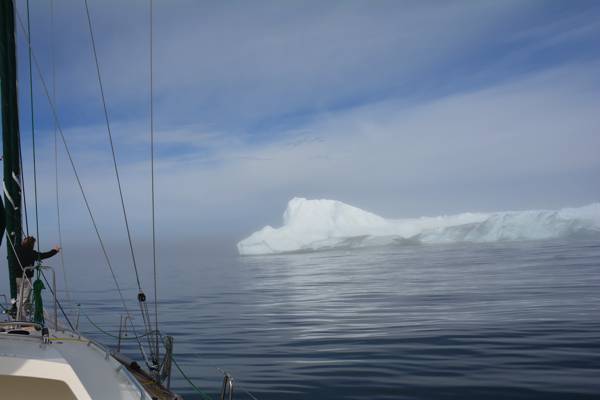
- Iceberg Watch: © Jimmy Cornell
On Iolaire in 1985 we had a good – though cold – passage on the northern route including one 48 hour run of 410 miles. I would not believe my morning sight as I thought 410 miles was impossible, but when a ship came over the horizon I contacted them via VHF and confirmed my calculated position was correct and that 40 miles ahead of us at latitude 41 N there was a large iceberg!
On the first morning of this run, the wind was out of the north building up a large sea that was crossing with the old SW swell. Periodically, the seas would meet at such an angle that the sea would erupt forming a 20/30 foot geyser! It was blowing hard out of the north, cold, overcast, heavy mist almost like rain. A logbook entry from this trip reads, “the most miserable dawn I have ever seen in more than 30 years of off shore sailing!”
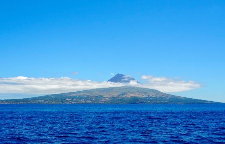
- Azores, Pico
Antigua to the Azores:
Some boats departing Antigua will head northeast on starboard tack, close reaching toward the Azores great circle, a distance of about 2,070 miles. When the wind dies they turn north, power across the high, pick up the south westerlies and it’s off to the Azores.
But this does not always work. In 1989 Iolaire took off direct to the Azores on a fast close reach. At the end of seven days we were half way there, but the wind was dying. So many of us had left Antigua the same day we were talking on the VHF. I announced that as the wind was dying I was turning north to cross the high and pick up the south westerlies.
Wet and Wild came on and said they had the weather info. and there was no wind in the entire north Atlantic, the only thing to do was to continue on and fight the light airs. We all did this. The boats with engines ran out of fuel. One day when all were becalmed with no wind at all, Iolaire covered 70 miles. Everyone wanted to know how? I said we dropped the main, squared the boom off and hoisted two spinnakers. We were not towing a prop, so we made the 70 miles.
Anything can happen
But anything can happen. In 2002 I met a friend that was delivering a 38’ sloop from St. Martin to the UK. He said he took off from St. Martin on a close reach, number 2 genoa, no main. He sailed a rhumb line course knocking off 160 MPD and never set the main.
Jamie Dobbs of Lost Horizon fame, for years commuted across the Atlantic in his 38’ Rival. He did 18 trips in 16 to 18 days. He said the wind vane did the steering, course set according to what his Brooks and Gatehouse VMG told him. His luck finally ran out and he had a bad slow passage of 21 days!
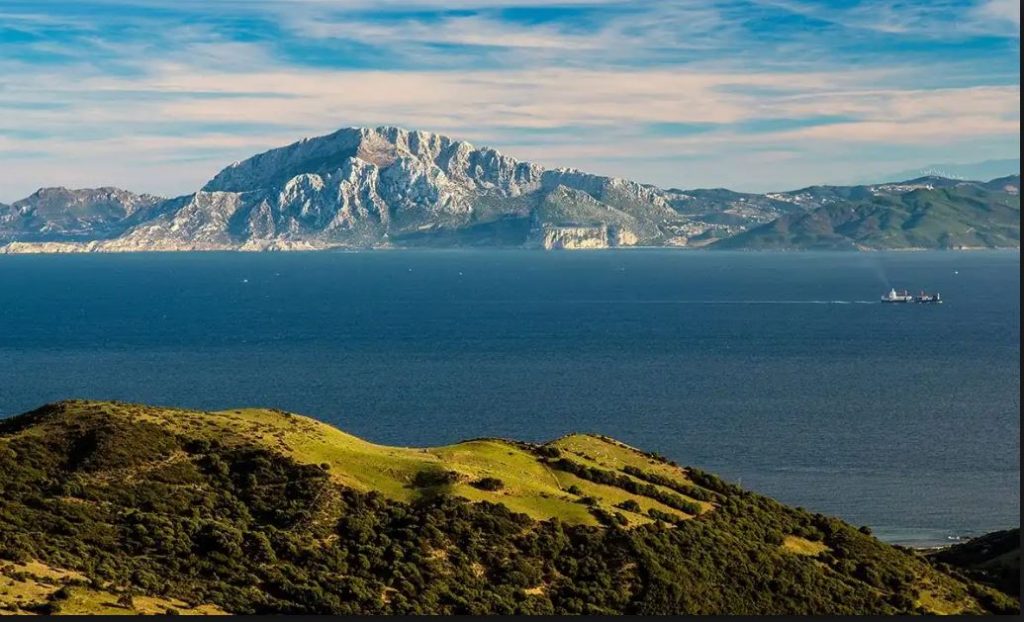
- Strait of Gibraltar
Antigua to Gibraltar Direct:
For boats that are good sailors with crew that are willing to do a lot of trimming and sail changes, have access to real time weather reports, have a moderate range under power using their normal fuel tanks, or are willing to supplement the fuel supply by carrying bladder tanks, then Antigua to Gibraltar 3,160 miles direct, is a viable option.
The charming, irrepressible Italian sailor Palo, who has sailed thousands of miles on Latifa, related to me how he did this trip on the Mylne designed, Fife built Mariella.
“We took off close reaching north east then turned east staying well south of the Great Circle route to the Azores, thus we were south of the Azores high. We sailed her hard in that we constantly trimmed sails and switched headsails as necessary. Whenever the wind went very light, we motorsailed, running the engine no more than half throttle which gave us very many miles per gallon. Staying south, we not only avoided the calms of the Azores high but also the heavy weather experienced by boats further north. By by-passing the Azores we saved the three-day stop in Horta, thus doing the entire trip in 18 days which was five days faster than the boats that took the normal route via Horta, stopping to re-fuel and re-provision.
…………………………………………………………………………………………………………………..
ONWARD FROM THE AZORES
The Azores to Ireland:
From the Azores to Crookhaven in Ireland or Falmouth in the UK is a journey of about 1,200 miles. Check the weather carefully before departure as you can run into periods of extended calm. In 1995 I had an unhappy crew on board Iolaire as I insisted in departing Horta in light airs only to discover the light airs went flat. Thirty six hours after leaving Horta we could still see the peak of Pico!
If the wind settles in the north east, head north on a fast close reach until you reach the southwesterlies, then head for Crookhaven.
Why Crookhaven?
When you arrive at Falmouth, UK, you will discover the beer is warm, the pub will be closed and a game of cricket will be in progress. Two things no American will ever understand is English pub hours and the game of cricket!
But if you sail into Crookhaven, even if the pub is closed, when they discover you have just sailed across the Atlantic they will open up and serve you a pint of Murphy’s. Guinness is the drink of Dublin, County Cork is Murphy territory!
(Editor’s Note: Crookhaven is only a very small village and is not an official port of entry. There is no harbourmaster. Yachts wanting to stop at Crookhaven should make contact with the most local police department – Garda – which in this case is in Schull – 15 miles away. [https://www.garda.ie/en/contact-us/station-directory/schull.html])
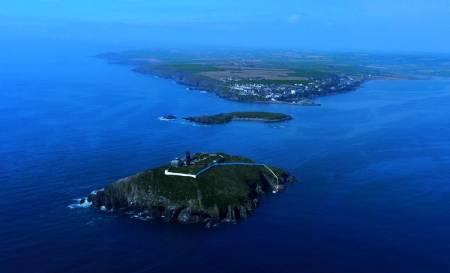
- Ireland, East Cork, Ballycotton Island
The Azores to Spain or Portugal:
If heading for Spain or Portugal, lay off your course to 30/40 miles North of your landfall, as when you approach the coast you will encounter the Portuguese trades – 20 to 25kts from the north and a south flowing current. If you end up south of your landfall, beating to windward against a strong current is a poor way to end a Transatlantic.
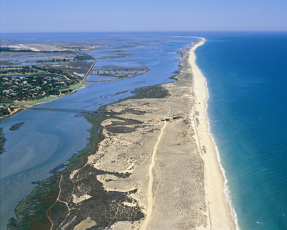
- Portugal, Ria Formosa
The Azores to Gibraltar:
If heading to Gibraltar, take a rhumb line course of 800 miles from Santa Maria, the easternmost island of the Azores.
…………………………………………………………………………………………………………………..
IN CONCLUSION
As you have read there are many routes to leave the Caribbean. On all routes, the boat, skipper and crew must all be prepared to weather a full gale at sea in cold weather. It is essential that before leaving the Caribbean the skipper makes each crew member lay out their foul and cold weather gear including sea boots, for inspection. If any of the gear is not up to snuff it is essential that the skipper instructs the crew member to beg, borrow, buy or steal the necessary gear so that the crew member is fully equipped to stay warm and relatively dry in a cold gale at sea.
In early June, 1967, when passing through NY harbour en route to City island on Djinn Morgan’s 63’ sloop, we had solid ice on deck and cabin top. It was blowing 25 kts straight from the North Pole – or so it seemed!
…and last but not least!
The skipper should ensure that he has a good supply of sea sick suppositories! A severely seasick crew is not only useless to the vessel, but crew can be a danger to themselves by becoming badly dehydrated.
………………………………………………………………………………………………………………………………………
Hurricane Season is Upon Us
Hurricane season is upon us. All sailors who have boats in the Caribbean afloat or ashore should check out Don’s website:https://www.street-iolaire.com/. Don Street arrived in the Caribbean in November 1956. He has made an intensive study of hurricane tracks using the NOAA hurricane book that shows the track of every hurricane 1851 to the present time. His site also has detailed background information on Don’s cruising experience.
………………………………………………………………………………………………………………………………………
About the Author
https://www.street-iolaire.com/
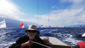
- Author Don Street at the helm.
Don Street is a fourth-generation racing sailor and at the age of 91 he still races his 88 year old Dragon Gypsy, the oldest dragon in the world still racing.
He wanted to be a yacht designer, but in 1956 age 25 the day before he was to start working in New York, he fled to the Caribbean and in 1957 he bought Iolaire, a 46 foot engineless Cutter built in 1905, which he owned for 52 years.
On Iolaire he cruised, chartered, explored, charted and wrote about the Caribbean and the Atlantic Islands. His first book, the 1966 Cruising Guide to the Lesser Antilles, is regarded as the book that opened up the Eastern Caribbean to the cruising yachtsman and made bareboat charter possible. Through the years this guide has been rewritten and expanded until now it is four volumes covering the entire eastern Caribbean from Puerto Rico eastwards to Anguilla, South to and including Trinidad and West along the Venezuelan coast and offshore islands to Aruba.
Don Street’s Guides to Cruising the Caribbean
Guide information rapidly gets dated, but piloting and sailing directions are timeless. Street points out that from 1957 when he purchased the 46 foot engineless Cutter Iolaire, built 1905, until he wrote his first guide in 1966, he used as his guide Norie and Wilson Sailing Directions to the West Indies published in 1867. Piloting/sailing directions, tidal information, ranges/transits information from this 1867 guide reappears in his guides.
Don’s guides can be purchased through Noonsite via the links below and are available from Imray, Amazon or facsimile editions from iUniverse.com
- Anguilla to Dominica
- A Cruising Guide to the Lesser Antilles
- Martinique to Trinidad
- Puerto Rico, the Spanish, U.S. and British Virgin Islands
- Street’s Guide to the Cape Verde Islands
……………………………………………………………………………………………………………………………………..
The opinions expressed in this article are the author’s own and do not reflect the view of Noonsite.com or World Cruising Club.
Related to following destinations: Azores, Bermuda, Canada, Cape Breton Island (Bras d'Or Lakes), Falmouth, Gibraltar, Halifax, Ireland, Nova Scotia, Plymouth, Portugal, South Coast, Spain, St. Pierre & Miquelon, United Kingdom
Related to the following Cruising Resources: Atlantic Crossing, Caribbean Sea, Hurricanes and Tropical Cyclones, Routing, Weather
Comments